Mayurbhanj district
| Mayurbhanj district ମୟୁରଭଞ ଜିଲ୍ଲା | |
|---|---|
| District | |
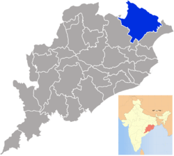 Location in Odisha, India | |
| Coordinates: 21°55′59″N 86°43′59″E / 21.933°N 86.733°ECoordinates: 21°55′59″N 86°43′59″E / 21.933°N 86.733°E | |
| Country |
|
| State | Odisha |
| Headquarters | Baripada |
| Government | |
| • Collector | Rajesh Prabhakar Patil |
| • Member of Lok Sabha | Ramachandra Hansdah |
| Area | |
| • Total | 10,418 km2 (4,022 sq mi) |
| Elevation | 559.31 m (1,835.01 ft) |
| Languages | |
| • Official | Odia, English |
| Time zone | IST (UTC+5:30) |
| PIN | 757 xxx |
| Vehicle registration | OR-11/OD-11 |
| Sex ratio | 1,005 ♂/♀ |
| Literacy | 63.98% |
| Lok Sabha constituency | Mayurbhanj |
| Vidhan Sabha constituency | 09 |
| Climate | Aw (Köppen) |
| Precipitation | 1,648.2 millimetres (64.89 in) |
| Website |
www |
Mayurbhanj district (Odia: ମୟୁରଭଂଜ ଜିଲ୍ଲା) is one of the 30 districts in Odisha state in eastern India. Baripada city is its headquarters. As of 2011, it is the third-most-populous district of Odisha (out of 30), after Ganjam and Cuttack.[1]
Mayurbhanj is land-locked with a geographical area of 10,418 km2 (4,022 sq mi) and is in the northern boundary of the state. It is bounded in the northeast by Midnapure district of West Bengal, Singhbhum district of Jharkhand in the northwest, Baleshwar district in the southeast and by Kendujhar in the southwest.
Demographics
According to the 2011 census Mayurbhanj district has a population of 2,513,895,[1] roughly equal to the nation of Kuwait[2] or the US state of Nevada.[3] This gives it a ranking of 171st in India (out of a total of 640).[1] The district has a population density of 241 inhabitants per square kilometre (620/sq mi).[1] Its population growth rate over the decade 2001-2011 was 13.06%.[1] Mayurbhanj has a sex ratio of 1006 females for every 1000 males[1] and a literacy rate of 63.98%.[1]
In 2006 the Ministry of Panchayati Raj named Mayurbhanj one of the country's 250 most backward districts (out of a total of 640).[4] It is one of the 19 districts in Odisha currently receiving funds from the Backward Regions Grant Fund Programme (BRGF).[4]
Bhumij tribal community speak Bhumij language and the language is written in Ol Onol script.[5]
People from the Mayurbhanj district
- Sriram Chandra Bhanj Deo - Ruler of Princely State of Mayurbhanj.
Vidhan sabha constituencies
The following is the nine Vidhan sabha constituencies[6][7] of Mayurbhanj district and the elected members[8] of that area:
| No. | Constituency | Reservation | Extent of the Assembly Constituency (Blocks) | Member of 14th Assembly | Party |
|---|---|---|---|---|---|
| 26 | Jashipur | ST | Jashipur, Raruan, Sukruli, Kusumi (part) | Kamala Kanta Nayak | BJD |
| 27 | Saraskana | ST | Saraskana, Bijatala, Bisoi, Kusumi (part) | Bhadav Chandra Hansdah | BJD |
| 28 | Rairangpur | ST | Rairangpur (NAC), Rairangpur, Tiringi, Bahalda, Jamda | Shyam Charan Hansdah | INC |
| 29 | Bangriposi | ST | Bangriposi, Kuliana, Shamakhunta | Mr. Sudam Marndi | BJD |
| 30 | Karanjia | ST | Karanjia (NAC), Karanjia, Thakurmunda, Kaptipada (part) | Bijay Kumar Nayak | BJD |
| 31 | Udala | ST | Udala (NAC), Udala, Gopabandhunagar, Kaptipada (part) | Golak Bihari Nayak | BJD |
| 32 | Badasahi | SC | Betnoti, Badasahi (part) | Ganeswar Patra | BJD |
| 33 | Baripada | ST | Baripada (M), Baripada, Khunta, Badasahi (part) | Sananda Marndi | BJD |
| 34 | Morada | None | Morada, Suliapada, Rasgobindapur | Praveen Chandra Bhanj Deo | BJD |
See also
References
- 1 2 3 4 5 6 7 "District Census 2011". Census2011.co.in. 2011. Retrieved 2011-09-30.
- ↑ US Directorate of Intelligence. "Country Comparison:Population". Retrieved 2011-10-01.
Kuwait 2,595,62
- ↑ "2010 Resident Population Data". U. S. Census Bureau. Archived from the original on 19 October 2013. Retrieved 2011-09-30.
Nevada 2,700,551
- 1 2 Ministry of Panchayati Raj (8 September 2009). "A Note on the Backward Regions Grant Fund Programme" (PDF). National Institute of Rural Development. Retrieved 27 September 2011.
- ↑ [hettp://timesofindia.indiatimes.com/city/bhubaneswar/Tribals-demand-official-status-for-Bhumij-language/articleshow/51437043.cms Tribals demand official status for Bhumij language]
- ↑ Assembly Constituencies and their EXtent
- ↑ Seats of Odisha
- ↑ "List of Member in Fourteenth Assembly". ws.ori.nic.in. Retrieved 19 February 2013.
MEMBER NAME
External links

| Governance |
|  |
|---|---|---|
| Topics | ||
| GI Products | ||
| Districts | ||
| Cities | ||