Maysville, Alabama
| Maysville, Alabama | |
|---|---|
| Unincorporated community | |
 Maysville, Alabama  Maysville, Alabama Location within the state of Alabama | |
| Coordinates: 34°46′11″N 86°25′49″W / 34.76972°N 86.43028°WCoordinates: 34°46′11″N 86°25′49″W / 34.76972°N 86.43028°W | |
| Country | United States |
| State | Alabama |
| County | Madison |
| Elevation | 692 ft (211 m) |
| Time zone | Central (CST) (UTC-6) |
| • Summer (DST) | CDT (UTC-5) |
| Area code(s) | 256 |
| GNIS feature ID | 152256[1] |
Maysville, also known as Mayville, is an unincorporated community in eastern Madison County, Alabama, United States. Maysville borders Ryland.
Demographics
| Historical population | |||
|---|---|---|---|
| Census | Pop. | %± | |
| 1890 | 218 | — | |
| U.S. Decennial Census[2] | |||
Maysville appeared on the 1890 U.S. Census with a population of 218. This was the only time it appeared on the census rolls.
History
Maysville was probably named for the May family, who were early settlers of the area.[3] The area was once cotton and corn fields, but with the high-tech boom created by NASA Marshall Space Flight Center, and the Missile Defense Agency, the area has transformed into a grouping of subdivisions such as Cooper Estates and Maysville Estates. A post office operated under the name Maysville from 1850 to 1955.[4]
References
- ↑ "Maysville". Geographic Names Information System. United States Geological Survey.
- ↑ "U.S. Decennial Census". Census.gov. Archived from the original on May 11, 2015. Retrieved June 6, 2013.
- ↑ Foscue, Virginia (1989). Place Names in Alabama. Tuscaloosa: The University of Alabama Press. p. 92. ISBN 0-8173-0410-X.
- ↑ "Madison County". Jim Forte Postal History. Retrieved 15 February 2015.
External links
Municipalities and communities of Madison County, Alabama, United States | ||
|---|---|---|
| Cities | 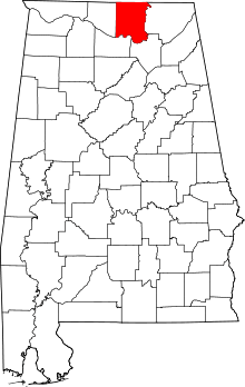 | |
| Towns | ||
| CDPs | ||
| Unincorporated communities | ||
| Footnotes | ‡This populated place also has portions in an adjacent county or counties | |
This article is issued from Wikipedia - version of the 7/31/2016. The text is available under the Creative Commons Attribution/Share Alike but additional terms may apply for the media files.