Mayerthorpe
| Mayerthorpe | |
|---|---|
| Town | |
| Town of Mayerthorpe | |
|
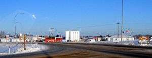
Highway 43 entrance to Mayerthorpe from the south. | |
 Mayerthorpe Location of Mayerthorpe in Alberta | |
| Coordinates: 53°57′01″N 115°08′01″W / 53.95028°N 115.13361°WCoordinates: 53°57′01″N 115°08′01″W / 53.95028°N 115.13361°W | |
| Country |
|
| Province |
|
| Region | Central Alberta |
| Census division | 13 |
| Municipal district | Lac Ste. Anne County |
| Incorporated[1] | |
| • Village | March 5, 1927 |
| • Town | March 20, 1961 |
| Government[2] | |
| • Mayor | Kate Patrick |
| • Governing body | Mayerthorpe Town Council |
| Area (2011)[3] | |
| • Total | 4.78 km2 (1.85 sq mi) |
| Elevation[4] | 712 m (2,336 ft) |
| Population (2011)[3] | |
| • Total | 1,398 |
| • Density | 292.7/km2 (758/sq mi) |
| Time zone | MST (UTC-7) |
| Area code(s) | -1+780 |
| Highways |
Highway 22 Highway 43 |
| Waterway | Paddle River |
| Website | Official website |
Mayerthorpe is a town in central Alberta, Canada, located approximately 120 km (75 mi) northwest of Edmonton at the intersection of Highway 43 and Highway 22 (Cowboy Trail). The town is surrounded by Lac Ste. Anne County and is located within Alberta's Census Division No. 13.
History
Mayerthorpe incorporated as a village on March 5, 1927.[1] It then incorporated as a town just over 34 years later on March 20, 1961.[1]
On March 3, 2005, four officers serving with the Mayerthorpe and Whitecourt detachments of the Royal Canadian Mounted Police (RCMP) were killed in the Mayerthorpe tragedy.
On July 29, 2008, the Mayerthorpe Arena was destroyed by a fire. In 2011, after three years of planning and fundraising, the new arena, now called the Mayerthorpe Exhibition Centre, was officially opened.
In 2016, a string of suspicious fires in the area resulted in the destruction of a CN trestle bridge.[5] The bridge was rebuilt shortly thereafter, in about twenty days.[6]
Demographics
In the 2011 Census, the Town of Mayerthorpe had a population of 1,398 living in 589 of its 629 total dwellings, a -5.2% change from its 2006 population of 1,474. With a land area of 4.78 km2 (1.85 sq mi), it had a population density of 292.5/km2 (757.5/sq mi) in 2011.[3]
In 2006, Mayerthorpe had a population of 1,474 living in 636 dwellings, a 6.1% decrease from 2001. The town has a land area of 4.78 km2 (1.85 sq mi) and a population density of 308.6/km2 (799/sq mi).[7]
Media
The local weekly newspaper serving Mayerthorpe and area is the Mayerthorpe Freelancer.[8]
Sports
The Whitecourt Wild Senior "AA" ice hockey team was added to the North Central Hockey League in 2013. The team plays in the Mayerthorpe Exhibition Centre.[9]
See also
References
- 1 2 3 "Location and History Profile: Town of Mayerthorpe" (PDF). Alberta Municipal Affairs. October 7, 2016. p. 386. Retrieved October 13, 2016.
- ↑ "Municipal Officials Search". Alberta Municipal Affairs. November 18, 2016. Retrieved November 21, 2016.
- 1 2 3 "Population and dwelling counts, for Canada, provinces and territories, and census subdivisions (municipalities), 2011 and 2006 censuses (Alberta)". Statistics Canada. 2012-02-08. Retrieved 2012-02-08.
- ↑ "Alberta Private Sewage Systems 2009 Standard of Practice Handbook: Appendix A.3 Alberta Design Data (A.3.A. Alberta Climate Design Data by Town)" (PDF) (PDF). Safety Codes Council. January 2012. pp. 212–215 (PDF pages 226–229). Retrieved October 8, 2013.
- ↑ Andrea Ross, "Former Mayerthorpe mayor defends son accused of arson in CN fire," CBC News May 1, 2016, URL accessed May 1, 2016.
- ↑ "Mayerthorpe's CN trestle bridge rebuilt after major fire". CBC News. May 17, 2016. Retrieved July 2, 2016.
- ↑ Statistics Canada. "Canada 2006 Census: Mayerthorpe - Community Profile". Retrieved 2007-06-12.
- ↑ "Mayerthorpe Freelancer". Sun Media Corporation. Retrieved 2012-07-15.
- ↑ Harvey, Ann (September 10, 2013). "North Central Hockey League comes to Whitecourt". Whitecourt Star.
External links
| Wikinews has related news: RCMP memorial for fallen Alberta mounties delayed |
 |
Blue Ridge | Swan Hills | Barrhead | |
| Whitecourt | |
Sangudo | ||
| ||||
| | ||||
| Edson | Entwistle | Wabamun |