Mayenne (river)
| Mayenne | |
|---|---|
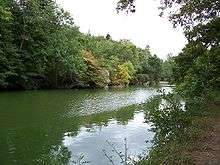 The Mayenne and Sainte-Apollonie Island near Entrammes | |
| Native name | La Mayenne |
| Country | France |
| Basin | |
| Main source |
Perche 300 m (980 ft) |
| River mouth |
Maine 47°29′35″N 0°32′34″W / 47.49306°N 0.54278°WCoordinates: 47°29′35″N 0°32′34″W / 47.49306°N 0.54278°W |
| Progression | Maine→ Loire→ Atlantic Ocean |
| Basin size | 5,820 km2 (2,250 sq mi) |
| Physical characteristics | |
| Length | 200 km (120 mi) |
| Discharge |
|
The Mayenne is a river in western France principally located in the French region of Pays de la Loire. Together with the river Sarthe and its tributary the Loir it forms the Maine, which is a tributary to the Loire.
Geography
Its source is in the department of Orne near the commune of Lalacelle, between Pré-en-Pail and Alençon. The source is in the foothills of Mont des Avaloirs at an altitude of 961 feet (293m); from there the river runs from east to west until it reaches Sept-Forges, at which point it turns to the south. After being joined by the Oudon, the Mayenne forms a confluence with the Sarthe north of Angers. The confluence of these two rivers is called the Maine, which is the local pronunciation of Mayenne. The waters of the Maine then empty into the Loire south of Angers.
Departments and towns along the river include:
- Orne
- Mayenne: Mayenne, Laval, Château-Gontier
- Maine-et-Loire: Chenillé-Changé, Chambellay, Montreuil-sur-Maine, Le Lion-d'Angers, Grez-Neuville, Pruillé, La Membrolle-sur-Longuenée, Feneu, Montreuil-Juigné, Cantenay-Epinard, Angers.
It is featured prominently in the video game Call of Duty 3.
Navigation
In the 16th century several works were undertaken to make the Mayenne navigable between Chateau-Gontier and Laval. Two ordinances of Francis I, in 1536 and 1537, allowing the necessary works. This new route allowed wines from the Loire valley to arrive in Laval.
Important works were also undertaken from 1853 to 1868. In 1863, projects to deepen the river of the Mayenne were undertaken. The Mayenne is navigable from Laval to the Loire, and is canalized from Laval to Mayenne. In the 19th century, the river allowed the navigation of boats up to 140 tons (130 tonnes), and especially boats carrying construction materials (wood and stone), coal from the mines of L'Huisserie, grains, fruits, and vegetables.
Flow
In spite of abundant precipitation, the flow of the Mayenne is irregular because of the impermeability of the sandstone, granite, and schist which form its drainage basin. Thus, for an average flow of 39 m3/s (1,400 cu ft/s) before the Mayenne's confluence with the Oudon, the yearly minimum flow can range from very low (4 m3/s (140 cu ft/s) at Laval) to very high (flash floods with flows of 200 m3/s (7,100 cu ft/s) at Laval and more than 800 m3/s (28,000 cu ft/s) at Chambellay).
The flow of the Mayenne has been observed for a period of 44 years (1965-2008) at Chambellay, situated upstream of the confluence with the Sarthe, and just upstream from where the Oudon joins the Mayenne. At this location, the drainage basin of the river is 4,160 km2 (1,610 sq mi) out of a total of 5,820 km2 (2,250 sq mi), which is less than three-quarters of the entire drainage basin (71.5%), and also does not include the flow of the Oudon, the Mayenne's principal tributary.
The average yearly flow at Chambellay is 39.3 m3/s (1,390 cu ft/s), which corresponds to over 50 m3/s (1,800 cu ft/s) if the rest of the drainage basin were included.