Maydena
| Maydena Tasmania | |||||||
|---|---|---|---|---|---|---|---|
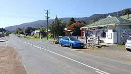 Looking east on main road | |||||||
 Maydena | |||||||
| Coordinates | 42°45′S 146°37′E / 42.750°S 146.617°ECoordinates: 42°45′S 146°37′E / 42.750°S 146.617°E | ||||||
| Population | 245 (2006 census)[1] | ||||||
| Postcode(s) | 7140 | ||||||
| Elevation | 281 m (922 ft)[2] | ||||||
| Location |
| ||||||
| LGA(s) | Derwent Valley Council | ||||||
| State electorate(s) | Lyons | ||||||
| Federal Division(s) | Lyons | ||||||
| |||||||
Maydena is a locality in Tasmania, Australia, alongside the River Tyenna.
Maydena is on the Gordon River Road, south west of New Norfolk, through the Bushy Park Hop Fields, past the Styx Valley, turn left at Westerway, past Mount Field National Park and Russell Falls, through Tyenna and Fitzgerald townships and then up to Maydena itself. Gordon River Road continues to Lake Pedder, Lake Gordon and Strathgordon, in the Southwest National Park of Tasmania.
At the 2006 census, Maydena had a population of 245.[1]
Maydena has a state primary school and a community online centre.[3]
History
The 3' 6" gauge railway line in Maydena was once used for hauling timber and osmiridium ore, as well as a way point for the Dam builders up at Strathgordon. A portion of the disused rail track is now being used by a pedal powered 'Rail track riders' tourist attraction.[4]
Maydena Post Office opened on 1 May 1944.[5]
Climate
The climate is generally cold and wet. Some winter nights drop below freezing, the average winter daytime temperatures average between 8 °C (46 °F) and 15 °C (59 °F). The summer is mild with temperatures averaging around 5 °C (41 °F) to 12 °C (54 °F) at night to 15 °C (59 °F) to 28 °C (82 °F) during the day. Rainfall is set to 1,187.9 millimetres (46.77 in) annually spread over 12 months and an average of 219.3 days of rainfall.
| Climate data for Maydena Post Office | |||||||||||||
|---|---|---|---|---|---|---|---|---|---|---|---|---|---|
| Month | Jan | Feb | Mar | Apr | May | Jun | Jul | Aug | Sep | Oct | Nov | Dec | Year |
| Record high °C (°F) | 37.0 (98.6) |
35.8 (96.4) |
35.2 (95.4) |
28.5 (83.3) |
25.3 (77.5) |
18.9 (66) |
17.4 (63.3) |
22.1 (71.8) |
26.7 (80.1) |
30.0 (86) |
32.3 (90.1) |
35.2 (95.4) |
37.0 (98.6) |
| Average high °C (°F) | 22.1 (71.8) |
22.3 (72.1) |
19.4 (66.9) |
15.8 (60.4) |
13.1 (55.6) |
10.8 (51.4) |
10.6 (51.1) |
12.0 (53.6) |
13.7 (56.7) |
15.6 (60.1) |
18.0 (64.4) |
19.7 (67.5) |
16.1 (61) |
| Average low °C (°F) | 9.0 (48.2) |
8.9 (48) |
6.9 (44.4) |
5.3 (41.5) |
4.4 (39.9) |
2.5 (36.5) |
2.2 (36) |
2.6 (36.7) |
3.4 (38.1) |
4.7 (40.5) |
6.4 (43.5) |
7.4 (45.3) |
5.3 (41.5) |
| Record low °C (°F) | −0.4 (31.3) |
−1.0 (30.2) |
−3.9 (25) |
−1.8 (28.8) |
−3.4 (25.9) |
−4.2 (24.4) |
−3.5 (25.7) |
−3.8 (25.2) |
−3.4 (25.9) |
−3.2 (26.2) |
−1.4 (29.5) |
−0.6 (30.9) |
−4.2 (24.4) |
| Average precipitation mm (inches) | 63.9 (2.516) |
64.7 (2.547) |
69.8 (2.748) |
85.1 (3.35) |
96.2 (3.787) |
99.0 (3.898) |
107.6 (4.236) |
156.8 (6.173) |
140.1 (5.516) |
122.7 (4.831) |
91.5 (3.602) |
89.7 (3.531) |
1,187.9 (46.768) |
| Average rainy days | 13.2 | 11.4 | 16.4 | 17.4 | 20.6 | 20.2 | 23.2 | 23.8 | 21.8 | 20.7 | 15.1 | 15.5 | 219.3 |
| Source: [6] | |||||||||||||
References
- 1 2 Australian Bureau of Statistics (25 October 2007). "Maydena (L) (Urban Centre/Locality)". 2006 Census QuickStats. Retrieved 2007-10-11.
- ↑ Bureau of Meteorology. Retrieved 2007-11-10
- ↑ Maydena Community Online Center
- ↑ Rail Track Riders
- ↑ Premier Postal History. "Post Office List". Premier Postal Auctions. Retrieved 16 June 2012.
- ↑ "Climate statistics for Maydena". Bureau of Meteorology.
External links
![]() Media related to Maydena, Tasmania at Wikimedia Commons
Media related to Maydena, Tasmania at Wikimedia Commons