Mattat
| Mattat | |
|---|---|
|
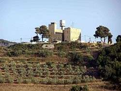
Sasa Tegart fort | |
 Mattat | |
| Coordinates: 33°2′25.47″N 35°21′17.45″E / 33.0404083°N 35.3548472°ECoordinates: 33°2′25.47″N 35°21′17.45″E / 33.0404083°N 35.3548472°E | |
| District | Northern |
| Council | Ma'ale Yosef |
| Founded | 1979 |
| Founded by | HaSuka members |
| Population (2015)[1] | 192 |
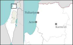
Mattat (Hebrew: מַתָּת) is a small communal settlement in northern Israel. Located near the Lebanese Border between the cities of Ma'alot-Tarshiha and Safed, it falls under the jurisdiction of Ma'ale Yosef Regional Council. In 2015 it had a population of 192.
History
The village was founded in 1979 by a group of families from an organisation called HaSukah, and was the first settlement of the Lookouts in the Galilee plan. It is founded on the land of the Arab village of Dayr al-Qassi,[2] which was depopulated in the 1948 Arab-Israeli War.
Today many of its residents are employed in local industry and agriculture. Tourism is also an important source of income, and Mattat natural beauty is taken advantage of by several small hotels.
Mattat's name is equivalent in gematria to 840, its altitude in metres. The high location and mountainous region provides the town with a relatively temperate climate. Summer temperatures rarely break 30°C and humidity is low, and summer nights are even chilly. The winters are cold and wet, with an average of over 800mm precipitation, including the occasional snow.
References
- ↑ "List of localities, in Alphabetical order" (PDF). Israel Central Bureau of Statistics. Retrieved 16 October 2016.
- ↑ Khalidi, Walid (1992), All That Remains, Washington D.C.: Institute for Palestine Studies, p. 13, ISBN 0-88728-224-5