Mather, Sacramento County, California
| Mather | |
|---|---|
| census-designated place | |
 Mather Position in California. | |
| Coordinates: 38°31′54″N 121°17′02″W / 38.53167°N 121.28389°WCoordinates: 38°31′54″N 121°17′02″W / 38.53167°N 121.28389°W | |
| Country |
|
| State |
|
| County | Sacramento |
| Area[1] | |
| • Total | 10.026 sq mi (25.967 km2) |
| • Land | 10.001 sq mi (25.902 km2) |
| • Water | 0.025 sq mi (0.065 km2) 0.25% |
| Elevation[2] | 108 ft (33 m) |
| Population (2010) | |
| • Total | 4,451 |
| • Density | 440/sq mi (170/km2) |
| Time zone | Pacific (PST) (UTC-8) |
| • Summer (DST) | PDT (UTC-7) |
| GNIS feature ID | 2583073 |
| U.S. Geological Survey Geographic Names Information System: Mather, Sacramento County, California | |
Mather is a census-designated place in Sacramento County, California.[2] Mather sits at an elevation of 108 feet (33 m).[2] The 2010 United States census reported Mather's population was 4,451. It is the site of the former Mather Air Force Base, closed by the federal government in 1993.
Geography
According to the United States Census Bureau, the CDP covers an area of 10.0 square miles (26.0 km²), 99.75% of it land and 0.25% of it water.
Demographics
The 2010 United States Census[3] reported that Mather had a population of 4,451. The population density was 444.0 people per square mile (171.4/km²). The racial makeup of Mather was 2,477 (55.7%) White, 393 (8.8%) African American, 42 (0.9%) Native American, 850 (19.1%) Asian, 84 (1.9%) Pacific Islander, 267 (6.0%) from other races, and 338 (7.6%) from two or more races. Hispanic or Latino of any race were 704 persons (15.8%).
The Census reported that 4,447 people (99.9% of the population) lived in households, 4 (0.1%) lived in non-institutionalized group quarters, and 0 (0%) were institutionalized.
There were 1,436 households, out of which 679 (47.3%) had children under the age of 18 living in them, 857 (59.7%) were opposite-sex married couples living together, 150 (10.4%) had a female householder with no husband present, 72 (5.0%) had a male householder with no wife present. There were 115 (8.0%) unmarried opposite-sex partnerships, and 14 (1.0%) same-sex married couples or partnerships. 237 households (16.5%) were made up of individuals and 24 (1.7%) had someone living alone who was 65 years of age or older. The average household size was 3.10. There were 1,079 families (75.1% of all households); the average family size was 3.57.
The population was spread out with 1,357 people (30.5%) under the age of 18, 379 people (8.5%) aged 18 to 24, 1,571 people (35.3%) aged 25 to 44, 924 people (20.8%) aged 45 to 64, and 220 people (4.9%) who were 65 years of age or older. The median age was 31.6 years. For every 100 females there were 100.1 males. For every 100 females age 18 and over, there were 96.7 males.
There were 1,520 housing units at an average density of 151.6 per square mile (58.5/km²), of which 1,061 (73.9%) were owner-occupied, and 375 (26.1%) were occupied by renters. The homeowner vacancy rate was 2.7%; the rental vacancy rate was 5.1%. 3,453 people (77.6% of the population) lived in owner-occupied housing units and 994 people (22.3%) lived in rental housing units.
References
- ↑ U.S. Census
- 1 2 3 U.S. Geological Survey Geographic Names Information System: Mather, Sacramento County, California
- ↑ "2010 Census Interactive Population Search: CA - Mather CDP". U.S. Census Bureau. Retrieved July 12, 2014.
Municipalities and communities of Sacramento County, California, United States | ||
|---|---|---|
| Cities | 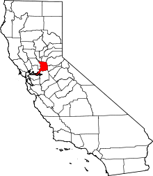 | |
| CDPs | ||
| Unincorporated communities | ||
| Ghost towns | ||