Matane
| Matane | ||
|---|---|---|
| Town | ||
 | ||
| ||
| Motto: Le succès dans l'effort (Success in effort) | ||
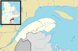
 Location within La Matanie RCM. | ||
 Matane Location in eastern Quebec. | ||
| Coordinates: 48°51′N 67°32′W / 48.850°N 67.533°WCoordinates: 48°51′N 67°32′W / 48.850°N 67.533°W[1] | ||
| Country |
| |
| Province |
| |
| Region | Bas-Saint-Laurent | |
| RCM | La Matanie | |
| Constituted | September 26, 2001 | |
| Government[2] | ||
| • Mayor | Jérome Landry | |
| • Federal riding | Avignon—La Mitis—Matane—Matapédia | |
| • Prov. riding | Matane-Matapédia | |
| Area[2][3] | ||
| • Town | 228.50 km2 (88.22 sq mi) | |
| • Land | 195.47 km2 (75.47 sq mi) | |
| • Metro[4] | 662.96 km2 (255.97 sq mi) | |
| Population (2011)[3] | ||
| • Town | 14,462 | |
| • Density | 74.0/km2 (192/sq mi) | |
| • Metro[4] | 18,368 | |
| • Metro density | 27.7/km2 (72/sq mi) | |
| • Pop 2006–11 |
| |
| • Dwellings | 7,293 | |
| Demonym(s) | Matanais, Matanaises | |
| Time zone | EST (UTC−5) | |
| • Summer (DST) | EDT (UTC−4) | |
| Postal code(s) | G4W | |
| Area code(s) | 418 and 581 | |
| Highways |
| |
| Website |
www | |
.svg.png)
Matane is a town on the Gaspé Peninsula in Quebec, Canada, on the south shore of the Saint Lawrence River at the mouth of the Matane River. The town is the seat for the La Matanie Regional County Municipality.
In addition to Matane itself, the town's territory also includes the communities of Petit-Matane and Saint-Luc-de-Matane.
There is a ferry service which crosses the river to Baie-Comeau and Godbout on the north shore as well as a rail ferry service to Baie-Comeau and Sept-Îles.[5]
Etymology
The name Matane was first assigned to the river by Samuel de Champlain as "Mantanne" in 1603. Its meaning is open to different interpretations, with the most common one being that it comes from the Mi'kmaq word mtctan meaning "beaver pond", since the region had an abundant beaver population. It could also come a Maliseet word for "spinal cord", referring to the course of the Matane River; or from the word Mattawa/Matawin, meaning "meeting of the waters". Finally, it could be an abbreviation of the word matandipives, meaning "shipwreck".[1]
History

In 1603, Samuel de Champlain visited the area and considered the location as "pleasant enough". In 1616 merchants known as the Rochelais from La Rochelle were the first Europeans to spend the winter. Matane was used as a trading post for the Rochelais who were exchanging European goods for furs with the Mi'kmaq people. In 1672, the land on both sides of the Matane River was granted as a seignory to Mathieu D'Amours, which led to the first settlements shortly after. The Mi'kmaq people lived there until 1845.[1][6]
In 1845, the place was first incorporated as the Municipality of Matane, but dissolved two years later. In 1855, it was reestablished as the Parish Municipality of Saint-Jérôme-de-Matane, named after the local parish. In 1893, the main population centre at the mouth of the Matane River separated from the parish municipality and was incorporated as the Village Municipality of Saint-Jérôme-de-Matane, which changed status and name to City of Matane in 1937 when city status was granted.[1][6]
After World War II, Matane merchants decided to strengthen their economic and maritime bonds with the North side of the Saint Lawrence River. They ran a service of a regular ferry in 1962. In 1978 a train ferry system was in place.[7]
On September 26, 2001, the neighbouring municipalities of Petit-Matane, Saint-Luc-de-Matane, and Saint-Jérôme-de-Matane were amalgamated into the Town of Matane.[1]
Tourism
Since Matane is the first step to Gaspé's tourist circuit it receives and accommodates many passing tourists. The old lighthouse of Matane was transformed into a tourist information centre with a panoramic view of its surroundings.
Matane is known for its excellent shrimp. The town is known also for its windmills with Quebec's biggest windfarm. The Matane River is known as the "River-School" in Quebec because so many people learn to fish there. The river itself is 101 km in length and is the only place in Quebec where you can fish in the town square.[7]
A number of people from Matane and the area are well known locally or internationally, including artist Claude Picher and NHL players such as Yves Racine. There are a number of art galleries in Matane that support local talent.[7]
In 2000 Matane was named East Quebec's industrial capital.[1]
Districts
The town is divided in 4 districts that match the former municipalities before amalgamation in 2001:
- District 1 - Matane
- District 2 - Saint-Jérome-de-Matane
- District 3 - Petit-Matane
- District 4 - Saint-Luc-de-Matane
Demographics
Population
| Canada census – Matane community profile | |||
|---|---|---|---|
| 2011 | 2006 | 2001 | |
| Population: | 14,462 (-1.9% from 2006) | 14,742 (+26.7% from 2001) | 11,635 (-5.9% from 1996) |
| Land area: | 195.47 km2 (75.47 sq mi) | 195.47 km2 (75.47 sq mi) | 24.80 km2 (9.58 sq mi) |
| Population density: | 74.0/km2 (192/sq mi) | 75.4/km2 (195/sq mi) | 469.2/km2 (1,215/sq mi) |
| Median age: | 49.7 (M: 48.2, F: 50.9) | 46.2 (M: 44.7, F: 47.4) | 43.4 (M: 42.0, F: 44.7) |
| Total private dwellings: | 7,293 | 7073 | 5573 |
| Median household income: | $37,718 | $29,595 | |
| Notes: Population in 1996: 12,364[8] (-3.1% from 1991) - Population in 1991: 12,756[8] 2006 Community Profile includes adjusted figures due to boundary change: Amalgamated with Petit-Matane, Saint-Luc-de-Matane, and Saint-Jérôme-de-Matane on September 26, 2001 – References: 2011[9] 2006[10] 2001[11] | |||
Population trend:[12]
|
|

Language
Mother tongue:[13]
- English as first language: 0.5%
- French as first language: 98.5%
- English and French as first language: 0.1%
- Other as first language: 0.9%
See also
References
- 1 2 3 4 5 6 "Matane (Ville)" (in French). Commission de toponymie du Québec. Retrieved 2012-01-23.
- 1 2 "Matane". Répertoire des municipalités (in French). Ministère des Affaires municipales, des Régions et de l'Occupation du territoire. Retrieved 2012-01-23.
- 1 2 "Matane census profile". 2011 Census data. Statistics Canada. Retrieved 2012-01-23.
- 1 2 "Matane (Census agglomeration) community profile". 2011 Census data. Statistics Canada. Retrieved 2012-05-24.. The census agglomeration consists of Matane, Saint-René-de-Matane, Saint-Ulric, Sainte-Félicité. In the 2006 census, the census agglomeration had not included Saint-René-de-Matane nor Sainte-Félicité.
- ↑ Train ferry
- 1 2 "Saint-Jérôme-de-Matane (Municipalité de paroisse)" (in French). Commission de toponymie du Québec. Retrieved 2012-01-23.
- 1 2 3 "Matane...Passion et savoir faire". Conception Kaleidos Multimédia. p. Tourism. Retrieved 19 November 2012.
- 1 2 "Electronic Area Profiles". Canada 1996 Census. Statistics Canada. Retrieved 2013-05-11.
- ↑ "2011 Community Profiles". Canada 2011 Census. Statistics Canada. July 5, 2013. Retrieved 2013-05-18.
- ↑ "2006 Community Profiles". Canada 2006 Census. Statistics Canada. March 30, 2011. Retrieved 2012-01-23.
- ↑ "2001 Community Profiles". Canada 2001 Census. Statistics Canada. February 17, 2012. Retrieved 2012-01-23.
- ↑ Statistics Canada: 1996, 2001, 2006, 2011 census
- ↑ "Matane community profile". 2006 Census data. Statistics Canada. Retrieved 2012-01-23.
External links
 |
Pointe-Lebel Saint Lawrence River |
Baie-Comeau / Franquelin Saint Lawrence River |
| |
| Saint-Ulric | |
Sainte-Félicité | ||
| ||||
| | ||||
| Saint-Léandre | Ste-Paule, St-René-de-Matane | Saint-Adelme |
| Cities & Towns | |
|---|---|
| Municipalities | |
| Parishes | |
| Unorganized territories | |
| |