Matale District
This article is about the district in Sri Lanka. For the town, see Matale.
| Matale District මාතලේ දිස්ත්රික්කය மாத்தளை மாவட்டம் | |
|---|---|
| Administrative District | |
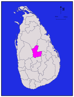 Map of Sri Lanka with Matale District highlighted | |
| Coordinates: 7°40′N 80°45′E / 7.667°N 80.750°ECoordinates: 7°40′N 80°45′E / 7.667°N 80.750°E | |
| Country | Sri Lanka |
| Province | Central Province |
| Largest city | Matale |
| Divisions |
List
|
| Government | |
| • District Secretary | H. M. Gamini Senavirathne |
| • Local |
List
|
| Area | |
| • Total | 1,993 km2 (770 sq mi) |
| • Land | 1,952 km2 (754 sq mi) |
| • Water | 41 km2 (16 sq mi) |
| Population (2001) | |
| • Total | 441,328 |
| • Density | 220/km2 (570/sq mi) |
| Time zone | Sri Lanka (UTC+05:30) |
| ISO 3166 code | LK-22 |
| Website | ds.gov.lk/dist_matale |
Matale District (Sinhalese: මාතලේ දිස්ත්රික්කය, Tamil: மாத்தளை மாவட்டம்) is a district in Central Province, Sri Lanka. Its area is 1,987 km².
Demographics
The population according to 2001 census is 441,328. 80.1% of the population are Sinhalese, 8.7% Sri Lankan Moors, 5.5% native Sri Lankan tamils and 5.3% tamils of Indian origin. 79% of the population are Buddhists, 9.6% Hindu, 9.1% Muslim and 2.3% Christian.[1]
Cities
- Matale (Municipal Council)
Big towns
- Dambulla (Municipal Council)
Small towns
Other places
- Gammaduwa
- Elkaduwa
- Inamaluwa
- Kaikawala
- Kibissa
- Laggala Pallegama
- Madawala Ulpotha
- Nalanda
- Palapathwela
- Sigiriya
- Wahacotte
- Yatawatta
Heritage Sites
Lists of other tourist attractions in Matale District
References
- ↑ Department of Census and Statistics official government website
| ||
This article is issued from Wikipedia - version of the 4/14/2016. The text is available under the Creative Commons Attribution/Share Alike but additional terms may apply for the media files.