Maryland Route 21
| ||||
|---|---|---|---|---|
| Tolchester Beach Road | ||||
|
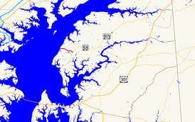
Maryland Route 21 highlighted in red | ||||
| Route information | ||||
| Maintained by MDSHA | ||||
| Length: | 2.42 mi[1] (3.89 km) | |||
| Existed: | 1927 – present | |||
| Major junctions | ||||
| West end: |
| |||
| East end: |
| |||
| Location | ||||
| Counties: | Kent | |||
| Highway system | ||||
| ||||

Maryland Route 21 (MD 21) is a state highway in the U.S. state of Maryland. Known as Tolchester Beach Road, the highway runs 2.42 miles (3.89 km) from MD 445 near Tolchester Beach east to MD 20 near Fairlee in western Kent County. MD 21 was constructed in the mid-1920s to provide a modern road connection to Tolchester Beach, then a major beach resort on the Chesapeake Bay. The highway's western terminus was rolled back to MD 445 in the early 1990s.
Route description
MD 21 begins at Tolchester Beach Road's intersection with the northern end of MD 445 (Tolchester Road), the north leg of the intersection is county-maintained Bay Shore Road, and Tolchester Beach Road continues west as a county road to the eponymous beach community and its marina. MD 21 heads southeast as a two-lane road. The highway reaches its eastern terminus at MD 20 (Rock Hall Road) at McClean's Corner south of Fairlee. The road continues southeast as county-maintained Sandy Bottom Road toward St. Paul's Church.[1][2]
History
Tolchester Beach was a major resort on the Chesapeake Bay that featured a hotel, pavilion, swimming, and amusement park rides. The resort opened in 1877 and thrived with the traffic generated by steamboat excursions from various ports on the bay, including Baltimore. However, the rise of more modern resorts caused a long decline; Tolchester Beach closed in 1962.[3] Tolchester Beach Road was constructed as a concrete road in 1924 and 1925 to connect the Tolchester Beach resort to the Rock Hall–Chestertown road at McClean's Corner.[4][5] By 1927, a ferry connected Tolchester Beach with the Inner Harbor of Baltimore.[5] This ferry service continued until between 1940 and 1946.[6][7] MD 21 was resurfaced with bituminous concrete in 1975.[8] The highway's westernmost 0.04 miles (0.064 km), measured from the high-water mark of the Chesapeake Bay, was transferred from state to county maintenance through a August 16, 1990, road transfer agreement.[9] The western terminus of MD 21 was moved again, this time to MD 445's northern terminus, when the portion of MD 21 between MD 445 and Tolchester Beach was transferred from state to county maintenance through a June 1, 1993, road transfer agreement.[10]
Junction list
The entire route is in Kent County.
| Location | mi[1] | km | Destinations | Notes | |
|---|---|---|---|---|---|
| Tolchester Beach | 0.00 | 0.00 | Western terminus | ||
| Fairlee | 2.42 | 3.89 | Eastern terminus | ||
| 1.000 mi = 1.609 km; 1.000 km = 0.621 mi | |||||
See also
 Maryland Roads portal
References
- 1 2 3 Highway Information Services Division (December 31, 2015). Highway Location Reference. Maryland State Highway Administration. Retrieved September 10, 2016.
- Kent County (PDF)
- ↑ Maryland State Highway Administration (2015). Maryland General Highway Statewide Grid Map (PDF) (Map). 1:12,000. Baltimore: Maryland State Highway Administration. §§ E14B, D14D. Retrieved September 10, 2016.
- ↑ Marshall, Bob (May 29, 2009). "Tolchester Beach Amusement Park Historical Marker". The Historical Marker Database. Springfield, VA: J.J. Prats. Retrieved September 10, 2016.
- ↑ Mackall, John N.; Darnall, R. Bennett; Brown, W.W. (January 1927). Annual Reports of the State Roads Commission of Maryland (1924–1926 ed.). Baltimore: Maryland State Roads Commission. pp. 31, 89. Retrieved September 10, 2016.
- 1 2 Maryland Geological Survey (1927). Map of Maryland: Showing State Road System and State Aid Roads (Map). Baltimore: Maryland Geological Survey.
- ↑ Maryland State Roads Commission (1940). Map of Maryland Showing Highways and Points of Interest (Map). Baltimore: Maryland State Roads Commission.
- ↑ Maryland State Roads Commission (1946). Maryland: Official Highway Map (Map) (1946–47 ed.). Baltimore: Maryland State Roads Commission.
- ↑ Maryland Road Construction Progress Log (PDF). Baltimore: Maryland State Highway Administration. Contract Number: K-350-277 (July 10, 1975). Retrieved September 10, 2016 – via Maryland State Archives.
- ↑ "Memorandum of Action of Director Neil J. Pedersen" (PDF). S.R.C. Minutes District No. 2 Kent County. Baltimore: Maryland State Highway Administration. August 16, 1990. Retrieved September 10, 2016 – via Maryland State Archives.
- ↑ "Memorandum of Action of Director Neil J. Pedersen" (PDF). S.R.C. Minutes District No. 2 Kent County. Baltimore: Maryland State Highway Administration. June 1, 1993. Retrieved September 10, 2016 – via Maryland State Archives.