Marvdasht
| Marvdasht مرودشت | |
|---|---|
| city | |
|
| |
 Marvdasht | |
| Coordinates: 29°52′27″N 52°48′09″E / 29.87417°N 52.80250°ECoordinates: 29°52′27″N 52°48′09″E / 29.87417°N 52.80250°E | |
| Country |
|
| Province | Fars |
| County | Marvdasht |
| Bakhsh | Central |
| Population (2006) | |
| • Total | 123,858 |
| Time zone | IRST (UTC+3:30) |
| • Summer (DST) | IRDT (UTC+4:30) |
.jpg)
Marvdasht (Persian: مرودشت, also Romanized as Marv Dasht)[1] is a city in and the capital of Marvdasht County, Fars Province, Iran. At the 2006 census, its population was 123,858, in 29,134 families.[2]
Historical background
Marvdasht is as ancient of the history of Iran and the vast Persian empire. The Persepolis is in the vincity of the city and few kilometers farther Naghsh-e-Rostam, Naghsh-e-Rajab and the ruins of the ancient city of Estakhr are reminiscent of the glorious history of the city. Archeological excavations have shown that millenniums before Darius decided to choose the plains of Rahmat Mount for the construction of the majestic Persepolis Palaces, civilized populations had been living in the Marvdasht Plains.
But the city itself does not have a long history and has been built in the 20th century. After the Pahlavi government built the sugar factory in 1935 (1314), the city gradually developed around the factory and each year it absorbed an enormous population leaving nearby villages or abandoning nomadic life and settling in the flourishing city. People from farther areas also migrated to Marvdasht. To the end of Pahlavi dynasty, other factories such as the petrochemical complex, Azmayesh (producing househould appliances and intended to be biggest in the middle east), Charmineh leather factory, Fars meat complex and Dadli biscuit company were constructed around the city and as a huge workforce was required, the population of Marvdasht increased and it became the second most populated city in Fars province and was called the industrial city of the province.But the city did not just excel in industry, the fertile lands around Marvdasht have turned it into a center of agriculture in Iran and it has surpassed other Iranian areas in producing wheat, maize, tomato, cucumber and other agricultural products.
The name of the city
The historians have said that Marvdasht was originally the name of one the neighborhoods of the ancient city of Estakhr and gradually the whole area was called Marvdasht. On the other hand, some have argued that Marv a plant which grew in the area and that is why the suffix "Dasht" which in Persian means Plain was added to the word to designate the plains in the area.
Geographical features
Marvdasht is one of the northern cities and also counties of Fars province. The city is located 45 km north of Shiraz and has an altitude of 1620 meters above the sea level. The county has an area of 3687 square kilometers and neighbors Arsenjan in the east, Pasargad in the north, Khorambid and Eghlid in the northwest, Sepidan in the southwest and Shiraz in the south. There are three cities in the county: Marvdasht, Seydan and Kamfirouz. Marvdasht as a county is divided into four districts: Central, Kamfirouz, Doroudzan and Seydan. Marvdasht has a cold weather in the hilly areas and moderate climate in other regions.
Higher education
The city has three universities: Islamic Azad University (Marvdasht Branch), Fars Science and Research University (دانشگاه علوم و تحقيقات فارس) and Payam-e-Nour university.
Archaeology
The Tokyo University Iraq-Iran Archaeological Expedition, headed by Namio Egami, carried out three seasons of excavations in the Marv Dasht plain from 1956 to 1965.
The excavations took place at the following prehistoric mounds situated in the vicinity of Marvdasht and Persepolis (map)[3]
- Tall-i Bakun A and B
- Tall-i Gap A
- Tall-i Jari A and B
- Tall-i Mushki.[4]
Tall-e Gap is an important ancient settlement belonging to Bakun culture, 5th millennium BCE Chalcolithic. Tall-e Gap belongs to the Middle Bakun sub-phase. Many ceramic items have been found.
References
- ↑ Marvdasht can be found at GEOnet Names Server, at this link, by opening the Advanced Search box, entering "-3074200" in the "Unique Feature Id" form, and clicking on "Search Database".
- ↑ "Census of the Islamic Republic of Iran, 1385 (2006)". Islamic Republic of Iran. Archived from the original (Excel) on 2011-11-11.
- ↑ locality map
- ↑ Prehistoric pottery from the Marv Dasht Plain, Iran The University Museum, University of Tokyo
External links
| Capital | 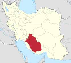 | ||||||||||||||||||||||||||||||||||||||||||||||||||||||||||||||
|---|---|---|---|---|---|---|---|---|---|---|---|---|---|---|---|---|---|---|---|---|---|---|---|---|---|---|---|---|---|---|---|---|---|---|---|---|---|---|---|---|---|---|---|---|---|---|---|---|---|---|---|---|---|---|---|---|---|---|---|---|---|---|---|
| Counties (A-K) and cities | |||||||||||||||||||||||||||||||||||||||||||||||||||||||||||||||
| Counties (L-Z) and cities | |||||||||||||||||||||||||||||||||||||||||||||||||||||||||||||||
| Landmarks |
| ||||||||||||||||||||||||||||||||||||||||||||||||||||||||||||||
| populated places | |||||||||||||||||||||||||||||||||||||||||||||||||||||||||||||||