Martin's Additions, Maryland
| Martin's Additions, Maryland | |
|---|---|
| Village | |
 | |
| Coordinates: 38°58′47″N 77°4′10″W / 38.97972°N 77.06944°WCoordinates: 38°58′47″N 77°4′10″W / 38.97972°N 77.06944°W | |
| Country |
|
| State |
|
| County |
|
| Government | |
| • Village Manager | Matt Trollinger |
| Area[1] | |
| • Total | 0.14 sq mi (0.36 km2) |
| • Land | 0.14 sq mi (0.36 km2) |
| • Water | 0 sq mi (0 km2) |
| Elevation | 338 ft (103 m) |
| Population (2010)[2] | |
| • Total | 933 |
| • Estimate (2012[3]) | 963 |
| • Density | 6,664.3/sq mi (2,573.1/km2) |
| Time zone | Eastern (EST) (UTC-5) |
| • Summer (DST) | EDT (UTC-4) |
| FIPS code | 24-50965 |
| GNIS feature ID | 1669431 |
Martin's Additions is a village in Montgomery County, Maryland, United States. It was established as a Special Tax District in 1916 and incorporated as a village in 1985. The population was 933 at the 2010 census.
Geography
Martin's Additions is located at 38°58′47″N 77°4′10″W / 38.97972°N 77.06944°W (38.979713, −77.069349).[4]
According to the United States Census Bureau, the village has a total area of 0.14 square miles (0.36 km2), all of it land.[1]
History
In 1896, Harry M. Martin began buying land from the Chevy Chase Land Company and others and called his holdings "Martin's Additions to Chevy Chase".[5] In 1916, the area was incorporated as the special tax district of Martin's First, Second, Third and Fourth Additions to the Village of Chevy Chase.[5] Following a referendum of residents and approval of Montgomery County and the state, the special tax district was incorporated as a municipality, the Village of Martin's Additions, on 19 March 1985.[5]
Demographics
| Historical population | |||
|---|---|---|---|
| Census | Pop. | %± | |
| 1990 | 846 | — | |
| 2000 | 875 | 3.4% | |
| 2010 | 933 | 6.6% | |
| Est. 2015 | 989 | [6] | 6.0% |
2010 census
As of the census[2] of 2010, there were 933 people, 321 households, and 269 families residing in the village. The population density was 6,664.3 inhabitants per square mile (2,573.1/km2). There were 329 housing units at an average density of 2,350.0 per square mile (907.3/km2). The racial makeup of the village was 92.7% White, 0.6% African American, 3.8% Asian, 0.5% Pacific Islander, 0.9% from other races, and 1.5% from two or more races. Hispanic or Latino of any race were 3.2% of the population.
There were 321 households of which 44.2% had children under the age of 18 living with them, 76.0% were married couples living together, 5.9% had a female householder with no husband present, 1.9% had a male householder with no wife present, and 16.2% were non-families. 13.4% of all households were made up of individuals and 6.6% had someone living alone who was 65 years of age or older. The average household size was 2.91 and the average family size was 3.19.
The median age in the village was 44.3 years. 30.4% of residents were under the age of 18; 3.6% were between the ages of 18 and 24; 17.3% were from 25 to 44; 33.1% were from 45 to 64; and 15.8% were 65 years of age or older. The gender makeup of the village was 49.1% male and 50.9% female.
2000 census
As of the census[8] of 2000, there were 875 people, 309 households, and 258 families residing in the village. The population density was 6,524.6 people per square mile (2,598.8/km²). There were 312 housing units at an average density of 2,326.5 per square mile (926.6/km²). The racial makeup of the village was 95.66% White, 0.11% African American, 1.26% Asian, 0.91% from other races, and 2.06% from two or more races. Hispanic or Latino of any race were 3.31% of the population.
There were 309 households out of which 46.0% had children under the age of 18 living with them, 73.5% were married couples living together, 7.4% had a female householder with no husband present, and 16.2% were non-families. 14.6% of all households were made up of individuals and 8.1% had someone living alone who was 65 years of age or older. The average household size was 2.83 and the average family size was 3.13.
In the village the population was spread out with 31.9% under the age of 18, 2.3% from 18 to 24, 20.8% from 25 to 44, 32.0% from 45 to 64, and 13.0% who were 65 years of age or older. The median age was 42 years. For every 100 females there were 93.2 males. For every 100 females age 18 and over, there were 88.0 males.
The median income for a household in the village was $135,443, and the median income for a family was $144,939. Males had a median income of $100,000 versus $91,112 for females. The per capita income for the village was $59,502. About 1.5% of families and 1.2% of the population were below the poverty line, including 2.1% of those under age 18 and none of those age 65 or over.
Education
Martin's Additions is served by the Montgomery County Public Schools.
The village is zoned to:
- Rosemary Hills Elementary School (PreK-2)
- Chevy Chase Elementary School (3-6)
- Westland Middle School (7-8)
- Bethesda-Chevy Chase High School (9-12)
References
- 1 2 "US Gazetteer files 2010". United States Census Bureau. Retrieved 2013-01-25.
- 1 2 "American FactFinder". United States Census Bureau. Retrieved 2013-01-25.
- ↑ "Population Estimates". United States Census Bureau. Retrieved 2013-06-26.
- ↑ "US Gazetteer files: 2010, 2000, and 1990". United States Census Bureau. 2011-02-12. Retrieved 2011-04-23.
- 1 2 3 Linda M. Burrell et al., eds. Maryland's 157: The Incorporated Cities and Towns. Annapolis, MD: Maryland Municipal League, 2000. p. 208.
- ↑ "Annual Estimates of the Resident Population for Incorporated Places: April 1, 2010 to July 1, 2015". Retrieved July 2, 2016.
- ↑ "Census of Population and Housing". Census.gov. Retrieved June 4, 2015.
- ↑ "American FactFinder". United States Census Bureau. Retrieved 2008-01-31.
External links
Municipalities and communities of Montgomery County, Maryland, United States | ||
|---|---|---|
| Cities | 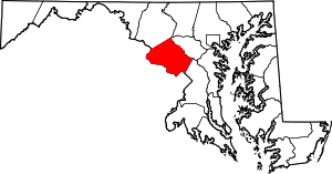 | |
| Towns | ||
| Villages & Special Tax Districts | ||
| CDPs |
| |
| Unincorporated communities | ||
| Footnotes | ‡This populated place also has portions in an adjacent county or counties | |