Mark West Creek
| Mark West Creek | |
| stream | |
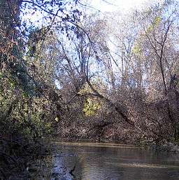 Mark West Creek between Windsor Creek and the Russian River. | |
| Name origin: William Marcus West | |
| Country | United States |
|---|---|
| State | California |
| Region | Sonoma County |
| Tributaries | |
| - left | Windsor Creek, Mill Creek, Weeks Creek, Van Buren Creek |
| - right | Laguna de Santa Rosa, Porter Creek, Humbug Creek |
| Cities | Mark West, California, Mark West Springs, California |
| Source | Mayacamas Mountains |
| - location | 6 mi (10 km) west of St. Helena, California |
| - elevation | 1,922 ft (586 m) |
| - coordinates | 38°31′3″N 122°33′47″W / 38.51750°N 122.56306°W [1] |
| Mouth | Russian River |
| - location | north of Forestville, California |
| - elevation | 45 ft (14 m) |
| - coordinates | 38°29′38″N 122°53′35″W / 38.49389°N 122.89306°WCoordinates: 38°29′38″N 122°53′35″W / 38.49389°N 122.89306°W [1] |
Mark West Creek is a 29.9-mile-long (48.1 km)[2] stream that rises in the Mayacamas Mountains of Sonoma County, California, United States. Tributaries of Mark West Creek include Porter Creek and Hummingbird Creek, both of which originate in the same mountain range. Discharge waters of Mark West Creek reach the Russian River after a confluence with the Laguna de Santa Rosa. The Community Clean Water Institute has developed a program for monitoring pollutants in Mark West Creek.[3]
The four-mile stretch of Mark West Creek from Mark West Lodge to Mark West Creek Road is a challenging class III-V whitewater kayaking run.[4]
Course
Mark West Creek originates about 6 miles (10 km) west of St. Helena, California near St. Helena Road. The road goes along the Creek westward to Calistoga Road, where the Creek turns northeast, flowing through the town of Mark West Springs. From there, it descends southward. Mark West Springs Road was built next to it. The Creek passes Mayacama Golf Club and turns westward, emerging from hills east of the Sonoma County Airport. U.S. Route 101 was built over it south of Airport Boulevard and the Creek continues generally westward, passing south of the airport to join the Laguna de Santa Rosa east of Forestville. From there, the Creek flows north to a confluence with Windsor Creek, and then flows westward, entering the Russian River east of Steelhead Beach Regional Park.
Near the Laguna de Santa Rosa confluence, Mark West Creek has been diverted southward in three separate places, making it appear that the Creek feeds the Laguna instead of vice versa. Since 1988, the Creek length between the Laguna de Santa Rosa and the Russian River has often been considered part of the Laguna. The Laguna de Santa Rosa Foundation has promoted this nomenclature.
Watershed
The Mark West Creek drainage basin covers a large portion of Sonoma County, from Mount Saint Helena and Sonoma Mountain in the east to Forestville in the west. It includes four cities (Santa Rosa, Rohnert Park, Sebastopol, and Cotati) and the incorporated town of Windsor. Adjacent watersheds include those of Green Valley Creek, Petaluma River, Sonoma Creek, the Napa River, and the Russian River.
See also
Footnotes
- 1 2 U.S. Geological Survey Geographic Names Information System: Mark West Creek
- ↑ U.S. Geological Survey. National Hydrography Dataset high-resolution flowline data. The National Map, accessed March 9, 2011
- ↑ Community Clean Water Institute: Mark West Creek
- ↑ California whitewater - Mark West Creek, Sonoma County