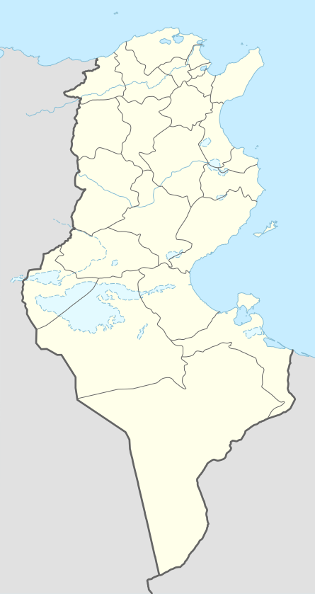
Mareth Line
| Mareth Line | |
|---|---|
| Part of French defence of Tunisia | |
| Tunisia | |
|
Mareth Line in 1943 | |
 Mareth Line | |
| Coordinates | 33°38′00″N 10°18′00″E / 33.63333°N 10.30000°ECoordinates: 33°38′00″N 10°18′00″E / 33.63333°N 10.30000°E |
| Height | 2,200 feet (670 m) |
| Length | 25 miles (40 km) |
| Site information | |
| Owner | French colonial administration of Tunisia |
| Operator | French army |
| Controlled by | German–Italian Panzer Army |
| Condition | Decrepit |
| Site history | |
| Built | 1936 |
| Built by | Le Deuxième Bureau au Travail |
| In use | March 1943 |
| Materials | reinforced concrete |
| Fate | Lapsed into desuetude |
| Battles/wars | Battle of the Mareth Line |
| Garrison information | |
| Past commanders | Erwin Rommel |
| Garrison |
1943, east to west: 136th Infantry Division Giovani Fascisti, 101st Motorised Division Trieste, 90th Light Division, 80th Infantry Division La Spezia, 16th Motorised Division Pistoia, 164th Light Afrika Division 15th Panzer Division (32 operational tanks) Reserve: 21st Panzer Division, 10th Panzer Division (110 operational tanks) |
| Djebel Tebaga–Djebel Melab: Raggruppamento Sahariano | |

The Mareth Line was a system of fortifications built by France in southern Tunisia, prior to World War II. It was to defend Tunisia against attacks from Libya, then a colony of Fascist Italy. Tunisia was occupied by Axis forces after Operation Torch in 1942 and the line was used by the Axis to defend against the British 8th Army, which had re-occupied Libya during 1943.
Background
French plans for defence of Tunisia assumed that Italy would launch an overwhelming assault that France could not easily oppose. Italy was expected to launch attacks on Egypt and Tunisia as soon as war was declared, with the Italian Navy securing supply and interdicting any substantial Anglo-French relief. With a limited force of six divisions, a fortress division and a cavalry division to defend the French protectorate of Tunisia in French North Africa, the French army settled on the idea of a ligne Maginot du désert (a Maginot Line in the desert).[1] The border with Libya was indefensible for an inferior force, so the French considered two positions inside Tunisia. The best prospect was the Wadi Akarit, which ran from the Chott El Fedjed which is the eastern extension of the Chott el Djerid salt flats, to the Mediterranean Sea.[2] The sea and the salt flats were impassable, so this position could not be flanked but the Wadi Akarit position did not protect the important town and harbour of Gabès. The French colonial government opposed the surrender of so much of Tunisia.
The French chose the next best prospect, along Wadi Zigzaou, between the Matmata Hills and the Mediterranean sea, 37 miles (60 km) south of Wadi Akarit. The banks of Wadi Zigzaou were up to 70 feet (21 m) high and surveys of the Matmata hills indicated they were impassable, with the western desert seeming equally forbidding.[2] This position secured Gabès as a supply base but was easily outflanked to the west, if a mobile force went around the Matmata Hills, and Wadi Zigzaou put the French in front of a bottleneck, vulnerable to air and artillery fire. Construction began in 1936, with the Mareth line laid out in a similar manner to the Maginot line. The fortification stretched for 28 miles (45 km) of fixed defences, trenches and cleared firing blinds. Infantry were to be housed in trenches and forty concrete casements as well as 15 fortified command posts and 28 support posts. The ground did not suit underground artillery but eight large artillery positions were constructed, each capable of accommodating a battery.[2]
The French Resident-General Charles Hippolyte Noguès (16 September 1936 to 21 June 1943) and the French Staff expected an extreme manpower shortage in France and units in Tunisia were not expected to be reinforced. Once mobilised, the French army in Tunisia was expected to hold out for up to two years against a superior Italian army attacking from Libya. The Mareth Line incorporated French experience of trench warfare and infantry–artillery attacks. The line would conserve French manpower and provide a force multiplier. As in France, the French were confident that fixed fortifications would be only harassed by tactical air power and immensely improved field artillery.[3] Eventually, the position might be used as a staging base to push into Libya but any such operation would occur far into a new war and only after a successful British invasion from Egypt.
Geography

The geography of central Tunisia is dominated by the Atlas Mountains, while the northern and southern portions are largely flat. The primary feature in the south is the Matmata Hills, a range running north-south roughly parallel to the eastern coast on the Mediterranean Sea. West of the hills, the land is inhospitable desert, making the region between the hills and the coast the only easily traversed approach to northern Tunisia. A smaller line of hills runs east–west along the northern edge of the Matmata range, further complicating this approach. There is a small gap between the two ranges, the Tebaga Gap, at the extreme northern end of the Matmata Hills.
The line broadly followed the Wadi Zigzaou for 22 miles (35 km) inland to the Matmata Hills, crossing the coastal road. The wadi provided a natural defence line with its steep, high banks. It was reputed to be the most difficult military defence line in North Africa. The French view was that the hills were sufficiently impassable to block any outflanking move on the landward side.[4] The line was broken in the Operation Supercharge II.
World War II
World War II began in 1939 but the Mareth Line saw no use from 1939–1940, as Italy remained neutral until a few days before the Armistice of 22 June 1940, after which, the line was demilitarised by an Italo-German commission. In November 1942, the British Eighth Army (General Bernard Montgomery) defeated Panzerarmee Afrika at the Second Battle of El Alamein and the British First Army landed in French North Africa in Operation Torch. Axis forces occupied Tunisia in the Tunisia Campaign and from November 1942 to March 1943, the Panzerarmee conducted a fighting retreat through Egypt and Libya, pursued by the Eighth Army. Axis engineers refurbished the Mareth Line for occupation by the Panzerarmee and by March 1943, more than 62 miles (100 km) of barbed wire, 100,000 anti-tank mines and 70,000 anti-personnel mines had been laid, bunkers had been reinforced with concrete and armed with anti-tank and anti-aircraft guns. In March 1943, the Eighth Army reached the Libya–Tunisia border and paused at Medenine to prepare to attack the Mareth Line. Axis forces were renamed the Italian 1st Army (General Giovanni Messe) and attempted a spoiling attack, Operation Capri. The attack failed and the Axis troops withdrew to the Mareth Line, to await the British attack.[lower-alpha 1] The British survey of the Mareth Line was assisted by General Rime-Bruneau an ex-Chief of Staff of the Tunisian garrison and Captain Paul Mezan, the Garrison Engineer of the Mareth Line.[6]
Battle of the Mareth Line

On 19 March 1943, the Eighth Army, made a frontal assault in Operation Pugilist. The British 50th Infantry Division penetrated the Line near Zarat but was driven back by the 15th Panzer Division on 22 March. Earlier reconnaissance by the Long Range Desert Group had shown that the Line could be outflanked. A force could pass through the southern Matmata Hills, reach the Tebaga Gap from the west and pass on to the coastal plain behind the Mareth Line, which became known as the "left hook". At the same time as Pugilist, Montgomery had sent the 2nd New Zealand Division around the Matmata Hills but its attack was contained at the gap from 21–24 March. Montgomery sent the 1st Armoured Division of X Corps to reinforce the Tebaga attack and put the corps commanders, Brian Horrocks, in joint charge. The British attacked again in Operation Supercharge II on 26 March and broke through the gap on 27 March. This success, combined with a fresh frontal assault, made the Mareth line untenable but the Italian 1st Army escaped encirclement, when the 1st Armoured Division was held up at El Hamma and the Axis forces retreated to Wadi Akarit, 37 miles (60 km) to the north.
Notes
- ↑ The Mareth Line was garrisoned by the 136th Infantry Division Giovani Fascisti, 101st Motorised Division Trieste, 90th Light Division, 80th Infantry Division La Spezia, 16th Motorised Division Pistoia, 164th Light Afrika Division and the 15th Panzer Division with 32 operational tanks and in reserve were the 21st Panzer Division and the 10th Panzer Division with 110 operational tanks. The line from Djebel Tebaga–Djebel Melab was held by the Raggruppamento Sahariano.[5]
Footnotes
- ↑ Playfair 1954, p. 92.
- 1 2 3 Gauché 1953.
- ↑ Jackson 2000, p. 207.
- ↑ Stevens 1962, p. 155.
- ↑ Playfair 2004, p. 333.
- ↑ Playfair 2004, p. 332.
References
- Dear, I. C. B., ed. (2001). The Oxford Companion to World War II. Oxford: Oxford University Press. ISBN 0-19-860446-7.
- Gauché, Maurice (1953). Le Deuxième Bureau au Travail, 1935–1940. Archives d'histoire contemporaine (in French). Paris: Amiot Dumont. OCLC 3093195.
- Jackson, P. (2000). France and the Nazi menace: Intelligence and Policy Making, 1933–1939. Oxford: Oxford University Press. ISBN 0-19820-834-0.
- Playfair, Major-General I. S. O.; et al. (2004) [1st. pub. HMSO 1954]. Butler, J. R. M., ed. The Mediterranean and Middle East: The Early Successes Against Italy (to May 1941). History of the Second World War, United Kingdom Military Series. I. Naval & Military Press. ISBN 1-84574-065-3.
- Playfair, Major-General I. S. O.; et al. (2004) [HMSO 1966]. Butler, J. R. M., ed. The Mediterranean and Middle East: The Destruction of the Axis Forces in Africa. History of the Second World War United Kingdom Military Series. IV. Uckfield: Naval & Military Press. ISBN 1-84574-068-8.
- Prior-Palmer, Brigadier G. E. (March 1946). "II, Medenine to Tunis". A Short History of the 8th Armoured Brigade. no isbn. Hanover: H.Q. 8th Armoured Brigade. Retrieved 3 June 2015.
- Stevens, Major-General W. G. (1962). "8–10". Bardia to Enfidaville. The Official History of New Zealand in the Second World War 1939–1945. Wellington, NZ: Historical Publications Branch. OCLC 4377202.
External links
| Wikimedia Commons has media related to Mareth Line. |
- Strader, J. W. Tactical Bomber Operations in the ETO (1944)
- Travel tips to visit the Mareth line museum