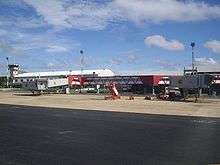
Marechal Cunha Machado International Airport
| Marechal Cunha Machado International Airport (Tirirical) Aeroporto Internacional Marechal Cunha Machado (Tirirical) | |||||||||||||||
|---|---|---|---|---|---|---|---|---|---|---|---|---|---|---|---|
 | |||||||||||||||
| IATA: SLZ – ICAO: SBSL | |||||||||||||||
| Summary | |||||||||||||||
| Airport type | Public | ||||||||||||||
| Operator | Infraero | ||||||||||||||
| Serves | São Luís | ||||||||||||||
| Elevation AMSL | 54 m / 178 ft | ||||||||||||||
| Coordinates | 02°35′13″S 044°14′10″W / 2.58694°S 44.23611°WCoordinates: 02°35′13″S 044°14′10″W / 2.58694°S 44.23611°W | ||||||||||||||
| Website | Infraero SLZ | ||||||||||||||
| Map | |||||||||||||||
 SLZ Location in Brazil | |||||||||||||||
| Runways | |||||||||||||||
| |||||||||||||||
| Statistics (2015) | |||||||||||||||
| |||||||||||||||
Marechal Cunha Machado International Airport (IATA: SLZ, ICAO: SBSL), formerly called Tirirical Airport, is the airport serving São Luís, Brazil. Since 17 October 1985 the airport is named after Marechal Cunha Machado.[4]
It is operated by Infraero.
History
In 1942, a grass track measuring one thousand meters (runway 09/27), which served the airbase of the Brazilian Army, was the only way that São Luís had to receive flights. Runway 06/24 was built as part of the US base which began operating in 1943. In 1974, the Air Ministry transferred to Infraero technical jurisdiction, administrative and operational airport. The current passenger terminal of Airport Marechal Cunha Machado opened in June 1998 The name of the airport is a tribute to the Air Marshall and Captain Lieutenant Commander Hugo da Cunha Machado, born in Maranhão. In October 2004 it was upgraded to international category.
Airlines and destinations
Accidents and incidents
Accidents
- 1 June 1973: a Cruzeiro do Sul Sud Aviation SE-210 Caravelle VI N registration PP-PDX operating flight 109 from Belém-Val de Cans to São Luís crashed on approach to São Luís. Engine no.1 lost power and the aircraft attained an extreme nose-up attitude. It stalled and crashed 760m to the right of the runway. All 23 passengers and crew died.[5][6]
Incidents
- 3 February 1984: a Cruzeiro do Sul Airbus A300B4-203 operating flight 302 en route from São Luís to Belém-Val de Cães with 176 passengers and crew aboard was hijacked by 3 persons who demanded to be taken to Cuba. The flight reached Camagüey in less than a day. There were no victims.[7]
Access
The airport is located 15 km (9 mi) from downtown São Luís.
See also
References
- ↑ "Estatísticas" (in Portuguese). Infraero. 2 February 2016. Retrieved 4 July 2016.
- ↑ "Airport Official Website" (in Portuguese). Infraero.
- ↑ "Lista de aeródromos públicos" (in Portuguese). ANAC.
- ↑ "Lei n˚7.383, de 17 de outubro de 1985" (in Portuguese). Senado Federal. 17 October 1985. Retrieved 18 April 2011.
- ↑ "Accident description PP-PDX". Aviation Safety Network. Retrieved 22 June 2011.
- ↑ Germano da Silva, Carlos Ari César (2008). "O mistério do Tirirical". O rastro da bruxa: história da aviação comercial brasileira no século XX através dos seus acidentes 1928–1996 (in Portuguese) (2 ed.). Porto Alegre: EDIPUCRS. pp. 279–284. ISBN 978-85-7430-760-2.
- ↑ "Incident description 3 February 1984". Aviation Safety Network. Retrieved 4 August 2011.
External links
- Airport information for SBSL at World Aero Data. Data current as of October 2006.Source: DAFIF.
- Airport information for SBSL at Great Circle Mapper. Source: DAFIF (effective October 2006).
- Current weather for SBSL at NOAA/NWS
- Accident history for SLZ at Aviation Safety Network