Marchais-en-Brie
| Marchais-en-Brie | ||
|---|---|---|
 | ||
| ||
 Marchais-en-Brie | ||
|
Location within Hauts-de-France region  Marchais-en-Brie | ||
| Coordinates: 48°53′05″N 3°29′05″E / 48.8847°N 3.4847°ECoordinates: 48°53′05″N 3°29′05″E / 48.8847°N 3.4847°E | ||
| Country | France | |
| Region | Hauts-de-France | |
| Department | Aisne | |
| Arrondissement | Château-Thierry | |
| Canton | Condé-en-Brie | |
| Intercommunality | Condé en Brie | |
| Government | ||
| • Mayor (2001–2008) | Alain Moroy | |
| Area1 | 12.78 km2 (4.93 sq mi) | |
| Population (2008)2 | 266 | |
| • Density | 21/km2 (54/sq mi) | |
| Time zone | CET (UTC+1) | |
| • Summer (DST) | CEST (UTC+2) | |
| INSEE/Postal code | 02458 / 02540 | |
| Elevation |
112–212 m (367–696 ft) (avg. 210 m or 690 ft) | |
|
1 French Land Register data, which excludes lakes, ponds, glaciers > 1 km² (0.386 sq mi or 247 acres) and river estuaries. 2 Population without double counting: residents of multiple communes (e.g., students and military personnel) only counted once. | ||

Marchais-en-Brie is a former commune in the department of Aisne in northern France. On 1 January 2016, it was merged into the new commune Dhuys-et-Morin-en-Brie.[1]
Population
| Historical population | ||
|---|---|---|
| Year | Pop. | ±% |
| 1962 | 204 | — |
| 1968 | 184 | −9.8% |
| 1975 | 152 | −17.4% |
| 1982 | 183 | +20.4% |
| 1990 | 231 | +26.2% |
| 1999 | 240 | +3.9% |
| 2008 | 266 | +10.8% |
See also
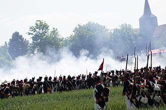
Napoleonic Wars reenactments, battle of Montmirail.
References
- ↑ Arrêté préfectoral 10 September 2015 (French)
| Wikimedia Commons has media related to Marchais-en-Brie. |
This article is issued from Wikipedia - version of the 11/21/2016. The text is available under the Creative Commons Attribution/Share Alike but additional terms may apply for the media files.