Mara Region
| Mara Region Mkoa wa Mara (Swahili) | |
|---|---|
| Region | |
|
| |
 Location in Tanzania | |
| Country | Tanzania |
| Zone | Lake |
| Capital | Musoma |
| Government | |
| • Regional Commissioner | John Tupa |
| Area | |
| • Total | 21,760 km2 (8,400 sq mi) |
| Population (2012) | |
| • Total | 1,743,830 |
| • Density | 80/km2 (210/sq mi) |
| Time zone | EAT (UTC+3) |
| Postcode | 31xxx |
| Area code(s) | 028 |
| Website |
mara |
.jpg)
Mara Region is one of Tanzania's 30 administrative regions. The regional capital is the municipality of Musoma. According to the 2012 national census, the region had a population of 1,743,830, which was lower than the pre-census projection of 1,963,460.[1]:page 2 For 2002-2012, the region's 2.5 percent average annual population growth rate was the thirteenth highest in the country.[1]:page 4 It was also the twelfth most densely populated region with 80 people per square kilometer.[1]:page 6
The neighboring regions are Mwanza Region and Simiyu Region (to the south), Arusha Region (to the southeast), and Kagera Region (across Lake Victoria). To the northeast, the Mara Region borders Narok County and Migori County in Kenya. The Mara Region is the home of Tanzania's first president, Julius Nyerere. The Mara Region was also the birthplace of Benga music.
Indigenous Groups
The Mara Region is the ancestral homeland to the following peoples:
- Luo
- Jita
- Ruri
- Zanaki,
- Kuria
- Kabwa
- Kiroba
- Simbiti
- Ngoreme
- Kwaya
- Nata
- Ikoma
- Isenye
- Ikizu
- Sizaki
- Sukuma
- Datooga
Under occupying British rule, the Mara region was a district called the Lake Province, which became the Lake Region after independence in 1961.[2]
National parks and monuments
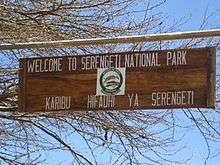
The Mara Region is home to the Serengeti National Park, one of the world's most famous national parks. Listed as a World Heritage Site, the national park occupies a large area of grasslands and woodlands and is home to a diverse range of wildlife. It attracts close to 150,000 tourists every year. The sanctuary is home to more than a million wildebeest, 200,000 zebras, and 300,000 Thomson's gazelles. Apart from conventional tourism in the park, there is also a range of ecotourism opportunities available in the Mara Region.[3]
Notable persons from Mara
- Julius Nyerere- the first president of both Tanganyika and Tanzania, attended Mwisenge Primary School in Musoma
- Joseph Warioba- Tanzania's sixth prime minister(1984-1985) and fourth vice president(1985-1990)
- Stephen Wassira- politician
- Maria Nyerere- Tanzania's first first lady
- Daniel Owino Misiani- Tanzanian musician (the grandfather of Benga music)
Academics:
- Ibrahim Juma- Tanzanian High Court judge
- Prof. Philemon Sarungi- Tanzania's first Orthopaedic Surgeon
- Dr. Lloyd A Binagi- Historian
- Dr. Ayubu C Ryoba - Communication
- Dr. Samwel Wangwe - Economist
- Dr. Mataro Sabai - Engineer
- Dr. Mohabe Nyirabu- Political Scientist
Athletes:
- Dickson Marwa Mkami- Tanzanian long-distance runner
- Mbwana Samata- football athlete (Simba, TP Mazembe, and national team)
- Amri Kiemba- football athlete (Simba and national team)
Administrative divisions
Districts
The region is administratively divided into seven districts:
| Districts of Mara Region | ||||||
|---|---|---|---|---|---|---|
| Map | District | Population (2012) | ||||
 |
Bunda | 335,061 | ||||
| Butiama | 241,732 | |||||
| Musoma Rural | 178,356 | |||||
| Musoma Urban | 134,327 | |||||
| Rorya | 265,241 | |||||
| Serengeti | 249,420 | |||||
| Tarime | 339,693 | |||||
| Total | 1,743,830 | |||||
Constituencies
For parliamentary elections, Tanzania is divided into constituencies. As of the 2010 elections the Mara Region had seven constituencies:[4]
- Bunda Constituency and Mwibara Constituency in Bunda District.
- Musoma Mjini Constituency in Musoma Urban District,
- Musoma Vijijini Constituency in Musoma Rural District,
- Rorya Constituency in Rorya District
- Serengeti Constituency in Serengeti District
- Tarime Constituency in Tarime District
See also
References
- 1 2 3 Population Distribution by Administrative Units, United Republic of Tanzania, 2013
- ↑ Ndembwike, John (2008). Life in Tanzania. Godfrey Mwakikagile. pp. 38–40.
- ↑ "Serengeti.org". Retrieved 16 January 2016.
- ↑ "Organisations located in Mara Region - Tanzania". African Development Information.
| Mainland | ||
|---|---|---|
| Zanzibar | ||
Coordinates: 1°45′S 34°00′E / 1.750°S 34.000°E