Maple Plain, Minnesota
| Maple Plain, Minnesota | |
|---|---|
| City | |
| Nickname(s): Suplex City | |
| Motto: "A Proud Partner Of Active Living Hennepin County" | |
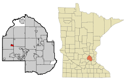 Location of Maple Plain within Hennepin County, Minnesota | |
| Coordinates: 45°0′30″N 93°39′32″W / 45.00833°N 93.65889°W | |
| Country | United States |
| State | Minnesota |
| County | Hennepin |
| Government | |
| • Mayor | Jerry Young |
| Area[1] | |
| • City | 1.12 sq mi (2.90 km2) |
| • Land | 1.11 sq mi (2.87 km2) |
| • Water | 0.01 sq mi (0.03 km2) 0.89% |
| Elevation | 1,027 ft (313 m) |
| Population (2010)[2] | |
| • City | 1,768 |
| • Estimate (2012[3]) | 1,803 |
| • Density | 1,592.8/sq mi (615.0/km2) |
| • Metro | 3,279,833 |
| Time zone | Central (UTC-6) |
| • Summer (DST) | Central (UTC-5) |
| Area code(s) | 763 |
| FIPS code | 27-40256[4] |
| GNIS feature ID | 0647497[5] |
Maple Plain is a city in Hennepin County, Minnesota, United States. The population was 1,768 at the 2010 census.[6]
Geography
According to the United States Census Bureau, the city has a total area of 1.12 square miles (2.90 km2), of which 1.11 square miles (2.87 km2) is land and 0.01 square miles (0.03 km2) is water.[1] Maple Plain is located 20 miles west of Minneapolis on U.S. Highway 12.
Pioneer Creek flows through the northwest corner of Maple Plain.
History
Maple Plain is named for the many sugar maples in its forests.[7] Early settlement of the area began in 1854 and revolved around Lake Independence to its north, and its outflow Pioneer Creek. In 1868 and 1869, the St. Paul, Pacific and Manitoba Railroad was built through Maple Plain. By 1871, Maple Plain had a post office. The city was incorporated as a village in 1912. Village water came to the town in 1939, sewer circa 1950, and blacktop in 1961.
Demographics
| Historical population | |||
|---|---|---|---|
| Census | Pop. | %± | |
| 1880 | 105 | — | |
| 1920 | 273 | — | |
| 1930 | 288 | 5.5% | |
| 1940 | 360 | 25.0% | |
| 1950 | 479 | 33.1% | |
| 1960 | 754 | 57.4% | |
| 1970 | 1,169 | 55.0% | |
| 1980 | 1,421 | 21.6% | |
| 1990 | 2,005 | 41.1% | |
| 2000 | 2,088 | 4.1% | |
| 2010 | 1,768 | −15.3% | |
| Est. 2015 | 1,785 | [8] | 1.0% |
| U.S. Decennial Census | |||
2010 census
As of the census[2] of 2010, there were 1,768 people, 723 households, and 462 families residing in the city. The population density was 1,592.8 inhabitants per square mile (615.0/km2). There were 775 housing units at an average density of 698.2 per square mile (269.6/km2). The racial makeup of the city was 94.2% White, 2.0% African American, 0.3% Native American, 0.6% Asian, 0.1% Pacific Islander, 1.4% from other races, and 1.4% from two or more races. Hispanic or Latino of any race were 4.8% of the population.
There were 723 households of which 31.3% had children under the age of 18 living with them, 48.4% were married couples living together, 9.7% had a female householder with no husband present, 5.8% had a male householder with no wife present, and 36.1% were non-families. 29.5% of all households were made up of individuals and 10.5% had someone living alone who was 65 years of age or older. The average household size was 2.36 and the average family size was 2.94.
The median age in the city was 43.1 years. 22.1% of residents were under the age of 18; 8.3% were between the ages of 18 and 24; 22.7% were from 25 to 44; 33.4% were from 45 to 64; and 13.6% were 65 years of age or older. The gender makeup of the city was 50.0% male and 50.0% female.
2000 census
As of the census[4] of 2000, there were 2,088 people, 770 households, and 536 families residing in the city. The population density was 1,875.4 people per square mile (726.3/km²). There were 786 housing units at an average density of 706.0 per square mile (273.4/km²). The racial makeup of the city was 97.65% White, 0.48% African American, 0.24% Native American, 0.62% Asian, 0.38% from other races, and 0.62% from two or more races. Hispanic or Latino of any race were 0.91% of the population.
There were 770 households out of which 41.9% had children under the age of 18 living with them, 54.8% were married couples living together, 10.9% had a female householder with no husband present, and 30.3% were non-families. 25.1% of all households were made up of individuals and 11.0% had someone living alone who was 65 years of age or older. The average household size was 2.61 and the average family size was 3.15.
In the city the population was spread out with 28.9% under the age of 18, 7.5% from 18 to 24, 32.3% from 25 to 44, 20.2% from 45 to 64, and 11.2% who were 65 years of age or older. The median age was 36 years. For every 100 females there were 91.0 males. For every 100 females age 18 and over, there were 88.6 males.
The median income for a household in the city was $50,938, and the median income for a family was $58,977. Males had a median income of $40,114 versus $32,121 for females. The per capita income for the city was $22,218. About 2.6% of families and 4.4% of the population were below the poverty line, including 3.4% of those under age 18 and 10.9% of those age 65 or over.
Notable residents
- Brock Lesnar, professional wrestler and former mixed martial artist, lived in Maple Plain from 2003 to 2014.[9][10]
References
- 1 2 "US Gazetteer files 2010". United States Census Bureau. Retrieved 2012-11-13.
- 1 2 "American FactFinder". United States Census Bureau. Retrieved 2012-11-13.
- ↑ "Population Estimates". United States Census Bureau. Retrieved 2013-05-28.
- 1 2 "American FactFinder". United States Census Bureau. Retrieved 2008-01-31.
- ↑ "US Board on Geographic Names". United States Geological Survey. 2007-10-25. Retrieved 2008-01-31.
- ↑ "2010 Census Redistricting Data (Public Law 94-171) Summary File". American FactFinder. U.S. Census Bureau, 2010 Census. Retrieved 23 April 2011.
- ↑ Upham, Warren (2001). Minnesota Place Names. Minnesota Historical Society Press. p. 229. ISBN 0-87351-396-7.
- ↑ "Annual Estimates of the Resident Population for Incorporated Places: April 1, 2010 to July 1, 2015". Retrieved July 2, 2016.
- ↑ http://www.latimes.com/business/realestate/hot-property/la-fi-hotprop-brock-lesnar-house-20140903-story.html
- ↑ http://www.citypages.com/news/brock-lesnars-800-000-maple-plain-home-for-sale-photos-6569274
External links
Municipalities and communities of Hennepin County, Minnesota, United States | ||
|---|---|---|
| Cities |
|  |
| Unorganized territory | ||
| Footnotes | ‡This populated place also has portions in an adjacent county or counties | |
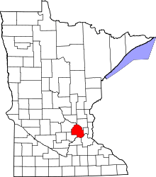
Coordinates: 45°00′26″N 93°39′21″W / 45.00722°N 93.65583°W