Kokhav HaShahar
| Kokhav HaShahar כּוֹכַב הַשַּׁחַר | |
|---|---|
 | |
 Kokhav HaShahar | |
| Coordinates: 31°57′36.00″N 35°20′52.80″E / 31.9600000°N 35.3480000°ECoordinates: 31°57′36.00″N 35°20′52.80″E / 31.9600000°N 35.3480000°E | |
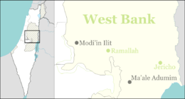
| District | Judea and Samaria Area |
| Council | Mateh Binyamin |
| Region | West Bank |
| Affiliation | Amana |
| Founded | 1979 |
| Population (2015)[1] | 1,945 |
| Name meaning | Morning Star |
Kokhav HaShahar (Hebrew: כּוֹכַב הַשַּׁחַר, also spelt Kochav Shachar and Kochav HaShachar, trans. Morning Star) is a communal Israeli settlement in the Binyamin region of northern West Bank. Located on a mountain ridge overlooking the Jordan Valley, and accessible via the Allon Road, it falls under the municipal jurisdiction of Mateh Binyamin Regional Council. In 2015 it had a population of 1,945.
The international community considers Israeli settlements in the West Bank illegal under international law, but the Israeli government disputes this.[2]
History
Kokhav HaShahar was founded by nine young couples in 1979 on the site of an Israel Defense Forces outpost.
Maoz Esther, north of Kokhav HaShahar and east of Ramallah, was an outpost established in 2005 by Kokhav HaShahar residents in memory of Ester Galia of Kokhav HaShahar who was murdered at Rimonim junction. The Israel Police destroyed the settlement's seven huts in May 2009.[3]After settlers attempted to rebuild the outpost, it was demolished again on 13 October 2010.[4]
References
- ↑ "List of localities, in Alphabetical order" (PDF). Israel Central Bureau of Statistics. Retrieved 16 October 2016.
- ↑ "The Geneva Convention". BBC News. 10 December 2009. Retrieved 27 November 2010.
- ↑ Israeli police remove settlement outpost BBC News, 21 May 2009
- ↑ Israel Police Demolish Maoz Esther--Again Chana Ya'ar, Arutz Sheva, 13 October, 2010.