Manzano Springs, New Mexico
| Manzano Springs, New Mexico | |
|---|---|
| Census-designated place | |
 Manzano Springs | |
| Coordinates: 34°57′40″N 106°14′25″W / 34.96111°N 106.24028°WCoordinates: 34°57′40″N 106°14′25″W / 34.96111°N 106.24028°W | |
| Country | United States |
| State | New Mexico |
| County | Torrance, Bernalillo |
| Area | |
| • Total | 2.3 sq mi (5.9 km2) |
| • Land | 2.3 sq mi (5.9 km2) |
| • Water | 0 sq mi (0 km2) |
| Elevation | 6,980 ft (2,130 m) |
| Population (2010) | |
| • Total | 137 |
| • Density | 60/sq mi (23.2/km2) |
| Time zone | Mountain (MST) (UTC-7) |
| • Summer (DST) | MDT (UTC-6) |
| Area code(s) | 505 |
| FIPS code | 35-46770 |
| GNIS feature ID | 0924440 |
Manzano Springs is a census-designated place (CDP) in Torrance and Bernalillo counties, New Mexico, United States. The population was 137 at the 2010 census.[1] It is part of the Albuquerque Metropolitan Statistical Area.
Geography
Manzano Springs is located in northwestern Torrance County and extends west into southeastern Bernalillo County. The main road through the CDP is New Mexico State Road 222.
According to the United States Census Bureau, the CDP has a total area of 2.3 square miles (5.9 km2), all land.[1]
References
- 1 2 "Geographic Identifiers: 2010 Demographic Profile Data (G001): Manzano Springs CDP, New Mexico". U.S. Census Bureau, American Factfinder. Retrieved January 29, 2014.
Municipalities and communities of Torrance County, New Mexico, United States | ||
|---|---|---|
| City | 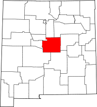 | |
| Towns | ||
| Village | ||
| CDPs | ||
| Other unincorporated communities | ||
| Footnotes | ‡This populated place also has portions in an adjacent county or counties | |
Municipalities and communities of Bernalillo County, New Mexico, United States | ||
|---|---|---|
| Cities | 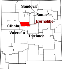 | |
| Town | ||
| Villages | ||
| CDPs | ||
| Other unincorporated communities | ||
| Indian reservations | ||
| Footnotes | ‡This populated place also has portions in an adjacent county or counties | |
This article is issued from Wikipedia - version of the 1/29/2014. The text is available under the Creative Commons Attribution/Share Alike but additional terms may apply for the media files.