Manger, Norway
| Manger | |
|---|---|
| Village | |
|
View of the village with Manger Church | |
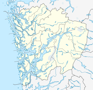 Manger  Manger Location in Hordaland county | |
| Coordinates: 60°38′29″N 05°02′29″E / 60.64139°N 5.04139°ECoordinates: 60°38′29″N 05°02′29″E / 60.64139°N 5.04139°E | |
| Country | Norway |
| Region | Western Norway |
| County | Hordaland |
| District | Nordhordland |
| Municipality | Radøy |
| Area[1] | |
| • Total | 1.05 km2 (0.41 sq mi) |
| Elevation[2] | 33 m (108 ft) |
| Population (2013)[1] | |
| • Total | 1,012 |
| • Density | 964/km2 (2,500/sq mi) |
| Time zone | CET (UTC+01:00) |
| • Summer (DST) | CEST (UTC+02:00) |
| Post Code | 5936 Manger |
.jpg)
Manger is the administrative center of Radøy municipality in Hordaland county, Norway. The village lies in the central part of the island of Radøy, along the Radfjorden. The village of Bøvågen lies about 10 kilometres (6 mi) to the northwest and the village of Sæbø lies about 10 kilometres (6 mi) to the southeast. The 1.05-square-kilometre (260-acre) village has a population (2013) of 1012, giving the village a population density of 964 inhabitants per square kilometre (2,500/sq mi).[1][3]
Manger has been the administrative center of Radøy municipality since 1964 when the municipality was established. Before that year, the village was the administrative center of the municipality of Manger which existed from 1838 until 1964. Manger Church is located in the village.
References
- 1 2 3 Statistisk sentralbyrå (1 January 2013). "Urban settlements. Population and area, by municipality.".
- ↑ "Manger" (in Norwegian). yr.no. Retrieved 2014-04-10.
- ↑ Store norske leksikon. "Manger – tettsted" (in Norwegian). Retrieved 2014-04-09.