Manbhum
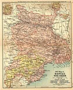
Manbhum was one of the districts of the East India during the British Raj. After India’s independence, the district became a part of Bihar state, and upon re-organization of the Indian states in the mid-1950s, the district became a part of the West Bengal. Present Purulia district was carved out of the district of Manbhum.[1]
Manbhum region has thick forests, with good mineral resources, and has a mixed demographic profile with people from different religious and social groups, including adivasis, particularly the Santals and the Mundas.[1]
See also
References
![]() This article incorporates text from a publication now in the public domain: Chisholm, Hugh, ed. (1911). "article name needed". Encyclopædia Britannica (11th ed.). Cambridge University Press.
This article incorporates text from a publication now in the public domain: Chisholm, Hugh, ed. (1911). "article name needed". Encyclopædia Britannica (11th ed.). Cambridge University Press.
Coordinates: 23°20′N 86°22′E / 23.333°N 86.367°E