Mana, French Guiana
| Mana | |
|---|---|
|
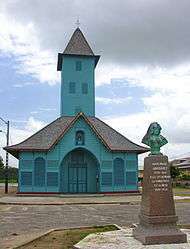
The church of Saint-Joseph of Mana | |
 Location of the commune (in red) within French Guiana | |
| Coordinates: 5°40′11″N 53°46′41″W / 5.6697°N 53.778°WCoordinates: 5°40′11″N 53°46′41″W / 5.6697°N 53.778°W | |
| Country | France |
| Overseas region and department | French Guiana |
| Arrondissement | Saint-Laurent-du-Maroni |
| Canton | Mana |
| Intercommunality | Ouest Guyanais |
| Government | |
| • Mayor (2014-2020) | Georges Patient |
| Area1 | 6,333 km2 (2,445 sq mi) |
| Population (2012)2 | 9,334 |
| • Density | 1.5/km2 (3.8/sq mi) |
| INSEE/Postal code | 97306 / 97360 |
|
1 French Land Register data, which excludes lakes, ponds, glaciers > 1 km² (0.386 sq mi or 247 acres) and river estuaries. 2 Population without double counting: residents of multiple communes (e.g., students and military personnel) only counted once. | |
Mana is a commune and town in French Guiana. It was founded in 1828 by Anne-Marie Javouhey. It borders the Mana river, whence it gets its name; and is nearby the Maroni River. Mana is the primary producer of rice in French Guiana, which it exports to Suriname.
On 1 January 1989, about 3% of the territory of Mana was detached and became the commune of Awala-Yalimapo.
See also
References
External links
| Wikimedia Commons has media related to Mana (French Guiana). |
- (French) Guide to Guyane: Mana]
This article is issued from Wikipedia - version of the 3/15/2016. The text is available under the Creative Commons Attribution/Share Alike but additional terms may apply for the media files.