Maltby, South Yorkshire
| Maltby | |
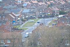 Cliff Hills, Maltby |
|
 Maltby |
|
| Population | 16,688 (2011 Census) |
|---|---|
| OS grid reference | SK524924 |
| – London | 145 mi (233 km) south |
| Civil parish | Maltby |
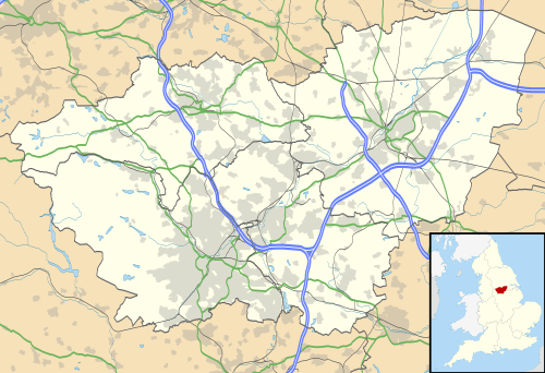
| Metropolitan borough | Rotherham |
| Metropolitan county | South Yorkshire |
| Region | Yorkshire and the Humber |
| Country | England |
| Sovereign state | United Kingdom |
| Post town | ROTHERHAM |
| Postcode district | S66 |
| Dialling code | 01709 |
| Police | South Yorkshire |
| Fire | South Yorkshire |
| Ambulance | Yorkshire |
| EU Parliament | Yorkshire and the Humber |
| UK Parliament | Rother Valley |
Coordinates: 53°25′34″N 1°12′36″W / 53.426°N 1.210°W
Maltby is a former mining town and civil parish of 16,688 inhabitants[1] (2011) in the Metropolitan Borough of Rotherham, South Yorkshire, England. It was historically in the West Riding of Yorkshire. It is located about 6 miles (10 km) east of Rotherham town centre and 10 miles (16 km) north-east of Sheffield city centre. It forms a continuous urban area with Hellaby, separated from the rest of Rotherham by the M18 motorway.
History
Maltby is mentioned in the Domesday Book as "by-malt", and was for centuries a very small village with the benefits of a fairly large stream nearby and very rich land for farming available. Roche Abbey, on the outskirts of Maltby, was founded in 1147 by Cistercian Monks from Newminster (near Morpeth, Northumberland), and was ruined during the Dissolution of the Monasteries in the reign of Henry VIII.
Coal was discovered in the area in the late 19th century; the last colliery in Rotherham was Maltby Main Colliery, established 1910 and faced with closure in March 2013. To house the colliery's workers, the colliery company built a large estate known as the 'Model Village' to the east of the town centre.
From 1900 until 1929, the town was served by Maltby railway station on the South Yorkshire Joint Railway, with services running between Doncaster and Worksop. The station's platforms still remain and the line is an important freight route. John Brown's Private Railway also ran by the west of Maltby, but the track has been lifted and is now a public footpath; a short stretch of track and a platform remains.
During the Second World War, a munitions factory, ROF Maltby, was established on the outskirts of Maltby close to the colliery; to house these workers, an estate nicknamed 'Little London' was built to house its workers, who had moved from Enfield in London.[2]
Maltby also had a knitwear factory, Byfords, which supplied companies including Pringle – this has long since closed, and a police station was built on the site.
Maltby's main council housing stock went into serious disrepair during the 1980s with areas like "White City" and the "Tarran estate" (now demolished) worst affected. Since Maltby began to benefit from local government funding in 1997, council estates such as White City and Birk's Holt Drive have been rejuvenated and refurbished. New council housing was opened in 2011 on the site of the former Tarran estate.[3]
Community
Before coal was discovered in the area, Maltby was a small agricultural village, centred on the Parish Church of St Bartholomew's (ref Domesday Book / Saxon Tower), with a population of around 500 at the start of the 1900s. With the opening of the mine in 1907 miners came from all parts of the UK – Wales, Staffordshire, Durham, Scotland and Ireland (the latter descendants of the canal (navvies) and railway building). The miner's Model Village was built with its centre piece as the Church of the Ascension, an annexe to the Parish Church, and in addition a significant presence of Methodist, Congregational, Salvation Army and Roman Catholic places of worship developed. The new community spawned several working men's clubs, including the 'Stute' (short for the Miner's Welfare Institute), the 'Slip', the ROF Club (Royal Ordnance Factory) and Catholic Club. The most significant sports clubs were the Miner's Institute ('Maltby Main' – football and cricket) and Roche Abbey Cricket Club, where Freddy Trueman commenced his illustrious career.
At its peak, Maltby had a population of 18,158 in 1991,[4] but following deindustrialisation in the 1980s/90s, this figure has dropped by roughly 10%, standing at 16,688 in 2011.
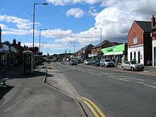
The town is served by a variety of shops and businesses. There is a large Tesco in the town centre on the site of what was once an indoor and outdoor market.
There are several public houses in the town, the oldest of which is the White Swan which dates from the 16th century.
Maltby Academy[5] on Braithwell Road (B6376) is a secondary school which serves the town and some surrounding villages. It was previously known as Maltby Comprehensive School until receiving academy status in 2010. Permission was granted in 2012 to rebuild the school, to the opposition of some residents.[6]
Initially however, the 'campus' comprised Maltby Grammar School and Maltby Hall Secondary Modern School built on the site of Rolleston Hall. The Grammar School was built in 1931 through the enterprise of County Alderman Dunn, a miner and Labour Councillor, and survived through to the 1970s, guided throughout by the Headmaster, Gerald Rush, pupils being drawn from the adjacent mining towns of Dinnington, Thurcroft, Edlington and Rossington, plus Wickersley, Bramley, Laughton, Tickhill, Bawtry and smaller villages of Braithwell, Micklebring, Anston, Austerfield and other smaller settlements. The Grammar School period architecture survives today with its imposing front and iconic clock set high above Rotherham Road.
The ancient game of "beck ball" was revived in the mid-1980s to some success; this is a sort of rugby game, where opposing teams generally fight a turf war in the local stream, Maltby Dike – or Beck as locally known. This stream runs through the valley past St Bartholomew's, thence past Maltby Crags, through the Norwoods, through the centre of Roche Abbey, emptying into the River Ryton at Blyth a few miles downstream. Below Maltby, the stream has also been referred to as the 'Comwell'. Near to Roche Abbey is Sandbeck Hall, the home of the Earl of Scarborough.
Despite the rebuilding/refurbishment of some housing stock at the beginning of the 21st century, the ward of Maltby, particularly the eastern area, (in 2010) included areas of high deprivation, according to data generated by the Department for Communities and Local Government.[7]
Governance
Until 1974, Maltby had an urban district council, and was part of the West Riding of Yorkshire. Following the Local Government Act 1972, Maltby is now governed by Rotherham Metropolitan Borough Council, part of the metropolitan county of South Yorkshire, and also has a parish council, Maltby Town Council. Both Rotherham Council and Maltby Town Council are Labour controlled. The political makeup of Maltby Town Council is below:
| Party | Number of councillors |
|---|---|
| Labour | 12 |
| Independent | 4 |
| Trade Unionist and Socialist Coalition | 2 |
The town lies in the South Yorkshire constituency of Rother Valley, currently held by Labour MP Kevin Barron, a seat which he has held continuously since 1983.
Maltby has four distinct areas.
- Maltby town centre
- Cliff Hills (to the west of the town centre)
- White City (to the southeast of the town centre)
- Little London (to the north of the town centre)
Transport
The town is served by high frequency buses (1, 2) to Rotherham town centre, and the 10 which serves Rotherham Hospital, run by First South Yorkshire. Buses also run to Doncaster, Meadowhall Centre and Sheffield. It is situated close to junction 1 of the M18 motorway, allowing quick access by car for commuters to Sheffield and Doncaster, plus the A631 road runs through the town linking it with Rotherham town centre.
Maltby Colliery
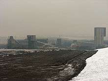
Sinking of the original shafts of Maltby Colliery began in 1907, as part of the development a large estate known as the "Model Village" was constructed as housing for the colliery workers.
An explosion in the colliery occurred in 1923, resulting in 27 deaths, and the pit was the site of mass picketing during the 1984–85 miners' strike. Post nationalisation the pit was sold to RJB Mining (later known as UK Coal) in 1994, and later to Hargreaves Services in 2007.
After encountering geological problems when trying to access a new coal seam, colliery owner Hargreaves announced that on health and safety grounds the mine would have to close. Maltby Colliery closed in March 2013, with a march held by former miners and residents of the town to mark the occasion.[8]
The Miners' Welfare Institute (locally known as the "stute"), a working men's club for miners, is still open to this day.
People associated with Maltby
- Chuckle Brothers, entertainers
- Fred Trueman, cricketer, was educated at Maltby Hall School. He moved to Maltby from Stainton, and worked at Maltby Colliery, as did his father.
- Lynne Perrie, an actress who played the role of Ivy Brennan in Coronation Street for 23 years, lived in the Cliff Hills area until her death in March 2006.
- Duggie Brown, Lynne Perrie's brother, entertainer (ex Brookside) lived in the Maltby area before moving away during the 1970s.
- Bill Waddington, actor, played Percy Sugden in Coronation Street
- Fred Kitchen, author, wrote a number of biographical works on rural life and worked in and around the Maltby area. His best-known work is Brother to the Ox.
- George Rolleston,English physician and zoologist. He was the first Linacre Professor of Anatomy and Physiology to be appointed at the University of Oxford.
Maltby was the setting for the book Welcome to Everytown by philosopher Julian Baggini, who lived in the area for six months for the purpose.
References
- ↑ http://www.citypopulation.de/php/uk-england-yorkshireandthehumber.php?cityid=E35001115
- ↑ "Local History in Maltby". bbc.co.uk. Retrieved 15 September 2016.
- ↑ Michael Upton (10 February 2011), "First new council homes for 30 years set for letting", www.rotherhamadvertiser.co.uk
- ↑ http://www.citypopulation.de/php/uk-england-yorkshireandthehumber.php?adm2id=E11000003
- ↑ Maltby Maltby Academy
- ↑ http://www.dinningtontoday.co.uk/news/campaign-to-save-part-of-maltby-academy-1-4481479
- ↑ Simon Rogers (31 March 2011), "Deprivation mapped: how you show the poorest (and richest) places in England", The Guardian, London, See map, areas Rotherham: 020A, 0202B, 020C, 020D, 020E, 020F, 018B, 018C, 018D, 018E, 018F scored 12138, 5479, 4854, 1861, 3025, 1207, 19592, 20592, 23685, 9239, and 10905 respectively. (out of 32,482)
- ↑ "Maltby miners face Christmas gloom". BBC News. 18 December 2012.
External links
| Wikimedia Commons has media related to Maltby, South Yorkshire. |