Malmesbury, Western Cape
| Malmesbury | |
|---|---|
|
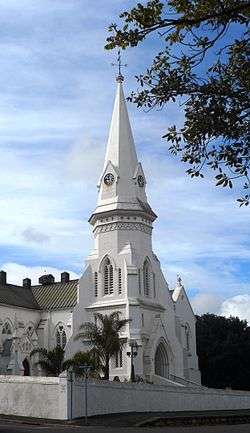
The Dutch Reformed Church in Malmesbury | |
 Malmesbury  Malmesbury  Malmesbury
| |
| Coordinates: 33°27′S 18°44′E / 33.450°S 18.733°ECoordinates: 33°27′S 18°44′E / 33.450°S 18.733°E | |
| Country | South Africa |
| Province | Western Cape |
| District | West Coast |
| Municipality | Swartland |
| Established | 1745[1] |
| Area[2] | |
| • Total | 18.8 km2 (7.3 sq mi) |
| Population (2011)[2] | |
| • Total | 35,897 |
| • Density | 1,900/km2 (4,900/sq mi) |
| Racial makeup (2011)[2] | |
| • Black African | 24.9% |
| • Coloured | 55.3% |
| • Indian/Asian | 0.5% |
| • White | 18.4% |
| • Other | 0.9% |
| First languages (2011)[2] | |
| • Afrikaans | 73.9% |
| • Xhosa | 16.3% |
| • English | 3.8% |
| • Sotho | 3.1% |
| • Other | 2.8% |
| Postal code (street) | 7300 |
| PO box | 7299 |
| Area code | 022 |
Malmesbury is a town of approximately 36,000 inhabitants in the Western Cape province of South Africa, about 65 km north of Cape Town.
The town is the largest in the Swartland (‘black land’) which took its name from the Renosterbos ('rhino bush'), an indigenous plant that turns black in the warm, dry summers. The area is especially known for its grain and wine cultivation as well as sheep and poultry farming.
Malmesbury was named after Sir Lowry Cole's father-in-law, the Earl of Malmesbury. Settlers were encouraged to make their homes here because of a tepid sulphur chloride mineral spring that was renowned for curing rheumatism. The first farms were allocated in 1703. When the fifth Dutch Reformed congregation in the Cape was established here, it became known as Zwartlands-kerk (Swartland Church) but was renamed Malmesbury in 1829. The town acquired municipal status in 1860. In 1911 the Encyclopædia Britannica recorded the population of the town at 3811 , however this may refer to a white population, as a census of 1849 recorded a total of 8520 residents.
The town no longer attracts the ailing because this aspect was never developed by the local authority, and today a shopping centre is located on top of the site with only a decorative fountain marking the location of the original spring.
Notable people from Malmesbury
Demographics
The following statistics describing Malmesbury are from the 2011 census.[2]
- Area: 18.8 square kilometres (7.3 sq mi)
- Population: 35,897: 1,909.3 inhabitants per square kilometre (4,945/sq mi)
- Households: 9,473: 503.9 per square kilometre (1,305/sq mi)
| Gender | Population | % |
|---|---|---|
| Male | 18,016 | 50.2 |
| Female | 17,880 | 49.8 |
| Race | Population | % |
|---|---|---|
| Coloured | 19,868 | 55.3 |
| Black African | 8,929 | 24.9 |
| White | 6,588 | 18.4 |
| Indian or Asian | 192 | 0.5 |
| Other | 319 | 0.9 |
| First language | Population | % |
|---|---|---|
| Afrikaans | 24,564 | 73.9 |
| isiXhosa | 5,433 | 16.3 |
| English | 1,251 | 3.8 |
| Sesotho | 1,044 | 3.1 |
| Setswana | 148 | 0.4 |
| Sign language | 77 | 0.2 |
| isiZulu | 64 | 0.2 |
| isiNdebele | 57 | 0.2 |
| Xitsonga | 26 | 0.1 |
| Sepedi | 22 | 0.1 |
| Tshivenda | 21 | 0.1 |
| siSwati | 18 | 0.1 |
| Other | 511 | 1.5 |
| Not applicable | 2,658 |
Coats of arms
Municipality — Malmesbury was a municipality in its own right from 1860 to 2000. By 1931, the council had adopted an emblem depicting a plough in front of a sheaf of wheat, surrounded by a buckled strap inscribed Deo frumentoque vires. This device was depicted on a cigarette card issued in 1931.
In 1963, the council assumed a coat of arms, designed by Cornelis Pama. It registered the arms with the Cape Provincial Administration in December 1963,[3] had them formally granted by the provincial administrator on 8 July 1966[4] and registered them at the Bureau of Heraldry in September 1969.[5]
The arms were : Per chevron Sable and Gules, a chevron ermine between in chief two garbs and in base a sea-lion Or. In layman's terms : the shield was divided by an ermine chevron, the upper half displaying two golden sheaves of wheat on a black background and the lower half a golden heraldic sea-lion on a red background. The sea-lion was evidently derived from the arms of Gustaaf Willem van Imhoff, who established the church from which the town developed.
The crest was an upright spade between two rhenosterbos branches, and the motto, once again, was Deo frumentoque vires.
Divisional council — The Malmesbury divisional council, which administered the rural areas of the district outside the town, assumed a coat of arms, designed by Ivan Mitford-Barberton, on 24 June 1958.[6]
The arms were : Per fess Sable and Azure, a fess wavy Gules fimbriated Argent between in chief an eagle displayed between two ears of wheat palewise Or and in base a sea-lion naiant per pale Or and Argent. In layman's terms : the shield was divided horizontally into black and blue and displayed, from top to bottom, a golden eagle between two sheaves of wheat, a red wavy stripe edged in silver, and a gold and silver heraldic sea-lion.
References
- ↑ "Chronological order of town establishment in South Africa based on Floyd (1960:20-26)" (PDF). pp. xlv–lii.
- 1 2 3 4 5 Sum of the following Main Places from Census 2011: Mount Royal Golf & Country Estate, Wesbank, Malmesbury, Ilinge Lethu.
- ↑ Cape of Good Hope Official Gazette 3217 (20 December 1963).
- ↑ Cape of Good Hope Official Gazette 3354 (8 July 1966).
- ↑ National Archives of South Africa : Data of the Bureau of Heraldry
- ↑ Western Cape Archives : Swartland Divisional Council Coat of Arms (4/SWL 4/1/5).
| Wikimedia Commons has media related to Malmesbury, Western Cape. |
Municipalities and communities of West Coast District Municipality, Western Cape | ||
|---|---|---|
District seat: Moorreesburg | ||
| Matzikama | .svg.png) | |
| Cederberg | ||
| Bergrivier | ||
| Saldanha Bay | ||
| Swartland | ||