Maling Road, Melbourne
| Maling Road Victoria | |
|---|---|
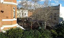 | |
| View of Theatre Place in the Maling Road shopping strip from Canterbury railway station. | |
| General information | |
| Type | Street |
| Location | Melbourne, Victoria |
| Major junctions | |
| South end | Prospect Hill Road |
| NW end |
|
| Location(s) | |
| LGA(s) | City of Boroondara |
| Major suburbs | |
| |
Maling Road is a popular shopping strip in Canterbury, Victoria, Australia. It contains over fifty Edwardian-style shops in a pseudo-village setting. Its location was chosen due to its proximity to Canterbury railway station.[1]
History
The present-day shopping strip has its roots in the construction of the railway line at Canterbury railway station in 1882.[2] Although most buildings in the area near the intersection with Canterbury Road date from the early 1900s, some were constructed before this time.[3]
In the 1970s after the grade separation of the railway line across Canterbury Road, there were proposals to demolish large parts of the shopping centre and construct a supermarket. This was met with resistance from the local community and the project successfully stopped.[4] A council proposal to turn part of the street into a pedestrian mall was also scrapped.[5]
See also
![]() Australian Roads portal
Australian Roads portal
References
- ↑ Gibb, Don; Warmington, Stuart (1995). Visions of a Village. Canterbury History Group. ISBN 0-646-25049-3.
- ↑ "Canterbury". VicSig. Retrieved 12 July 2016.
- ↑ "Canterbury Walk" (PDF). Canterbury History Group. Retrieved 12 July 2016.
- ↑ Masanauskas, John (26 April 2014). "Canterbury shopping village is a time capsule". Herald Sun. Retrieved 12 July 2016.
- ↑ "Our History". Maling Road Canterbury. Retrieved 12 July 2016.
Coordinates: 37°49′30″S 145°4′55″E / 37.82500°S 145.08194°E