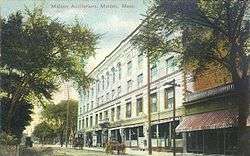
Malden, Massachusetts
| Malden, Massachusetts | ||
|---|---|---|
| City | ||
|
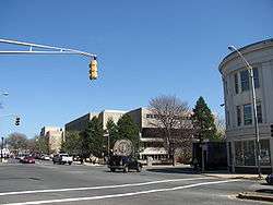
View of Malden High School | ||
| ||
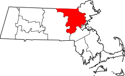
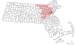 Location in Middlesex County in Massachusetts | ||
 Malden, Massachusetts Location in the United States | ||
| Coordinates: 42°25′30″N 71°04′00″W / 42.42500°N 71.06667°WCoordinates: 42°25′30″N 71°04′00″W / 42.42500°N 71.06667°W | ||
| Country | United States | |
| State | Massachusetts | |
| County | Middlesex | |
| Settled | 1640 | |
| Incorporated | 1649 | |
| Government | ||
| • Type | Mayor-council | |
| • Mayor | Gary Christenson | |
| Area | ||
| • Total | 5.1 sq mi (13.2 km2) | |
| • Land | 5.1 sq mi (13.1 km2) | |
| • Water | 0.0 sq mi (0.1 km2) | |
| Elevation | 13 ft (4 m) | |
| Population (2014) | ||
| • Total | 60,859 | |
| • Density | 11,656.8/sq mi (4,503.7/km2) | |
| Time zone | Eastern (UTC-5) | |
| • Summer (DST) | Eastern (UTC-4) | |
| ZIP code | 02148 | |
| Area code(s) | 339 / 781 | |
| FIPS code | 25-37875 | |
| GNIS ID | 0612773 | |
| Website |
cityofmalden | |

Malden is a city in Middlesex County, Massachusetts, United States. At the time of the 2010 United States Census, the population was at 59,450 people. In 2009, Malden was named the "Best Place to Raise Your Kids" in Massachusetts by Bloomberg Businessweek.[1][2]
History
Malden, a hilly woodland area north of the Mystic River, was settled by Puritans in 1640 on land purchased in 1629 from the Pennacook tribe. The area was originally called the "Mistick Side"[3] and was a part of Charlestown. It was incorporated as a separate town in 1649.[4] The name Malden was selected by Joseph Hills, an early settler and landholder, and was named after Maldon, England.[5] The city originally included what are now the adjacent cities of Melrose (until 1850) and Everett (until 1870).
At the time of the American Revolution, the population was at about 1,000 people, and the citizens were involved early in resisting the oppression of Britain: they boycotted the consumption of tea in 1770 to protest the Revenue Act of 1766, and it was also the first town to petition the colonial government to withdraw from the British Empire.[4]
Malden High School has the second-oldest continuous high school football rivalry in the United States with Medford High School. The first "Thanksgiving Day Game" dates back to 1889.[6]
In 1984, Malden came to national renown as the location of the controversial Fells Acres Day Care Center preschool trial.
In 2004, a same-sex Malden couple was the first to marry in Massachusetts at precisely 9:15 AM on May 17, 2004 at Cambridge City Hall. Massachusetts was the first state in the United States to issue same-sex marriage licenses.[7]
Geography
_map.jpg)
Malden is bordered by Melrose on the north, Stoneham on the northwest, Medford on the west, Everett on the south, Revere on the east, and Saugus on the northeast. Boojum Rock located in the north west corner of Malden inside the Middlesex Fells Reservation is the second highest point in Malden with an elevation of approximately 275 feet. Waits Mount is the highest point.
According to the United States Census Bureau, the city has a total area of 5.1 square miles (13 km2), of which 5.1 square miles (13 km2) is land and 0.04 square miles (0.10 km2) (0.78%) is water. Bordered on the northwest by the cliffs of Middlesex Fells, Malden is drained by the Malden River.
Demographics
| Historical population | ||
|---|---|---|
| Year | Pop. | ±% |
| 1790 | 1,033 | — |
| 1800 | 1,059 | +2.5% |
| 1810 | 1,384 | +30.7% |
| 1820 | 1,731 | +25.1% |
| 1830 | 2,010 | +16.1% |
| 1840 | 2,514 | +25.1% |
| 1850 | 3,520 | +40.0% |
| 1860 | 5,865 | +66.6% |
| 1870 | 7,367 | +25.6% |
| 1880 | 12,017 | +63.1% |
| 1890 | 23,031 | +91.7% |
| 1900 | 33,664 | +46.2% |
| 1910 | 44,404 | +31.9% |
| 1920 | 49,103 | +10.6% |
| 1930 | 58,036 | +18.2% |
| 1940 | 58,010 | −0.0% |
| 1950 | 59,804 | +3.1% |
| 1960 | 57,676 | −3.6% |
| 1970 | 56,127 | −2.7% |
| 1980 | 53,386 | −4.9% |
| 1990 | 53,884 | +0.9% |
| 2000 | 56,340 | +4.6% |
| 2010 | 59,450 | +5.5% |
| 2015 | 61,068 | +2.7% |
| * = population estimate. Source: United States Census records and Population Estimates Program data.[8][9][10][11][12][13][14][15][16][17] Source: | ||

As of the 2010 United States Census, there were 59,450 people, 25,161 households, and 13,575 families residing in the city. The population density was 11,788.6 people per square mile (4,290.5/km²). There were 23,634 housing units at an average density of 4,657.5 per square mile (1,799.8/km²). The racial makeup of the city was 52.5% White, 14.8% African American, 0.14% Native American, 20.1% Asian (11.1% Chinese, 3.1% Asian Indian, 2.8% Vietnamese[19]), 0.06% Pacific Islander, 2.10% from other races, and 3.46% were multiracial. 8.6% of the population were Hispanic or Latino of any race (1.8% Puerto Rican, 1.7% Brazilian, 1.5% Salvadoran, 0.9% Colombian, 0.7% Dominican, 0.5% Mexican, 0.4% Peruvian, 0.4% Guatemalan).
There were 23,009 households out of which 25.4% had children under the age of 18 living with them, 42.8% were married couples living together, 12.3% had a female householder with no husband present, and 41.0% were non-families. 32.2% of all households were made up of individuals and 11.5% had someone living alone who was 65 years of age or older. The average household size was 2.42 and the average family size was 3.13.
In the city, the population was spread out with 19.9% under the age of 18, 8.5% from 18 to 24, 36.9% from 25 to 44, 20.8% from 45 to 64, and 13.9% who were 65 years of age or older. The median age was 36 years. For every 100 females there were 92.8 males. For every 100 females age 18 and over, there were 90.0 males.
The median income for a household in the city was $45,654, and the median income for a family was $55,557. Males had a median income of $37,741 versus $31,157 for females. The per capita income for the city was $22,004. About 6.6% of families and 9.2% of the population were below the poverty line, including 11.6% of those under age 18 and 10.2% of those age 65 or over.
Foreign-born population
As of 2009 and 2010,[20][21] 37% of residents of Malden were born outside of the United States. This is twice the number in 1990,[20] and an increase from the 26% of foreign-born residents in 2000. Malden's percentage of foreign-born residents was the second-highest in Massachusetts, after Chelsea.[21]
As of 2009 and 2010 immigrants originate from Brazil,[21] China, Haiti, India, Morocco, and Pakistan. The Moroccan American Civic and Cultural Association is located in Malden.[20]
Previous immigrants included Italians and Irish in the late 1800s and early 1900s. Malden also received Jews who arrived escaping Europe before and after World War II.[20]
Asian population
In 1990 Malden had 2,805 Asian residents, making the city 5.2% Asian. In 2000 this increased to 7,882 Asians, or 14.5% of the city's population, in 2000, making it one of ten Massachusetts cities with the largest Asian populations in the state. There were 4,504 ethnic Chinese people (57% of Malden's Asians), 876 ethnic Vietnamese, and 696 ethnic Indians. From 1990 to 2000 the Vietnamese population increased by 187% and the Indian population increased by 262%.[22]
From 2000 to 2010 the Chinese population of Malden increased by about 50%.[23]
Institutions serving the Asian community in Malden include the Immigrant Learning Center, which offers English as a second language classes; the Malden Asian Pacific American Coalition; a satellite office of the Vietnamese American Civic Association; the nonprofit multiservice organization Great Wall Center; and the antipoverty agency Tri-City Community Action Program Inc.[22]
Education
Malden Public Schools is the school district. Malden has five public elementary and middle schools; one charter elementary, middle, and high school;[24] one public high school; one Catholic high school, one Catholic Pre-K through 8 school; and one public preschool. The elementary schools in Malden were replaced in the late 1990s with five new facilities: Beebe, Ferryway, Forestdale, Linden, and Salemwood. The city's three high schools are Malden High School, Malden Catholic High School and Mystic Valley Regional Charter High School. According to a study conducted by the National Center for Education Statistics in 2013, Malden High School was found to be the most diverse public high school in Massachusetts.[25]
Neighborhoods
Like many communities in New England, many towns and neighborhoods are organized around squares, which are located at the crossroads and town commons dating back from the colonial times and the early 19th century. Many of the neighborhoods take their name and identity from the main square in their area.
Malden's squares include Malden Square (at Main and Pleasant streets), Converse Square (at Main, Salem, and Ferry streets) Oak Grove Square (at Oak Grove T Station), Bellrock Square (at the intersections of Cross, Main and Medford Sts.), Judson Square (near Ferryway School), former Suffolk Square (at Cross and Bryant Streets), and the location of a thriving Jewish community, Maplewood Square (at Lebanon, Maplewood and Salem Streets) and Linden Square.
Some of the neighborhoods in Malden include Faulkner (location of the former Suffolk Square) West End, Edgeworth, Linden, Ferryway, Forestdale, Maplewood, Bellrock, and Belmont Hill (located between Bellrock and Ferryway).
Bellrock
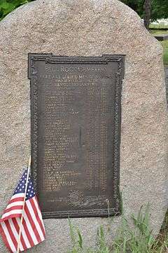
Bellrock is the south central section of the city, bordered by Main Street on the east, Charles Street on the north, the Malden River on the west, and the Everett line on the south. It contains Bell Rock Memorial Park (listed on the National Register of Historic Places) and Bell Rock Cemetery (also listed), which contains marked graves dating back to 1670. Bell Rock Cemetery was called Sandy Bank until the establishment of the Salem Street Cemetery in 1832; it was then known as the Old Burial Ground for half a century until it was renamed in 1882. Also located in this area are the headquarters for New England Coffee.
Edgeworth
The Edgeworth neighborhood is the southwest section of the city. It contains Devir Park, Pearl St. Park, and Callahan Park. The city's football stadium, MacDonald Stadium is in Edgeworth. A school in Edgeworth is the former Emerson grammar school. The Converse Rubber Factory and offices once operated in Edgeworth at the bottom of Pearl Street. This is the original home of the Converse "All-Star" Basketball Sneakers. Malden Catholic High School was originally located in Edgeworth on Highland Ave. The school's football team played their home games at Brother Gilbert Stadium, located at Commercial & Medford Streets in Edgeworth. Immaculate Conception Grammar School was located in Edgeworth on the corner of Charles St. and Highland Ave. Edgeworth touches Everett and Medford. Edgeworth is also home to St. Rocco's Feast, SunSetter Awnings and Pisa Pizza.
Maplewood
In 1847, Joshua Webster, president of the Saugus Branch Railroad, purchased 200 acres in Malden along its projected route. Here, he planned a residential development with wide streets and ornamental trees. Due to the hundreds of maple trees Webster planted, the neighborhood became known as Maplewood.[26][27]
Government and infrastructure
Education
The headquarters of the Massachusetts Department of Elementary and Secondary Education are in Malden.[28]
Transportation
Major highways
Route 28, Route 60, Route 99, and U.S. 1 run through Malden. Route 16 and Interstate 93 are a short distance outside the city's borders.
Bus and rail
The city is served by the Orange Line subway that connects it to downtown Boston. The city's subway stops are Malden Center and Oak Grove. The MBTA's commuter rail also has one stop in the city (Malden Center) and can stop at Oak Grove if necessary. During the first few years of the 2000s, the MBTA updated signal systems and Orange Line service was replaced by shuttle buses at night. Since September 2007, such service interruptions have been limited to occasional weekends, while signal system repairs necessitated closing off the northern portion of the Orange Line and rerouting passengers via replacement bus service from either the Haymarket subway stop or Wellington Station.
There is a sizable section of the old Boston and Maine Saugus Branch Railroad line running across the middle of Malden. This line is currently owned by the MBTA, but has been out of use since 1993 and has not seen passenger service since 1958. A plan exists to create a bike trail (Bike to the Sea) along the side of these tracks on right-of-way land. Progress was hampered by lack of funds and land encroachment, but is now slated for ribbon cutting in June 3, 2012.[29] The path will be known as the Northern Strand Community Trail.
Bus service to all adjacent communities is also available via the service of the MBTA.
Points of interest
Approximately 30 park sites throughout the city provide a variety of recreational facilities including tennis courts, basketball courts, playgrounds and ballfields. Other sites include a 400-meter synthetic running track at MacDonald Stadium; 56 acres (23 ha) of the Middlesex Fells Reservation; the 25-acre (10 ha) Fellsmere Pond; a DCR-owned-and-operated swimming pool; a 30,000 square feet (2,800 m²) field house built under the new school rebuilding plan; the state-of-the-art Malden YMCA finished construction in early 2007; and Pine Banks Park, operated by a Board of Trustees with equal representation by the cities of Malden and Melrose. Waitt's Mountain is also in Malden.
Other points of interest include the Converse Memorial Library and the Congregation Beth Israel. One of Malden's finest and most notable landmarks is the public library which was designed by Henry Hobson Richardson and built in 1885.
Notable people
- Johnny A., musician
- Jack Albertson, award-winning actor
- The Ames Brothers, singing quartet
- Reginald R. Belknap, military officer
- Walter Brennan, award-winning actor[30]
- Edna May Oliver, actress
- George Loring Brown, painter
- George R. Carey, inventor[31]
- Gary Cherone, singer-songwriter
- Elisha S. Converse, first mayor of Malden
- Kevin Cullen, journalist
- Timothy Dexter, businessman
- Gary DiSarcina, former Major League Baseball player
- Erle Stanley Gardner, author, creator of Perry Mason
- Breno Giacomini, National Football League player
- John Gilgun, poet and novelist
- Norman Greenbaum, guitarist, singer-songwriter
- Willis B. Hunt, Jr., federal judge
- Adoniram Judson, first Protestant missionary in Burma
- Toni Kelner, mystery and urban fantasy writer and editor[32]
- Keith Knight, cartoonist
- Killer Kowalski, former professional wrestler
- Ellis F. Lawrence, architect
- Fred A. Leuchter, execution technician and Holocaust denial author
- Torbert MacDonald, US Representative
- Ed Markey, member of the United States Senate
- Nerlens Noel, National Basketball Association player
- Helen Nordquist, All-American Girls Professional Baseball League player
- Lawrence Palmer, Olympic gold medalist and ice hockey player
- Elliot Paul, author
- Marjorie Pierce, architect
- Richard Rodenheiser, Olympic gold medalist and ice hockey player
- Dan Ross, former National Football League player
- William Schofield, federal judge
- Frank Stella, artist
- John A. Volpe, former Governor of Massachusetts and United States Ambassador to Italy
- Michael Wigglesworth preacher and author of " The Day of Doom: or a Poetical Description of the Great and Last Judgement," a best-selling classic of Puritan New England
References
- ↑ "The Best Places to Raise Your Kids 2009: Massachusetts – BusinessWeek". Images.businessweek.com. Retrieved 2011-03-11.
- ↑ Abel, David (November 13, 2008). "Magazine calls Malden state's best place to raise children – The Boston Globe". Boston.com. Retrieved 2011-03-11.
- ↑ History of Middlesex County, p. 114-116.
- 1 2 History of Malden – City Website
- ↑ Deloraine Pendre Corey. The History of Malden, Massachusetts, 1633–1785.
- ↑ Malden/Medford Football: By the numbers Archived July 31, 2013, at the Wayback Machine.
- ↑ "The first same-sex marriage in the U.S., May 17, 2004 – Andrew Glass". Politico.Com. Retrieved 2014-08-02.
- ↑ "TOTAL POPULATION (P1), 2010 Census Summary File 1". American FactFinder, All County Subdivisions within Massachusetts. United States Census Bureau. 2010.
- ↑ "Massachusetts by Place and County Subdivision - GCT-T1. Population Estimates". United States Census Bureau. Retrieved July 12, 2011.
- ↑ "1990 Census of Population, General Population Characteristics: Massachusetts" (PDF). US Census Bureau. December 1990. Table 76: General Characteristics of Persons, Households, and Families: 1990. 1990 CP-1-23. Retrieved July 12, 2011.
- ↑ "1980 Census of the Population, Number of Inhabitants: Massachusetts" (PDF). US Census Bureau. December 1981. Table 4. Populations of County Subdivisions: 1960 to 1980. PC80-1-A23. Retrieved July 12, 2011.
- ↑ "1950 Census of Population" (PDF). Bureau of the Census. 1952. Section 6, Pages 21-10 and 21-11, Massachusetts Table 6. Population of Counties by Minor Civil Divisions: 1930 to 1950. Retrieved July 12, 2011.
- ↑ "1920 Census of Population" (PDF). Bureau of the Census. Number of Inhabitants, by Counties and Minor Civil Divisions. Pages 21-5 through 21-7. Massachusetts Table 2. Population of Counties by Minor Civil Divisions: 1920, 1910, and 1920. Retrieved July 12, 2011.
- ↑ "1890 Census of the Population" (PDF). Department of the Interior, Census Office. Pages 179 through 182. Massachusetts Table 5. Population of States and Territories by Minor Civil Divisions: 1880 and 1890. Retrieved July 12, 2011.
- ↑ "1870 Census of the Population" (PDF). Department of the Interior, Census Office. 1872. Pages 217 through 220. Table IX. Population of Minor Civil Divisions, &c. Massachusetts. Retrieved July 12, 2011.
- ↑ "1860 Census" (PDF). Department of the Interior, Census Office. 1864. Pages 220 through 226. State of Massachusetts Table No. 3. Populations of Cities, Towns, &c. Retrieved July 12, 2011.
- ↑ "1850 Census" (PDF). Department of the Interior, Census Office. 1854. Pages 338 through 393. Populations of Cities, Towns, &c. Retrieved July 12, 2011.
- ↑ "Census of Population and Housing". Census.gov. Retrieved June 4, 2015.
- ↑ "QT-P8: Race Reporting for the Asian Population by Selected Categories: 2010". factfinder2.census.gov. 2010 Census. Retrieved June 1, 2014.
- 1 2 3 4 Saccheti, Maria. "A place where all belong." Boston Globe. December 23, 2009. p. 1 (Archive).
- 1 2 3 Sacchetti, Maria. "A melting pot stretches out to the suburbs." Boston Globe. September 15, 2010. p. 1 (Archive). Retrieved on September 23, 2014.
- 1 2 Buote, Brenda J, "Asian population up in small cities" (Archive). Boston Globe. June 13, 2004. Retrieved on September 10, 2015.
- ↑ Fox, Jeremy C. "Chinese population expanding in Boston suburbs" (Archive). Boston Globe. Retrieved on September 8, 2015.
- ↑ "Mvrcs.com". Mvrcs.com. Retrieved 2014-08-02.
- ↑ "News | CHART: The Most and Least Diverse Public High Schools in MA". GoLocalWorcester. June 1, 2013. Retrieved 2014-08-02.
- ↑ Tinkham, George H. (1923). History of San Joaquin County, California. Los Angeles: Historic Record Co.
- ↑ Blake, Andrew (September 12, 1999). "Neighbors to revel in Maplewood pride". The Boston Globe.
- ↑ "Contact ESE." Massachusetts Department of Elementary and Secondary Education. Retrieved on February 29, 2012. "75 Pleasant Street Malden, MA 02148-4906"
- ↑ Mmicheli (December 9, 2015). "Bike to the Sea President Honored At State House". Biketothesea.com. Bike To The Sea, Inc.
- ↑ "Malden District Court MA". Town-court.com. Retrieved 2014-08-02.
- ↑ "Catalogs | Michael Brown Rare Books". Mbamericana.com. Retrieved 2014-08-02.
- ↑ "Biography". tonilpkelner.com. Retrieved February 11, 2016.
External links
- Official website
- Malden Public Library website
- History of Middlesex County, Volume II, p. 113 etc. (Medford, by W. H. Whitmore). 1880, published by Estes and Lauriat; edited by Samual Adams Drake.
- Births, Marriages and Deaths in the Town of Malden, 1649–1850 by Deloraine Pendre Corey, published 1903.
| Wikimedia Commons has media related to Malden, Massachusetts. |
Boston (capital) | |
| Topics |
|
| Society | |
| Regions | |
| Counties | |
| Cities |
|