Malaysia–Thailand border

The Malaysia–Thailand border consists of both a land boundary across the Malay Peninsula and maritime boundaries in the Straits of Malacca and the Gulf of Thailand/South China Sea. Malaysia lies to the south of the border while Thailand lies to the north. The Golok River forms the easternmost 95 km stretch of the land border.
The land border is based on the 1909 treaty between Thailand, then known as Siam, and the British which started to exert its influence over the northern Malay states of Kedah, Kelantan, Perlis, Perak and Terengganu in the early 20th century. The four states had earlier been under Siamese control. Four Malaysian states abut the border. They are (from west to east) Perlis, Kedah, Perak and Kelantan. The four Thai provinces which abut the border are (again from west to east) are Satun, Songkhla, Yala and Narathiwat.
Malaysia and Thailand have a territorial sea and continental shelf boundary agreements for the Straits of Malacca which was signed in 1979 and 1971 respectively. The 1979 agreement also included Indonesia as a signatory as it also determined the common continental shelf border tripoint for the three countries. The 1979 agreement also established the territorial sea boundary in the Gulf of Thailand while a separate memorandum of understanding signed in 1979 established a short continental shelf boundary in the area. The boundary beyond that agreed is subject to dispute because of overlapping claims over the seabed. The overlapping claims led to the establishment of a joint development area in 1990 where both countries agreed to share mineral resources in a 7,250 square km wedge-shaped area.
Maritime border
Malaysia and Thailand share maritime borders in two areas: in the Straits of Malacca and in the Gulf of Thailand/South China Sea.
Straits of Malacca
At the western terminus of the land boundary, the 1909 Anglo-Siamese treaty determines the start of the maritime boundary as:
- With regard to the islands close to the west coast, those lying to the north of the parallel of latitude where the most seaward point of the north bank of the estuary of the Perlis River (the western terminus of the Malaysia-Thailand land boundary) touches the sea shall remain to Siam, and those lying to the south of the parallel shall become British."
- The island known as Pulau Langkawi, together with all the islets south of the mid-channel between Tarutao and Langkawi, and all the islands south of Langkawi shall become British. Tarutao and the islets to the north of mid-channel shall remain to Siam.
The territorial sea boundary agreement between the two countries signed on 24 October 1979[1] determined the mid-channel point between Langkawi and Tarutao to be at 6°28′30″N 99°39′12″E / 6.47500°N 99.65333°E which was made the eastern starting point of the territorial sea boundary. Both countries also have a continental shelf boundary agreement for this segment of their maritime boundary. The agreement, signed 21 December 1978, included Indonesia as a signatory to enable the establishment of the common tripoint at 5°57′0″N 98°1′30″E / 5.95000°N 98.02500°E[2]
| Point | Latitude (N) | Longitude (E) | Remarks | |
|---|---|---|---|---|
| Territorial sea border end and turning points | ||||
| 1 | 6° 28'.5 | 99° 39'.2 | ||
| 2 | 6° 30'.2 | 99° 33'.4 | ||
| 3 | 6° 28'.9 | 99° 30'.7 | ||
| 4 | 6° 18'.4 | 99° 27'.5 | ||
| Indonesia-Malaysia-Thailand common point | ||||
| CP | 5° 57'.0 | 98° 1'.5 | The border is a straight line connecting the common point with Point 1 below | |
| Outer limit border turning point coordinates[1] | ||||
| 1 | 6° 18'.0 | 99° 6'.7 | The border connects to the common point above via a straight line | |
| 2 | 6° 16'.3 | 99° 19'.3 | ||
| 3 | 6° 18'.4 | 99° 27'.5 | This point is the same as Point 4 of the territorial sea border | |
Gulf of Thailand/South China Sea
Agreements
The 1909 Anglo-Siamese Treaty states that the maritime boundary between the two countries as follows:
- "All islands adjacent to the eastern States of Kelantan and Terengganu, south of the parallel of latitude drawn from the point where the Sungei Golok reaches the coast at a place called Kuala Tabar, shall be transferred to Great Britain, and all islands to the north of that parallel shall remain to Siam."
Subsequently, the two governments signed several agreements over their common maritime boundary in the Gulf of Thailand and South China Sea. The 1973 continental shelf boundary agreement between the two governments only covered the Straits of Malacca segment and did not cover the border in the Gulf of Thailand but on 24 October 1979, an agreement[1] and a memorandum of understanding[3] were signed to determine the common maritime boundary of the two countries in the Gulf of Thailand. The first agreement established the territorial sea boundary from the mouth of the Golok River at 6°14′30″N 102°5′36″E / 6.24167°N 102.09333°E to 6°27′30″N 102°10′0″E / 6.45833°N 102.16667°E. The MOU established the continental shelf boundary from the northern end-point to 6°50′0″N 102°21′12″E / 6.83333°N 102.35333°E with one turning point in between.
The boundary beyond the northern end-point is subject to dispute (see Disputes section below). However, both countries have come to an agreement to put aside the border dispute and allow for the joint exploitation of natural resources of the disputed area. The two countries signed a Memorandum of Understanding for the Establishment of a Joint Authority for the Exploitation of the Resources of the Sea-Bed in a Defined Area of the Continental Shelf of the Two Countries in the Gulf of Thailand on 21 February 1979, followed by an Agreement on the Constitution and Other Matters Relating to the Establishment of the Malaysia-Thailand Joint Authority on 30 May 1990 establishing a joint development area (JDA). Both agreements do not settle disputed maritime border and sovereignty issue of the disputed area and the countries continue staking their overlapping continental shelf claims.
Malaysia's 1979 map and Thailand's EEZ proclamation
In December 1979 just after the two countries signed the MOU on the joint development area, Malaysia published a map[4] showing its territorial sea and continental shelf and continued to assert its sovereignty over the entire joint development area. Malaysia's continental shelf boundary on the map corresponds with the western and northern limit of the joint development area.
On 16 February 1988, Thailand issued a royal proclamation to establish its exclusive economic zone boundary with Malaysia, establishing the limits of its claims in the disputed area. The boundary follows the eastern boundary of the Joint Devevelopment Area.[5]
A small triangle in the northern portion of the joint development area is also subjected to an overlapping claim by Vietnam. In 1999, Malaysia, Thailand, and Vietnam agreed to apply the joint development principles to this area. See section below.
| Point | Latitude (N) | Longitude (E) | Remarks | |
|---|---|---|---|---|
| Territorial sea border end and turning points | ||||
| 1 | 6° 14'.5 | 102° 5'.6 | ||
| 2 | 6° 27'.5 | 102° 10'.0 | ||
| Continental shelf border end and turning points | ||||
| 1 | 6° 27'.5 | 102° 10'.0 | Same point as northern terminus of the territorial sea border, also Point 47 on Malaysia's 1979 continental shelf claim map | |
| 2 | 6° 27'.8 | 102° 9'.6 | Same as Point 46 on Malaysia's 1979 continental shelf claim map | |
| 3 | 6° 50'.0 | 102° 21'.2 | Same as Point 45 on Malaysia's 1979 continental shelf claim map | |
| Continental shelf border end and turning points claimed by Malaysia | ||||
| 45 | 06° 50'.0 | 102° 21'.2 | Same point as the northern terminus of the agreed continental shelf border; also Point A of Joint Development Area. | |
| 44 | 07° 10'.25 | 102° 29'.0 | Same as Point B of Joint Development Area | |
| 43 | 07° 49'.0 | 103° 02'.5 | Same as Point C of Joint Development Area | |
| Exclusive economic zone border end and turning points claimed by Thailand | ||||
| 1 | 6° 14'.5 | 102° 5'.6 | Southern terminus of territorial sea boundary | |
| 2 | 6° 27'.5 | 102° 10'.0 | Northern terminus of territorial sea boundary and southern terminus of agreed continental shelf border; same as Point 47 on Malaysia's 1979 map | |
| 3 | 6° 27'.8 | 102° 9'.6 | Same as Point 46 on Malaysia's 1979 map | |
| 4 | 06° 50'.0 | 102° 21'.2 | Northern terminus of the agreed continental shelf border; same as Point 45 on Malaysia's 1979 map; also Point A of Joint Development Area. | |
| 5 | 06° 53'.0 | 102° 34'.0 | Same as Point G of Joint Development Area | |
| 6 | 07° 03'.0 | 103° 06'.0 | Same as Point F of Joint Development Area | |
| 7 | 07°20'.0 | 103° 39'.0 | Same as Point E of Joint Development Area | |
| 8 | 07° 22'.0 | 103° 42'.5 | Same as Point D of Joint Development Area, located on Malaysia's continental shelf border between Point 43 and Point 42 on 1979 map | |
History
The border between Thailand or Siam and the sultanates of the Malay Peninsula (Peninsular Malaysia today) has varied throughout history according to the influence the kingdom had over the sultanates. The southern part of Siam has always been populated by Malays and traditional Malay sultanates of Kedah (of which Perlis, Setul was part), Kelantan, Pattani (which consist of the areas of Singgora, Yala, Ligor) and Terengganu came under Siamese suzerainty in the 19th century. The Malay states to immediately to the south, namely Perak and Pahang were independent sultanates until the British started asserting influence over them in the late 1800s. The frontier between the states were largely vague and not well defined.
In 1785, the British obtained the island of Penang from the Sultan of Kedah. The channel between the island and the mainland of peninsular Malaysia became the border between British territory and Kedah, and therefore Siamese, territory.
On 6 May 1869, Great Britain and Siam signed an agreement known as the Bangkok Treaty of 1869 where Siam ceded a piece of territory on the mainland opposite Penang to Great Britain. The territory became known as Province Wellesley (known as Seberang Perai today). The treaty also defined the border between British and Siamese territory and this border remains the boundary line between Penang and Kedah today, although both are now constituent states of Malaysia.
On 9 July 1909, Great Britain and Siam signed another agreement in Bangkok. Known as the Anglo-Siamese Treaty of 1909, the agreement ceded the states of Kedah, Kelantan, and Terengganu to Great Britain while Pattani remained in Siamese hands. The treaty, in one of its four annexes, defined the border between British and Siamese territories. This border ultimately became today's border between Malaysia and Thailand.
Thailand regained control of the Kedah, Kelantan, and Terengganu during World War II when the Japanese handed them over to the kingdom, thus moving the Malay States-Siamese border southwards again. The states were returned to the British at the end of the war.[6]
Disputes
There are two stretches of the Malaysia–Thailand border which is subject to dispute. The first involves the land border in the Bukit Jeli (Jeli Hill) at the headwaters of the Golok River and the second involves the continental shelf boundary in the Gulf of Thailand. Neither dispute has resulted in aggression between the two countries.
Bukit Jeli
The alignment of an 8.5 km stretch of the land border in the area known as Bukit Jeli (Jeli Hill) near the headwaters of the Golok River is currently being disputed by both countries. The resulting disputed territory has an area of 42 hectares. Negotiations to resolve the dispute through the joint subcommittee on co-operation along the border is on-going. The dispute arose in the 1990s when demarcation work for the land border almost reached completion. Malaysia's former Foreign Minister Syed Hamid Albar was quoted as saying that the failure was because of the inability to reach a consensus over a formula to solve the dispute. He said problems arose because the geographical features as described in border protocol of the 1909 Anglo-Siamese Treaty had changed.[7]
Gulf of Thailand
The dispute over the continental shelf boundary between Malaysia and Thailand arises from the different baselines for Thailand which the two countries adopt in calculating the equidistant line for boundary. Thailand's proclaimed baseline runs from the terminus at Kuala Tabar (the eastern terminus of the Malaysia-Thailand land border as defined by the 1909 Anglo-Siamese Treaty) northwards to Ko Losin islet and then northwestwards to Ko Kra. Malaysia however does not regard Ko Losin as valid baseline point and calculates the equidistant line on a baseline running along the shore.[8]
While both countries have agreed on 24 October 1979[9] on their maritime boundary for this area running 29 nautical miles (54 km) out to sea, the boundary beyond the northeastern terminus of the territorial sea is subject to dispute. Malaysia's continental shelf boundary extends from the terminus at co-ordinate 07° 49' N, 103° 02' 30" E which corresponds to Point 43 in a 1979 map published by Malaysia denoting its territorial sea and continental shelf. Thailand claims its continental shelf boundary extends from the terminus to co-ordinate 07° 22'.0 N, 103° 42' 30" E. A small slice of the disputed area is also subjected to a claim by Vietnam.
As a temporary solution to the dispute, Malaysia and Thailand on 21 February 1979 signed a memorandum of understanding to create a 7,250 km square joint development area encompassing the entire disputed area. This was later followed by an agreement on 30 May 1990. The agreement allows for joint exploitation and benefit of natural resources in the joint development area. In 1999, Malaysia, Thailand and Vietnam reached an agreement based on the principle of joint development for the area where the three countries have overlapping claims. All the agreements specifically state that they do not compromise each country's sovereignty claim over the disputed area.[8]
Joint development area
The Malaysia-Thailand Joint Development Area is a 7,250 km square area in the Gulf of Thailand which was created as an interim measure to deal with the overlapping claims of the continental shelf between the two countries. The formula allows for both countries to share the non-living natural resources from the area on a 50:50 basis. It however does not extinguish the sovereignty claims by both countries over the area.
| Point | Latitude (N) | Longitude (E) | Remarks | |
|---|---|---|---|---|
| Joint Development Area boundary turning points | ||||
| A | 6° 50'.0 | 102° 21'.2 | Northern terminus of agreed continental shelf border; Point 45 on Malaysia's 1979 map; Point 4 of Thailand's EEZ border | |
| B | 7° 10'.25 | 102° 29'.0 | Same as Point 44 on Malaysia's 1979 map | |
| C | 7° 49'.0 | 103° 02'.5 | Same as Point 43 on Malaysia's 1979 map; Point C (eastern terminus) of the agreed Thailand-Vietnam continental shelf boundary. | |
| D | 7° 22'.0 | 103° 42'.5 | Same as Point 8 of Thailand's EEZ border; located on Malaysia's continental shelf boundary between Point 43 and Point 42 in the 1979 map. | |
| E | 7° 20'.0 | 103° 39'.0 | Same as Point 7 of Thailand's EEZ border | |
| F | 7° 03'.0 | 103° 39'.0 | Same as Point 6 of Thailand's EEZ border | |
| G | 6° 53'.0 | 102° 34'.0 | Same as Point 5 of Thailand's EEZ border | |
| Coordinates of area within the joint development area claimed by Malaysia, Thailand and Vietnam | ||||
| 1 | 7° 48'.0 | 103° 02'.5 | Same as Point C of the Malaysia-Thailand JDA boundary; Point 43 on Malaysia's 1979 map; and Point C (eastern terminus) of the agreed Thailand-Vietnam continental shelf boundary. | |
| 2 | 7° 22'.0 | 103° 42'.5 | Same as Point D of the Malaysia-Thailand JDA | |
| 3 | 7° 20'.0 | 103° 39'.0 | Same as Point E of the Malaysia-Thailand JDA; same as Point B of the Malaysia-Vietnam joint development defined area boundary. | |
| 4 | 7° 18'.31 | 103° 35'.71 | Located along the south-eastern border of the Malaysia-Thailand JDA between Point E and Point F; same as Point C of the Malaysia-Vietnam joint development defined area boundary. The boundary then continues back to Point 1. | |
Malaysia's continental shelf limit claim is from Point A to Point C via Point B and thence to Point G while Thailand's Exclusive Economic Zone claim limit is from Point A to Point G through Points D, E, and F. It has not delimited its continental shelf limits beyond Point G.
Barrier
In the 1970s, both Malaysia and Thailand constructed walls along their common border, mostly in Perlis/Satun and Perlis/Songkhla as well as Kedah/Songkhla portions of the border to curb smuggling. The walls were of concrete, steel, and topped barbed wire as well as iron fencing at other stretches. As both countries constructed their walls on their own territory, a strip of "no man's-land" about 10 m wide was created and this strip of land became a convenient refuge for smugglers (not all smuggling was deterred by the wall) and drug runners.
In 2001, the two countries agreed to construct just one wall along the border which would be just inside Thai territory. The new border wall is 2.5 m high and made up of a concrete lower half and steel fencing on the upper half. At the base, barbed wire runs along the length of the wall.[10]
The reason given for the construction of the wall was to curb smuggling and encroachment. However, security concerns arising from the South Thailand insurgency in the late-1990s and early-2000s have also been an impetus for the barrier's construction.
Border crossings
Road crossings
_with_Thailand_at_Rantau_Panjang.jpg)
The following list names the Malaysian town/immigration post followed by the Thai town or post across the border, from west to east.
- Wang Kelian/Perlis - Wang Prachan/Satun Province
- Padang Besar/Perlis - Padang Besar, Thailand, Padang Kecil
- Bukit Kayu Hitam/Kedah - Ban Dan Nok/Sadao District/Songkhla Province
- Durian Burung/from Kuala Nerang, Kedah - Ban Prakob/Na Thawi/Songkhla Province
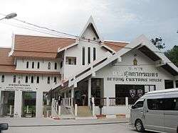
- Pengkalan Hulu/Perak (previously known as Keroh) - Betong/Yala Province
- Bukit Bunga/Jeli/Kelantan - Ban Buketa/Waeng District/Narathiwat Province
- Rantau Panjang/Kelantan - Su-ngai Kolok District/Narathiwat Province

Railway crossings
There are two rail crossings along the Malaysian-Thai border.
- Padang Besar, Malaysia-Padang Besar, Thailand: Both the Malaysian and Thai towns where the crossing is located are known by the same name. This crossing connects to Malaysia's West Coast trunk line and Thailand's main southern line to Bangkok via Hat Yai. Both Malaysian and Thai customs, immigration and quarantine formalities are conducted at Malaysia's Padang Besar railway station.
- Rantau Panjang-Su-ngai Kolok: On the Malaysian side, this bridge crossing is on a branch line which is connected to Malaysia's East Coast line. In Thailand, the crossing is connected to the Su-ngai Kolok branch line which links up with the main southern line at Hat Yai. The crossing is currently not in use.
Ferry crossings
- Pengkalan Kubor/Tumpat/Kelantan - Tak Bai
- Telaga Harbour in Langkawi/Kedah - Ko Lipe/Satun
- Resort World/Langkawi/Kedah - Ko Lipe/Satun
- Kuah/Langkawi/Kedah - Ko Lipe/Satun
- Kuah - Tammalang Port in Satun
- Kuala Perlis/Perlis - Satun Pier/Satun
- Penang - Phuket
Airline crossings
- Kuala Lumpur - Don Muang Airport (DMK) Bangkok[11]
- Kuala Lumpur - Chiang Mai
- Kuala Lumpur - Hat Yai
- Kuala Lumpur - Ko Samui
- Kuala Lumpur - Krabi
- Kuala Lumpur - Phuket
- Kuala Lumpur - Surat Thani
- Penang - Don Muang Airport (DMK) Bangkok
- Penang - Phuket
- Penang - Ko Samui
- Subang - Ko Samui
- Subang - Hua Hin
See also
References
- 1 2 3 Treaty between the Kingdom of Thailand and Malaysia relating to the Delimitation of the Territorial Seas of the two Countries (PDF), 24 October 1979, retrieved 28 June 2008
- ↑ "Maritime Boundaries: Indonesia-Malaysia-Thailand" (PDF), Limits in the Seas, 81, 27 December 1978
- ↑ Memorandum of Understanding between the Kingdom of Thailand and Malaysia on the Delimitation of the Continental Shelf Boundary between the two Countries in the Gulf of Thailand (PDF), 24 October 1979, retrieved 28 June 2008
- ↑ See map reproduced by the Singapore Ministry of Foreign Affairs in the country's response in the International Tribunal of the Law of the Sea case concerning the reclamation of lands by Singapore in the Straits of Johor.
- ↑ Royal proclamation establishing the Exclusive Economic Zone of the Kingdom of Thailand adjacent to the Exclusive Economic Zone of Malaysia in the Gulf of Thailand (PDF), 16 February 1988, retrieved 2 July 2008
- ↑ "Malaysia-Thailand Boundary" (PDF), International Boundary Study, 57: 3–4, 15 November 1965
- ↑ "Talks over border demarcation with Thais to continue", New Straits Times, p. 12, 11 March 2003
- 1 2 Nguyen, Hong Thao (1999). "Joint development in the Gulf of Thailand" (PDF). IBRU Boundary and Security Bulletin Autumn 1999. Retrieved 24 April 2008.
- ↑ Treaty between Thailand and Malaysia relating to the Delimitation of the Territorial Seas of the Two Countries (24 October 1979), Article 2 and Memorandum of Understanding between the Kingdom of Thailand and Malaysia on the Delimitation of the Continental Shelf Boundary between the two Countries in the Gulf of Thailand (24 October 1979) Article 1.
- ↑ ""No man's land" in M'sia-Thai border to be scrapped", Utusan Malaysia Internet Edition, 3 August 2001
- ↑ http://www.bangkokairportonline.com/node/71
External links
- See Clip videos Thailand Border
- Thailand proposes security fence along border with M'sia
- Thailand to erect security fence along border with Malaysia