Malaimbandy
| Malaimbandy | |
|---|---|
 Malaimbandy Location in Madagascar | |
| Coordinates: 20°20′S 45°36′E / 20.333°S 45.600°E | |
| Country |
|
| Region | Menabe |
| District | Mahabo |
| Elevation[1] | 140 m (460 ft) |
| Population (2001)[2] | |
| • Total | 26,000 |
| Time zone | EAT (UTC3) |
Malaimbandy is a town and commune (Malagasy: kaominina) in Madagascar. It belongs to the district of Mahabo, which is a part of Menabe Region. The population of the commune was estimated to be approximately 26,000 in 2001 commune census.[2]
Malaimbandy is just served by a local airport. Primary and junior level secondary education are available in town. The majority 70% of the population of the commune are farmers, while an additional 30% receives their livelihood from raising livestock. The most important crop is rice, while other important products are cassava and tobacco.[2]
Geography
This town lies at the intersection of the Route nationale 35 from Morondava to Ivato, Ambositra and the Route nationale 34 to Miandrivazo.
It is located at a distance of 280 km to Ivato, Ambositra, 176 km to Morondava, 77 km to Ankilizato, Mahabo and 72 km from Mandrosonoro.[3]
References and notes
- ↑ Estimated based on DEM data from Shuttle Radar Topography Mission
- 1 2 3 "ILO census data". Cornell University. 2002. Retrieved 2008-03-10.
- ↑ Atlas Mondial, France Loisir, page 159
| Belo sur Tsiribihina | 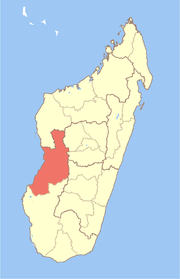 | |
|---|---|---|
| Mahabo | ||
| Manja | ||
| Miandrivazo | ||
| Morondava | ||
Coordinates: 20°20′S 45°36′E / 20.333°S 45.600°E