Mainling County
| Mainling County 米林县 • སྨན་གླིང་རྫོང་། | |
|---|---|
| County | |
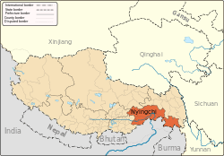
.png) Location of Mainling County within Tibet | |
 Mainling County Location in Tibet | |
| Coordinates: 29°36′0″N 94°12′7.20″E / 29.60000°N 94.2020000°E | |
| Country | China |
| Province | Tibet |
| Prefecture | Nyingchi Prefecture |
| Time zone | China Standard (UTC+8) |
Mainling County (Tibetan: ཀོང་པོ་རྒྱ་མདའ་རྫོང་, Wylie: sman gling rdzong ; Chinese: 米林县; pinyin: Mǐlín Xiàn) is a county of the Nyingtri Prefecture in eastern Tibet Autonomous Region.
Geography
Mainling County is located in the central-west of the Nyingtri Prefecture, at the middle reaches of the Yarlung Tsangpo River, and between the Nyenchen Tanglha Mountains and the Himalayan Mountains. It covers an area of 9,471 square kilometres. The average altitude is 3,700 metres above sea level.
Economy
The mine resources of the county are gold dust, plaster, limestone, chromium and iron, etc.
The main economy style in Mainling County is farming and forest industry. The main species of the trees are fir, spruce, pine, oak, and cypress, etc. The total cumulation volume of woods is 40 million cubic metres. The special fruit productions are apples, apple pears, walnuts and peaches.
Nyingchi Mainling Airport is the third airport in the Tibet Autonomous Region.
Demography
In 1999 the county had a population of 17347 inhabitants.[1]
The county is home to the Lhoba people.
References
- ↑ National Population Statistics Materials by County and City - 1999 Period, in China County & City Population 1999, Harvard China Historical GIS
External links
Coordinates: 29°36′00.00″N 94°12′07.20″E / 29.6000000°N 94.2020000°E