Interstate 95 in Maine
| ||||
|---|---|---|---|---|
|
Maine Turnpike in green, the rest of I-95 in red | ||||
| Route information | ||||
| Maintained by MDOT and Maine Turnpike Authority | ||||
| Length: |
303.20 mi[1] (487.95 km) Maine Turnpike: 101.43 miles (163.24 km)[2] | |||
| Existed: | 1960 – present | |||
| Major junctions | ||||
| South end: |
| |||
|
| ||||
| North end: |
| |||
| Location | ||||
| Counties: | York, Cumberland, Androscoggin, Kennebec, Somerset, Waldo, Penobscot, Aroostook | |||
| Highway system | ||||
| ||||
_map.svg.png)
In the U.S. state of Maine, Interstate 95 (I-95) is a 303-mile-long (488 km) highway running from the New Hampshire state line near Kittery, to the Canadian border near Houlton. It is the only two-digit Interstate Highway in Maine. In 2004, the highway's route between Portland and Gardiner was changed so that it encompasses the entire Maine Turnpike (including the former I-495 between Falmouth and Gardiner), which runs from Kittery to Augusta.
Route description
I-95 enters Maine from New Hampshire on the Piscataqua River Bridge, which connects Portsmouth, New Hampshire with Kittery. At mile 2 (Spruce Creek) in Kittery, the highway becomes the Maine Turnpike. The highway runs in a general northeasterly direction, parallel with U.S. 1, at this point. I-95 bypasses the Biddeford/Saco area, with a spur route (Interstate 195) connecting to Old Orchard Beach.
At Scarborough, Interstate 95 meets Interstate 295. The highway turns north, serving the Portland International Jetport and bypassing Portland to the west. At Falmouth, the highway meets unsigned Interstate 495, also called the Falmouth Spur. Until January 2004, I-95 followed the Falmouth Spur and I-295 between Falmouth and Gardiner.
The highway continues north along the Maine Turnpike (which was I-495 prior to 2004) through Gray to Auburn and Lewiston, which the Turnpike bypasses to the south. The highway then runs in an easterly direction to meet Interstate 295 at Gardiner. From there, I-95 parallels the Kennebec River past Augusta and Waterville, where a new interchange is being planned at Trafton Road. The highway then crosses the river at Fairfield and then turns northeast along the Sebasticook River past Pittsfield to Newport.
I-95 then continues east alongside U.S. Route 2 from Newport to Bangor, where Interstate 395 connects to the city of Brewer. The highway runs along the northern edge of Bangor's center, then turns northeast, following the Penobscot River past Orono and Old Town (Prior to the early 1980s, I-95 was a super two highway north of Old Town).
The highway continues north, still running near the river, towards Howland. Near Lincoln, Interstate 95 runs north through uninhabited forest land, crossing the Penobscot River at Medway. The highway goes northeast and east, passing a series of small Aroostook County farming towns before reaching Houlton, where it connects to New Brunswick Route 95 and U.S. Route 2 at the international border. North of Bangor, traffic levels drop noticeably, with AADT averaging only about 5,000 in northern Penobscot County and going down to as low as 2,000–4,000 in Houlton.[3]
Speed limits
The Maine Turnpike had a posted speed limit of 70 mph in the early 1970s, but as Maine then had no law against traveling less than 10 mph over the posted speed, the de facto speed limit was 79 mph. In 1974, as part of a federal mandate, the speed limit was reduced to 55 mph, with a new law including a "less than 10 over" violation. In 1987, Congress allowed states to post 65 mph on rural interstate highways. Following the relaxation, Maine increased its speed limit. In May 2011, a bill was introduced to raise the speed limit from Old Town to Houlton from 65 to 75 mph. It passed, with Maine the first state east of the Mississippi River since the 1970s to establish a 75 mph speed limit.[4][5]
A further law passed in 2013 by the Maine Legislature allowed the Maine Department of Transportation and the Turnpike Authority to change speed limits with the approval of the Maine State Police. Per that law, Maine DOT increased the 65 mph limit to 70 mph on several sections of Interstate 95 on May 27, 2014. These areas included the section from mile marker 114 just outside Augusta to mile 126 just before Waterville. In addition, the section from Fairfield (just above Waterville) to Bangor also saw an increase to 70.[6] Speed limits on sections controlled by the Turnpike Authority increased on August 11, 2014. The sections from mile marker 2.1 in Kittery to mile marker 44.1 in Scarborough, and the section from mile marker 52.3 in Falmouth to mile marker 109 in Augusta, increased from 65 mph to 70 mph. The section from mile marker 44.1 in Scarborough to mile marker 52.3 in Falmouth increased from 55 mph to 60 mph. The Falmouth Spur, outside the toll plaza area, increased from 50 mph to 60 mph.[7]
Exit list
Note: toll rates listed in this exit list are for Class 1 vehicles paying cash. They do not reflect lower rates for drivers using E-ZPass tags or higher rates for other vehicle classes.
| County | Location | mi | km | Exit | Destinations | Notes | ||
|---|---|---|---|---|---|---|---|---|
| York | Kittery | 0.0 | 0.0 | Continuation into New Hampshire | ||||
| 0.6 | 0.97 | 1 | Northbound exit and southbound entrance | |||||
| 1.1 | 1.8 | 2 | ||||||
| 1.3 | 2.1 | 3 | Southbound exit is via exit 2 | |||||
| York | 6.8 | 10.9 | 7 | |||||
| 7.2 | 11.6 | Maine Turnpike York Toll Barrier—Cars $3 | ||||||
| Wells | 19.1 | 30.7 | 19 | Entrance toll $1.50 (northbound only) | ||||
| Kennebunk | 25.2 | 40.6 | 25 | Entrance toll $1 | ||||
| Biddeford | 31.1 | 50.1 | 32 | Entrance toll $1 | ||||
| Saco | 35.2 | 56.6 | 36 | Entrance toll $1 | ||||
| Cumberland | Scarborough | 41.9 | 67.4 | 42 | Entrance toll $1 | |||
| South Portland | 43.6 | 70.2 | 44 | Northbound exit and southbound entrance; toll $1 both directions | ||||
| 44.3 | 71.3 | 45 | Entrance toll $1 | |||||
| Portland | 45.5 | 73.2 | 46 | Entrance toll $1 | ||||
| 46.7 | 75.2 | 47 | Entrance toll $1 | |||||
| 47.8 | 76.9 | 48 | Entrance toll $1 | |||||
| 50.8 | 81.8 | 52 | Toll $1 both directions on I-495 / Falmouth Spur | |||||
| Falmouth | 51.6 | 83.0 | 53 | Entrance toll $1 | ||||
| Gray | 62.2 | 100.1 | 63 | Entrance toll $1.50 (southbound only) | ||||
| New Gloucester | 66.1 | 106.4 | Maine Turnpike New Gloucester Toll Barrier—Cars $2.25 | |||||
| Androscoggin | Auburn | 74.2 | 119.4 | 75 | ||||
| Lewiston | 79.0 | 127.1 | 80 | |||||
| Sabattus | 84.9 | 136.6 | 86 | |||||
| Kennebec | West Gardiner | 99.7 | 160.5 | Maine Turnpike West Gardiner Toll Barrier—Cars $1.75 | ||||
| Gardiner | 101.9 | 164.0 | 102 | Northbound exit and southbound entrance | ||||
| 103.0 | 165.8 | 103 | Southbound exit and northbound entrance; toll $1 either direction | |||||
| Augusta | 109.5 | 176.2 | 109 | Signed as exits 109A (west) and 109B (east) southbound | ||||
| 112.0 | 180.2 | 112 | Signed as exits 112A (south) and 112B (north) northbound | |||||
| 112.9 | 181.7 | 113 | ||||||
| Sidney | 120.5 | 193.9 | 120 | Lyons Road, Sidney | ||||
| Waterville | 127.2 | 204.7 | 127 | |||||
| 130.2 | 209.5 | 130 | ||||||
| Somerset | Fairfield | 132.3 | 212.9 | 132 | ||||
| 133.3 | 214.5 | 133 | ||||||
| Kennebec | Clinton | 137.9 | 221.9 | 138 | Hinckley Road—Clinton, Burnham | |||
| Waldo |
No major junctions | |||||||
| Somerset | Pittsfield | 149.8 | 241.1 | 150 | Somerset Avenue—Pittsfield, Hartland, Burnham | |||
| Palmyra | 156.7 | 252.2 | 157 | |||||
| Penobscot | Newport | 158.8 | 255.6 | 159 | Ridge Road—Newport, Plymouth | Southbound exit and northbound entrance | ||
| Plymouth | 160.6 | 258.5 | 161 | |||||
| Etna | 166.9 | 268.6 | 167 | |||||
| Newburgh | 173.6 | 279.4 | 174 | |||||
| Hampden | 179.5 | 288.9 | 180 | Cold Brook Road—Hermon, Hampden | ||||
| Bangor | 182.1 | 293.1 | 182A | South end of SR 15 overlap; I-395 exits 1A-B | ||||
| 182.4 | 293.5 | 182B | ||||||
| 183.1 | 294.7 | 183 | ||||||
| 183.9 | 296.0 | 184 | ||||||
| 185.3 | 298.2 | 185 | North end of SR 15 overlap | |||||
| 186.3 | 299.8 | 186 | Stillwater Avenue | No northbound entrance | ||||
| 187.1 | 301.1 | 187 | Hogan Road—Bangor, Veazie | |||||
| Orono | 190.5 | 306.6 | 191 | Kelly Road—Orono, Veazie | ||||
| 192.7 | 310.1 | 193 | Stillwater Avenue—Stillwater, Old Town, Orono | |||||
| Old Town | 196.7 | 316.6 | 197 | |||||
| Lagrange | 199.0 | 320.3 | 199 | Northbound exit and southbound entrance | ||||
| Howland | 216.3 | 348.1 | 217 | |||||
| Lincoln | 227.1 | 365.5 | 227 | |||||
| Medway | 244.0 | 392.7 | 244 | |||||
| Benedicta | 258.2 | 415.5 | 259 | Casey Road – Benedicta | Northbound exit and southbound entrance. Northbound Interstate 95 enters Aroostook County for about ½ mile, including northbound exit. | |||
| Aroostook | Sherman | 263.8 | 424.5 | 264 | ||||
| Island Falls | 275.4 | 443.2 | 276 | |||||
| Oakfield | 285.3 | 459.1 | 286 | Oakfield Road—Oakfield, Smyrna Mills | ||||
| Smyrna | 290.7 | 467.8 | 291 | |||||
| Houlton | 301.3 | 484.9 | 302 | |||||
| 304.1 | 489.4 | 305 | East end of US 2 | |||||
| 304.4 | 489.9 | Northern end of I-95; continuation into New Brunswick, Canada | ||||||
1.000 mi = 1.609 km; 1.000 km = 0.621 mi
| ||||||||
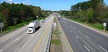
Maine Turnpike

History
.jpg)
The Maine Turnpike Authority was created by the Maine Legislature in 1941 to connect Kittery and Fort Kent. In 1947, the first section of highway, designated the Maine Turnpike, opened between Kittery and Portland. In 1953, the Turnpike Authority began construction on an extension to the state capital at Augusta using the former right-of-way of the Portland–Lewiston Interurban railway from Portland through Falmouth.[8] The original turnpike was the largest construction project in the state's history until the construction of the extension, which opened to the public on December 13, 1955.[9]
The Maine Turnpike was the first highway funded using revenue bonds. It remains self-financed, and does not receive funding from the state or federal government. When the first section opened in 1947, it was only the second superhighway in the United States following the October 1940 opening of the Pennsylvania Turnpike. For these reasons, the Maine Turnpike was named a National Historic Civil Engineering Landmark by the American Society of Civil Engineers in 1999[10] .
In 1956, one year after the Portland-Augusta extension opened, Congress created the Interstate Highway System. The remaining sections to be built—from Augusta to Fort Kent—would be publicly funded freeways instead of toll roads under the Maine Turnpike Authority. Today this highway, which ends at Houlton instead of Fort Kent, is signed as Interstate 95 throughout and the Maine Turnpike between the New Hampshire line at Kittery and the junction with US 202 near Augusta.
The former head of the Maine Turnpike Authority served 19 months in prison for stealing as much as $230,000 from the toll revenue generated by the Maine Turnpike Authority for his personal use from 2003 to 2010.[11]
Tolls
.jpg)
The segment of Interstate 95 from Kittery to Augusta runs along the Maine Turnpike. This is a toll road for all of its length except for sections near Kittery and Lewiston. Flat-fee tolls are paid upon entering the turnpike. There are also barrier tolls in York, New Gloucester, and West Gardiner. Drivers using exits 44 and 52 must also pay a toll upon exiting. The turnpike joined the E-ZPass electronic toll collection network in 2005, replacing the former Maine-only system designated Transpass that was implemented in 1997.[12]
The tollbooths on the Maine Turnpike were not supposed to be permanent. Toll collections were to stop once the Maine Turnpike Authority paid off the debt from the road's construction. In the 1980s the bonds were going to be paid off but the Maine Legislature authorized the Maine Turnpike Authority in 1982 to continue as a quasi-governmental agency and to continue to collect tolls in order to fund the maintenance of the section of highway controlled by the MTA.[13]
Service areas
There are five service areas on the turnpike. Two are accessible northbound, two southbound, and one is accessible from both directions. All are open 24 hours and provide food and fuel services. They also have ATMs. Some have small gift shops. The plazas are at the following locations:
- Kennebunk plazas: Northbound and southbound at MP 25—food, fuel, gift shop. The original plazas, which included Howard Johnson's restaurants, opened in 1947 and incorporated a pedestrian tunnel under the highway to connect the two. These original plazas were replaced in 1972 and the tunnel was sealed. These 1972 plazas were replaced during the winter of 2006–2007. Both service plazas open with "food court layout featuring Starbucks coffee, Burger King, Hershey’s Ice Cream, a Z-Market convenience store and a Popeye’s Chicken on the northbound side and Sbarros Pizza on the southbound side."[14]
- Gray plaza (NB)/Cumberland plaza (SB): Northbound and Southbound at MP 58—food and fuel. Both plazas have been replaced with new service plazas with a Starbucks and a Z-Market convenience store. On March 21, 2016 both the Gray and Cumberland service areas will close for a period of approximately 9 weeks to remove the Starbucks restaurants and add a drive-thru Burger King. [15]
- West Gardiner plaza: At the I-95/I-295/ME 126 intersection,accessible by both directions of I-95 and I-295. Food court, fuel, gift shop, information.
There is a Rest Area / Tourist Welcome Center located on the turnpike Northbound at MP 3 in Kittery.
There are weigh stations located on the turnpike Northbound and Southbound in York at MP 4 (SB) and MP 6 (NB).
There are ramps to/from the northbound turnpike to the Saco Ramada Hotel and Conference Center in Saco at MP 35 (Old MP 33 before the southern extension).[16] The ramps are from the original exit 5 which was replaced when I-195 was opened just to the north. The hotel was built on the site of the old toll plaza. Ramps connecting the hotel to/from the southbound turnpike were removed as part of the widening project in the early 2000s, when hotel ownership opted not to pay nearly $1 million to build a new bridge.
Previous to the West Gardiner rest area opening, there were rest areas located in Lewiston (Southbound at MP 83) and Litchfield (Northbound at MP 98).
References
- ↑ Maine State Route Log (via floodgap.com)
- ↑ "Welcome to the Maine Turnpike Authority". Maineturnpike.com. Retrieved 2011-09-19.
- ↑ "Interstate 95 Annual Average Daily Traffic". Interstate-Guide. Retrieved 2011-09-19.
- ↑ Miller, Kevin (May 12, 2011). "Bill would boost speed limit to 75 mph on northern highway". Bangor Daily News. Retrieved May 22, 2011.
- ↑ "Lawmakers OK 75-mph speed limit between Old Town, Houlton, Bangor Daily News, June 29, 2011". The Bangor Daily News. Retrieved October 4, 2014.
- ↑ Koenig, Paul (May 27, 2014). "Speed limit increasing by 5 mph on parts of I-295, I-95". Kennebec Journal. Retrieved May 27, 2014.
- ↑ "Turnpike News: Travel Advisories". Turnpike Traveler Services. Maine Turnpike Authority. Retrieved October 4, 2014.
- ↑ Cummings, Osmond Richard. "Portland-Lewiston Interurban: a history of the finest electric interurban railway to run in the State of Maine". Bangor Public Library. Retrieved 5 September 2014.
- ↑ "Maine Turnpike Authority History".
- ↑ "Maine Turnpike".
- ↑ "Paul Violette, 61, served less than 20 months for stealing as much as $230,000 in public funds.".
- ↑ "E-ZPass Information Frequently Asked Questions".
- ↑ "Keep the change: Toll highways aren't going away".
- ↑ Turnpike Press Release Archived October 15, 2007, at the Wayback Machine.
- ↑ Turnpike Press Release
- ↑ "Ramada Saco / Old Orchard Beach Area (official site)". Retrieved October 4, 2014.
External links
| Wikimedia Commons has media related to Interstate 95 in Maine. |
| Previous state: New Hampshire |
Maine | Next state: Terminus |
| ||