Main Street (Vancouver)


Main Street is a major north-south thoroughfare bisecting Vancouver, British Columbia, Canada. It runs from Waterfront Road by Burrard Inlet in the north, to Kent Avenue alongside the north arm of the Fraser River in the south.
Route
Beginning by the Port of Vancouver terminals near the nexus of the city's historic Downtown Eastside and Gastown districts, the street runs south through Chinatown south of Hastings Street, and continues past the Pacific Central railway station and the Main Street-Science World SkyTrain station (the latter about a block away from Science World). At Terminal Avenue it slopes up into the Mount Pleasant neighbourhood, which mixes commerce, light industry, brewing, and high-density residential areas. The residential/commercial mix continues south of Broadway, with a high density of restaurants and fashion retailing. This neighbourhood was once blue-collar but is growing distinctly upscale.
Between 33rd and 41st Avenue the street becomes decidedly more residential as it reaches its topographical summit. South of 41st, the street enters the Sunset neighbourhood and takes on a markedly Indo-Canadian character. The Punjabi Market district begins just north of 49th avenue; south of the Market the street again becomes predominantly residential.
At Main Street’s South-Vancouver intersection with Marine Drive its character becomes big-box commercial, notably including a Real Canadian Superstore supermarket. Between Marine and its southern terminus, Main Street’s neighbourhood is a highly-miscellaneous commercial mix including office space, manufacturing, and warehousing.
History
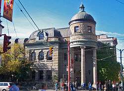
The north end of Main Street is located just west of the historic site of Hastings Mill, the nucleus around which Granville, later Vancouver, grew. In its earliest days, the intersection of Main and Hastings Streets was the centre of downtown Vancouver, boasting the city's central public library (now the Carnegie Centre) and — a few blocks away — the old City Hall. The intersection of Main and Hastings is now a local byword for the poverty, addictions, homelessness, and prostitution often associated with the Downtown Eastside.
The thoroughfare was originally named "Westminster Avenue", since it connects to New Westminster Road (now Kingsway). It received its present name in 1910[1] at the behest of local merchants, who thought that it bestowed a more cosmopolitan air to the neighbourhood.
Main Street was previously separated into two segments by False Creek, with a bascule bridge linking the two.[2] The two segments were joined together after the eastern section of False Creek was reclaimed for railway lands in the 1910s and 1920s.
Neighbourhoods
Main Street passes through the following Vancouver neighbourhoods (north to south):
- Downtown Eastside
- Old Japantown
- Chinatown
- Strathcona
- Mount Pleasant
- Riley Park-Little Mountain
- Punjabi Market
- Sunset
Intersections
The following are the major east-west intersections with Main Street (north to south):
- Cordova Street
- Hastings Street
- Georgia Viaduct
- Terminal Avenue
- Broadway
- 12th Avenue
- King Edward Avenue
- 33rd Avenue
- 41st Avenue
- 49th Avenue
- Southeast Marine Drive
References
- ↑ Walker, Elizabeth (1999). Street Names of Vancouver. Vancouver Historical Society. pp. 74–75. ISBN 0-9692378-7-1.
- ↑ Thirkell, Fred; Scullion, Bob (1996). Postcards from the past: Edwardian images of Greater Vancouver and the Fraser Valley. Heritage House Publishing Co. p. 31. ISBN 978-1-895811-23-0.