Mahinahina, Hawaii
| Mahinahina, Hawaii | |
|---|---|
| Census-designated place | |
 Mahinahina, Hawaii | |
| Coordinates: 20°57′14″N 156°39′23″W / 20.95389°N 156.65639°WCoordinates: 20°57′14″N 156°39′23″W / 20.95389°N 156.65639°W | |
| Country | United States |
| State | Hawaii |
| County | Maui |
| Area[1] | |
| • Total | 6.708 sq mi (17.37 km2) |
| • Land | 6.699 sq mi (17.35 km2) |
| • Water | 0.009 sq mi (0.02 km2) |
| Elevation | 732 ft (223 m) |
| Population (2010)[1] | |
| • Total | 880 |
| • Density | 130/sq mi (51/km2) |
| Time zone | Hawaii-Aleutian (UTC-10) |
| Area code(s) | 808 |
| GNIS feature ID | 2583423[2] |
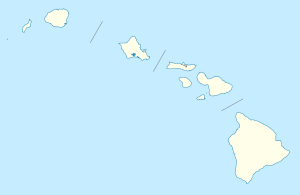
Mahinahina is an unincorporated community and census-designated place on the island of Maui in Maui County, Hawaii, United States. Its population was 880 as of the 2010 census.[1] The community is located on the west side of the island.
Geography
Mahinahina is located at 20°57′14″N 156°39′23″W / 20.9539453°N 156.6564808°W. According to the U.S. Census Bureau, the community has an area of 6.708 square miles (17.37 km2), of which 6.699 square miles (17.35 km2) is land and 0.009 square miles (0.023 km2) is water.[1]
References
Islands, municipalities, and communities of Maui County, Hawaii, United States | ||
|---|---|---|
| CDPs | 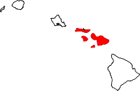 | |
| Unincorporated communities | ||
| Footnotes | ‡This populated place also has portions in an adjacent county or counties | |
This article is issued from Wikipedia - version of the 4/24/2016. The text is available under the Creative Commons Attribution/Share Alike but additional terms may apply for the media files.