Mahakoshal
| Mahakoshal महाकोशल Mahakaushal | |
|---|---|
| Historical region of Central India | |
|
Madan Mahal Fort | |
| Country | India |
| State | Madhya Pradesh |
| Established | ~1000 CE |

Mahakoshal is a region of central India. Mahakoshal lies in the upper or eastern reaches of the Narmada River valley in the Indian state of Madhya Pradesh. Jabalpur is the largest city in the region. Nimar region lies to the west, in the lower reaches of the Narmada valley.
Mahakoshal is mainly a Hindi-speaking area. Other languages used in the region include Standard Hindi, Gondi, and Marathi. It is highly demanded state from Undivided Madhya Pradesh due to lack of recognition and development. Recently an initiative has been started by MP High Court Bar council with a demand of New State "Rewakhand" with 25 Districts of Mahakaushal and Bundelkhand.
Geography
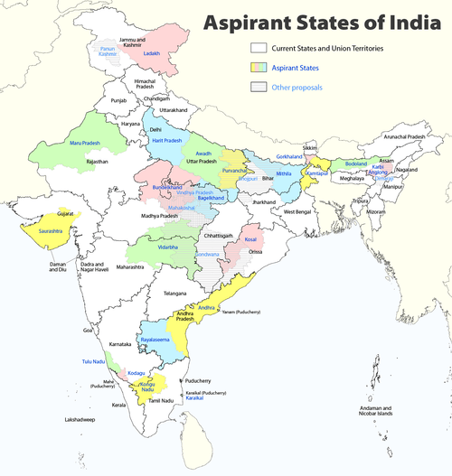
The Vindhya Range forms the northern boundary of the region; north of the Vindhya Range lie the regions of Malwa to the northwest, Bundelkhand to the north, and Bagelkhand to the northeast. Chhattisgarh state lies to the east, and the Vidarbha region of Maharashtra state lies to the south across the Satpura Range. Cities and districts of the region include Jabalpur, Katni, Narsinghpur, Mandla, Dindori, Seoni and Chhindwara.
History
Dynasties that have held the territory include the Gonds Kalachuri, Satavahanas, and Marathas.[1] During the British Raj Mahakoshal was part of the Central Provinces which contained two distinct linguistic regions: Mahakoshal and Vidarbha. The two linguistic regions could not be fully integrated as a unit owing to regional and cultural differences.[2]
Demand for a Separate State
It is highly demanded state from undivided Madhya Pradesh due to lack of recognition and development. Recently an initiative has been started by MP High Court Bar council with a demand of New State "Rewakhand" with 25 Districts of Mahakaushal and Bundelkhand.
See also
References
- ↑ Hunter, William Wilson, Sir, et al. (1908). Imperial Gazetteer of India, Volume 6. 1908-1931; Clarendon Press, Oxford.
- ↑ Raghaw Raman Pateriya, Provincial Legislatures and the National Movement. Northern Book Centre, 1992. pg. 9
| Proposed states |
|  |
|---|---|---|
| Proposed territories | ||
Coordinates: 23°09′N 79°56′E / 23.150°N 79.933°E