Mahébourg

Mahébourg is a small city (population 15,457 as of 2015)[1] on the south-eastern coast of the island of Mauritius. It is considered the main village of the Grand Port District.
Overview
It is named after Bertrand-François Mahé de La Bourdonnais, one of the most successful governors of the French colonial period. It was originally built by the Netherlands during their brief period of colonisation of the island. It was close to their landing port, had ample water supply from many rivers and streams and had a scenic view of the large bay area. Mahébourg knew major development around 1806 during the French colonisation era.
The well-planned wide streets in the old section of Mahébourg still bear testimony to this Dutch and French colonial past. After the French chose Port Louis as the main port Mahébourg declined into a sleepy coastal city. The past is still preserved today in the Historical Naval Museum which also recounts the epic naval battles of the past between the French Navy and the Royal Navy. The Dutch historical museum in Grand Port recounts the early Dutch settlement of the island.
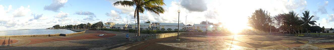
Nowadays, Mahébourg is a bustling centre of local trade. The new waterfront complex promises some memorable walks along the sea-side. It even has a casino, mark of a developing tourism industry. There is a growing number of small inns in the city itself and the surrounding districts which cater for local and foreign visitors.
In spite of being well known for its lagoon (the biggest of Mauritius) and for its fishing industry, Mahébourg also has three primary schools namely, Willoughby Government School, Dupérré Government School and Notre Dame des Anges Roman Catholic Aided (RCA) and four secondary schools, namely Emmanuel Anquetil State Secondary School, Hamilton College Boys, Hamilton College Girls and Loretto Convent of Mahébourg.
View
See also
References
- ↑ Digest of Demographic Statistics 2015; Available at http://statsmauritius.govmu.org/English/Pages/POPULATION--And-VITAL-STATISTICS.aspx
External links
| Wikimedia Commons has media related to Mahébourg. |
Coordinates: 20°24′S 57°42′E / 20.400°S 57.700°E