Magnac-Laval
| Magnac-Laval | ||
|---|---|---|
|
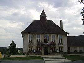
The town hall in Magnac-Laval | ||
| ||
 Magnac-Laval | ||
|
Location within Nouvelle-Aquitaine region  Magnac-Laval | ||
| Coordinates: 46°12′58″N 1°10′04″E / 46.2161°N 1.1678°ECoordinates: 46°12′58″N 1°10′04″E / 46.2161°N 1.1678°E | ||
| Country | France | |
| Region | Nouvelle-Aquitaine | |
| Department | Haute-Vienne | |
| Arrondissement | Bellac | |
| Canton | Magnac-Laval | |
| Intercommunality | Brame-Benaize | |
| Government | ||
| • Mayor (2008–2014) | Jean-Bernard Jarry | |
| Area1 | 72.22 km2 (27.88 sq mi) | |
| Population (2006)2 | 2,117 | |
| • Density | 29/km2 (76/sq mi) | |
| Time zone | CET (UTC+1) | |
| • Summer (DST) | CEST (UTC+2) | |
| INSEE/Postal code | 87089 / 87190 | |
| Elevation | 189–324 m (620–1,063 ft) | |
|
1 French Land Register data, which excludes lakes, ponds, glaciers > 1 km² (0.386 sq mi or 247 acres) and river estuaries. 2 Population without double counting: residents of multiple communes (e.g., students and military personnel) only counted once. | ||

Magnac-Laval (Occitan: Manhac la Vau) is a commune in the Haute-Vienne department in the Nouvelle-Aquitaine region in west-central France.
Geography
The river Brame flows westward through the middle of the commune and crosses the town.
Inhabitants are known as Magnachons.[1]
See also
References
- ↑ http://www.habitants.fr/magnac-laval/ Name of magnac-laval inhabitants
| Wikimedia Commons has media related to Magnac-Laval. |
This article is issued from Wikipedia - version of the 11/11/2016. The text is available under the Creative Commons Attribution/Share Alike but additional terms may apply for the media files.