Maghval
| Maghval Bombay Enclave Megwal | |
|---|---|
| village | |
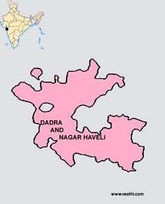 Dadra and Nagar Haveli map in pink colour depicting the Gujarati enclave village of Maghval in grey colour | |
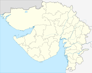 Maghval  Maghval Location in Gujarat, India | |
| Coordinates: 20°13′N 73°01′E / 20.21°N 73.02°ECoordinates: 20°13′N 73°01′E / 20.21°N 73.02°E | |
| Country |
|
| State | Gujarat |
| District | Valsad district |
| Elevation | 16 m (52 ft) |
| Population (2011) | |
| • Total | 2,678 |
| Languages | |
| • Official | Gujarati, Marathi |
| Time zone | IST (UTC+5:30) |
| PIN | 396240 |
| Vehicle registration | GJ |
| Nearest city | Silvassa |
| Website |
gujaratindia |
Maghval, also known as Megwal, is a village in the Kaprada tehsil of Valsad district in Gujarat State, India. It is a small enclave belonging to Gujarat, but located within Nagar Haveli, just south of Silvassa in the Indian Union Territory of Dadra and Nagar Haveli.
History
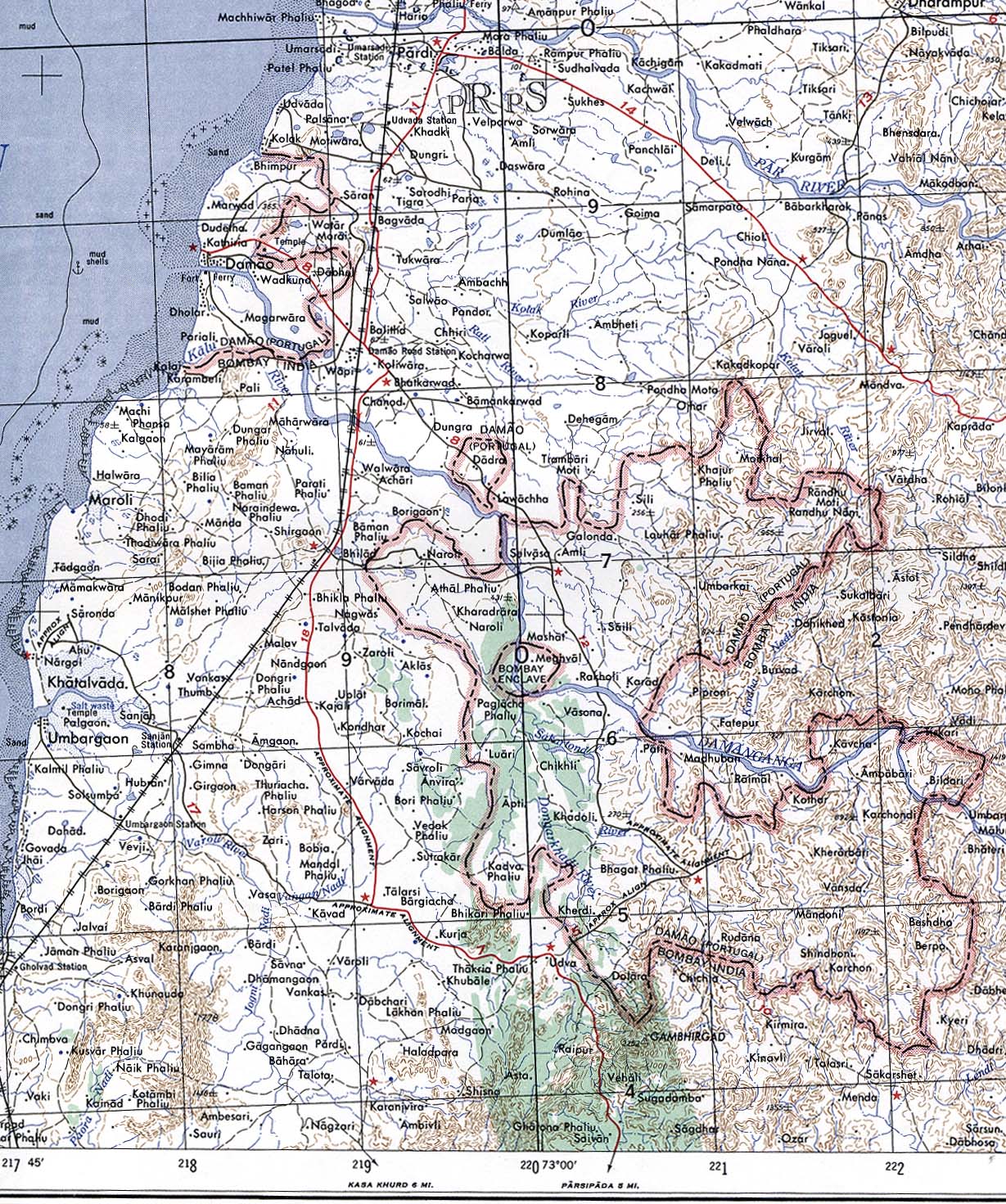
Formerly "Bombay Enclave," Maghval was a British counter-enclave within the Portuguese enclave within British India until independence.[1][2]
References
- ↑ Yoshida Ichiro. "Megubaru, Former British territory, India". Retrieved 2013-10-06.
- ↑ Damao (Daman) 1954 (Topographic Map) original scale 1:250,000. (Map). 1956. Retrieved 2013-10-06.
Portion of Navsari, Sheet NF 43-13, Series U502, U.S. Army Map Service compiled in 1954 and printed in 1956 (Perry-Castañeda Library Map Collection, University of Texas Libraries)
This article is issued from Wikipedia - version of the 10/3/2016. The text is available under the Creative Commons Attribution/Share Alike but additional terms may apply for the media files.