Mafinga Central
| Mafinga Central | |
|---|---|
 Mafinga Central from the Mafinga Hills ridge on the Zambia/Malawi border. | |
| Highest point | |
| Elevation | 2,339 m (7,674 ft) |
| Listing | Country high point |
| Coordinates | 9°57′9.7″S 33°21′8.5″E / 9.952694°S 33.352361°ECoordinates: 9°57′9.7″S 33°21′8.5″E / 9.952694°S 33.352361°E |
| Geography | |
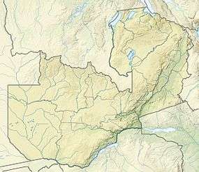 Mafinga Central Location in Zambia, on the border with Malawi | |
| Location | Zambia–Malawi border |
| Parent range | Mafinga Hills |
Mafinga Central is the highest point in the Mafinga Hills on the border of Zambia and Malawi. At 2,339-metre (7,674 ft) it is likely to be the highest mountain in Zambia. It is most easily accessed from the town of Chisenga in Malawi.[1]
The peak was climbed in 2014 by an international team from the United Kingdom, Malawi and Lithuania, who measured it to be slightly higher than 2,337-metre (7,667 ft) Mafinga South, another peak on the watershed close by. A more accurate survey is needed to establish for certain which of the two peaks is higher.[1] Both peaks are found on the Mafinga Ridge, an area composed of quartzites, phyllites, and feldspathic sandstones of sedimentary origin. The Luangwa River, one of Zambia's major river systems, rises in the Mafinga Hills on the western side of the ridge.[2]
References
- 1 2 "Mafinga South and Mafinga Central: the highest peaks in Zambia". Footsteps on the Mountain blog. 16 October 2014.
- ↑ "Mafinga Hills". Encyclopaedia Britannica. Retrieved 16 October 2014.