Madang
| Madang | |
|---|---|
| Town | |
|
Coastwatchers Memorial Lighthouse, Kalibobo, Madang | |
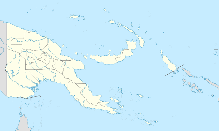 Madang Location in Papua New Guinea | |
| Coordinates: 5°13′S 145°48′E / 5.217°S 145.800°ECoordinates: 5°13′S 145°48′E / 5.217°S 145.800°E | |
| Country |
|
| Province | Madang Province |
| District | Madang District |
| Established | 1884 |
| Elevation | 3 m (10 ft) |
| Population (2013) | |
| • Total | 29,339 |
| Time zone | AEST (UTC+10) |
| Climate | Af |

Madang (old German name: Friedrich-Wilhelmshafen [1]) is the capital of Madang Province and is a town with a population of 27,420 (in 2005) on the north coast of Papua New Guinea. It was first settled by the Germans in the 19th century.
Madang is the home of Divine Word University. The University accepts local and international students.
History
Russian biologist Nicholai Miklukho-Maklai was probably the first European to visit the area. In 1871 he stayed at Astrolabe Bay just south of present-day Madang for 15 months. He had a good relationship with the local communities before leaving, suffering from malaria.
In 1884 the German New Guinea Company arrived and tried to establish a base at various locations including at present day Madang but were continually beaten by malaria. They eventually moved to Rabaul.
The Japanese invaded and captured Madang without a fight during World War II in 1942. In September 1943, Australian forces launched a sustained campaign to retake the Finisterre Range and Madang. The town was captured on April 24, 1944. During the occupation and fighting the town was virtually destroyed and had to be rebuilt afterwards.
NGO Presence in Madang
Madang is viewed by many in the country as being safer and more pleasant for expatriates than the larger cities of Lae and Port Moresby. Because of this, some NGOs have chosen Madang as the location of their main offices in country.
CUSO (a Canadian NGO) and VSO (a British NGO) both have their headquarters in Madang.
Save the Children, WWF, and World Vision are also present with branch offices in Madang.
As a consequence Madang has a larger number of expatriates working and living in the town than its small population would suggest.
Transport
Climate
| Climate data for Madang | |||||||||||||
|---|---|---|---|---|---|---|---|---|---|---|---|---|---|
| Month | Jan | Feb | Mar | Apr | May | Jun | Jul | Aug | Sep | Oct | Nov | Dec | Year |
| Record high °C (°F) | 33.2 (91.8) |
33.3 (91.9) |
33.3 (91.9) |
33.7 (92.7) |
32.2 (90) |
32.2 (90) |
31.5 (88.7) |
31.7 (89.1) |
33.4 (92.1) |
31.7 (89.1) |
32.5 (90.5) |
33.6 (92.5) |
33.7 (92.7) |
| Average high °C (°F) | 30.8 (87.4) |
30.6 (87.1) |
30.6 (87.1) |
30.6 (87.1) |
30.7 (87.3) |
30.4 (86.7) |
30.2 (86.4) |
30.2 (86.4) |
30.5 (86.9) |
30.9 (87.6) |
31.2 (88.2) |
30.9 (87.6) |
30.6 (87.1) |
| Average low °C (°F) | 23.9 (75) |
23.8 (74.8) |
23.9 (75) |
23.8 (74.8) |
23.9 (75) |
23.7 (74.7) |
23.4 (74.1) |
23.7 (74.7) |
23.6 (74.5) |
23.8 (74.8) |
23.9 (75) |
23.9 (75) |
23.8 (74.8) |
| Record low °C (°F) | 21.0 (69.8) |
20.7 (69.3) |
20.8 (69.4) |
21.1 (70) |
20.1 (68.2) |
19.9 (67.8) |
20.0 (68) |
18.9 (66) |
20.8 (69.4) |
20.3 (68.5) |
20.0 (68) |
19.4 (66.9) |
18.9 (66) |
| Average rainfall mm (inches) | 343.8 (13.535) |
292.0 (11.496) |
329.8 (12.984) |
389.4 (15.331) |
343.4 (13.52) |
186.4 (7.339) |
144.2 (5.677) |
93.8 (3.693) |
82.6 (3.252) |
239.2 (9.417) |
280.2 (11.031) |
382.0 (15.039) |
3,106.8 (122.315) |
| Average rainy days | 23 | 21 | 23 | 23 | 21 | 18 | 15 | 12 | 11 | 15 | 19 | 23 | 224 |
| Average relative humidity (%) | 85 | 85 | 85 | 85 | 85 | 84 | 84 | 82 | 83 | 83 | 84 | 84 | 84 |
| Mean monthly sunshine hours | 160 | 140 | 144 | 162 | 193 | 195 | 198 | 210 | 227 | 210 | 185 | 160 | 2,184 |
| Source #1: World Meteorological Organisation[2] | |||||||||||||
| Source #2: Deutscher Wetterdienst (extremes, humidity and sun)[3][4][lower-alpha 1] | |||||||||||||
Products
Industry and farming are growing constantly in importance, more for export to distant lands. There are the widespread coconut palm plantations on the coast and cardamum is grown on Madang.
The Kilili plantation is the second largest of Kar Kar Island's twelve plantations with its more than a thousand coconut palms and cocoa trees. 70% of the cocoa and 50% of the copra produced in Madang province comes from Kar Kar.
In Madang province 173 regional languages are spoken, some of them being extremely different from the others.
Images
.jpg)
 Madang from space
 Madang lagoon
See also
References
- ↑ The New Encyclopædia Britannica (1974), Micropædia Vol. 6 (15th ed.). p. 467.
- ↑ "World Weather Information Service — Madang". World Meteorological Organisation. Retrieved 15 December 2015.
- ↑ "Klimatafel von Madang / Papua-Neuguinea" (PDF). Baseline climate means (1961-1990) from stations all over the world (in German). Deutscher Wetterdienst. Retrieved 29 January 2016.
- ↑ "Station 92014 Madang W.O". Global station data 1961–1990—Sunshine Duration. Deutscher Wetterdienst. Retrieved 29 January 2016.
External links
- "When the Japanese bombed Magang (sic): Bob Emery". Papua New Guinea Association of Australia. 16 September 2015. Retrieved 23 April 2016.. An eyewitness recollection of the 1942 Japanese attack on Madang
| Wikimedia Commons has media related to Madang. |
| Wikivoyage has a travel guide for Madang. |
Notes
- ↑ Station ID for Madang W.O is 92014 Use this station ID to locate the sunshine duration
Provincial capitals of Papua New Guinea | ||
|---|---|---|