Machu Kuntur Sinqa
| Machu Kuntur Sinqa | |
|---|---|
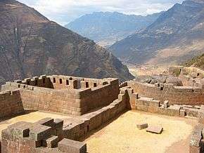 View of the Sacred Valley with the Willkanuta River from Inti Watana. Machu Kuntur Sinqa is on the left. | |
| Highest point | |
| Elevation | 4,200 m (13,800 ft) [1] |
| Coordinates | 13°26′18″S 71°48′38″W / 13.43833°S 71.81056°WCoordinates: 13°26′18″S 71°48′38″W / 13.43833°S 71.81056°W |
| Geography | |
 Machu Kuntur Sinqa Peru | |
| Location | Peru, Cusco Region, Calca Province |
| Parent range | Andes |
Machu Kuntur Sinqa (Quechua machu old, kuntur condor, sinqa nose,[2] also spelled Machucóndor Senqa)[3] or Machu Kuntur Sankha (sankha cliff,[2] hispanicized Machucóndor Sanga)[1] is a mountain in the Cusco Region in Peru, about 4,200 metres (13,780 ft) high. It is situated in the Calca Province, on the border of the districts Pisac and San Salvador.[1] Machu Kuntur Sinqa lies on the right bank of the Willkanuta River, near the archaeological park of Pisac.
References
- 1 2 3 escale.minedu.gob.pe - UGEL map of the Calca Province (Cusco Region) (unnamed)
- 1 2 Teofilo Laime Acopa, Diccionario Bilingüe, Iskay simipi yuyay k'ancha, Quechua – Castellano, Castellano – Quechua (Quechua-Spanish dictionary)
- ↑ "South America Maps". Joint Operations Graphic. Retrieved June 27, 2014.
This article is issued from Wikipedia - version of the 12/6/2015. The text is available under the Creative Commons Attribution/Share Alike but additional terms may apply for the media files.