MV Sea Empress
| History | |
|---|---|
| Name: | Sea Empress |
| Owner: | Oriental Ocean Shipping |
| Builder: |
|
| Acquired: | 2010 |
| Status: | Bulk carrier |
| General characteristics | |
| Displacement: | 147,273 DWT |
| Length: | 274.3 m (899.93 ft) |
| Beam: | 43.2 m (141.73 ft) |
| Draft: | 17.02 m (55.84 ft) |
| Installed power: | 13,475 kW (18,070.27 hp) |
| Propulsion: | direct-drive diesel, single propeller |
| Capacity: | 164,156 m3 (1,003,035.33 imp bbl) |
The MV Sea Empress was a single-hull oil tanker that ran aground near the southwest coast of Wales in February 1996. The ensuing oil spill, Britain's third largest oil spillage and the twelfth largest in the world at the time,[1] devastated a considerable area of local coastline and killed many birds, and continued to affect the Pembrokeshire coast for years afterwards.
Grounding
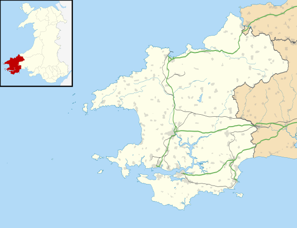
On the evening of 15 February 1996 the Sea Empress was entering the mouth of the Cleddau Estuary on her way into Milford Haven in Pembrokeshire to deposit its oil cargo at the Texaco oil refinery. Sailing against the outgoing tide, at 20:07 UTC the ship was pushed off its course by the current, and hit rocks in the middle of the channel, which punctured her starboard hull causing oil to pour out into the bay.[2][3]
Short-term effects
Over the first few days of the disaster an estimated 73,000 tonnes out of the ship's 130,000 tonne cargo of North Sea crude oil was spilt, most of which spread along either the shoreline of Milford Haven waterway or the coastline to the south. This caused an enormous amount of environmental and aesthetic damage to the coastline and its marine life in an area which lies within the protection of the Pembrokeshire Coast National Park.
Birds
The most visible effect of the spill was seen in the large number of birds covered in oil that were shown on television and in newspapers.[4] Amongst the birds affected were guillemots, razorbills and the worst affected bird, the common scoter duck. 83% of the birds affected were common scoter birds, and it is estimated that 5,000 of the 15,000 population in the area were killed.[5][6] The RSPB set up a temporary bird hospital in Milford Haven to try to treat as many birds as possible. This centre is now a storage area but in the aftermath of the Sea Empress disaster it became a hive of activity where many birds were showered and cleaned as best as possible. Unfortunately the life expectancy of a cleaned Guillemot or Razorbill that was oiled once it was let back into the sea was a very short 9 days. Members of the public also helped rescue the birds.[4] It was later revealed in a study by the British Trust for Ornithology that the average survival time for a rescued oiled Auk (Razorbill or Guillemot) was seven days.[6]
Seals
Although the Sea Empress ran aground near to a breeding area for the grey seal, the time of year meant that only a minority of seals were in the area. Although some seals showed signs of oil on their coats, there is no record of a seal dying as a result of the spill.
Beaches
201 kilometers of coastline were covered in crude oil.[6]
The total cost of the cleanup operation was approximately £60 million[7][8]
It took almost five years for the coastline to be fully cleaned up and restored by the Pembrokeshire Council, Texaco workers and subcontractors, and wildlife conservationists. There was much speculation in the media at the time over the inherent lack of safety of single hull tankers and accordingly, their fate, particularly in view of the MV Braer disaster in Scotland just three years earlier, the Braer being a single hull vessel.
Fate of the Sea Empress
The Sea Empress was recovered and subsequently re-christened MV Sea Spirit. Later renamed MV Front Spirit, it was sold as MV Ocean Opal to Chinese buyers who used it as a floating storage and offloading unit (FSO) from 2004.[9] In 2009/2010, she was converted in Shanghai into a bulk carrier, and reflagged as the Panamanian registered MV Welwind.[10][11] In 2012, she was renamed for a fifth time and became known as Wind 3.
While being brought to Chittagong for dismantling in the Shitakunda ship breaking yard, as MV Wind 3, the tanker developed a crack in one side of its engine room. This resulted from a collision with a sunken ship, Hang Ro Bong, in the afternoon of 3 June 2012, when it was attempting to anchor at the B (Bravo) anchorage of the port.[12][13] As at April 2016 she is listed as "Not Under Command" and "Decommissioned or Lost".[14]
See also
References
- ↑ "The Sea Empress oil spill" (PDF). Parliamentary office of Science and Technology. February 1996. Retrieved 16 August 2010.
- ↑ Tugs raced to the rescue, but she became detached several more times from them, and was also hit hard by a storm, whilst still stranded. This pushed her back onto the rocks several times and more oil continued to leak, now at a faster rate. In the end she lost 72,000 tons of crude oil. BBC News: Sea Empress - The first few minutes...
- ↑ BBC News Summary: Disaster strikes... The ship's cargo of 130,000 tonnes of crude North Sea oil started to spill into the sea.
- 1 2 Swansea University: Sea Empress Oil Spill - Birds
- ↑ Countryside Council for Wales: Sea Empress Report Archived August 24, 2004, at the Wayback Machine.
- 1 2 3 BBC News: Assessing the oil spill impact
- ↑ BBC Wales On Air:Sea Empress Archived September 24, 2010, at the Wayback Machine.
- ↑ BBC: In detail: The Sea Empress disaster Page 7- Counting the cost
- ↑ "Sea Empress 'could happen again'". BBC News. 2006-02-15. Retrieved 2009-12-03.
- ↑ "Page for 'Ocean Opal' at shipspotting.com". Retrieved 2015-08-20.
- ↑ "China Shipping Industry Co page for conversion of 'MV Welwind' from Tanker to Bulk". Archived from the original on 2016-01-14. Retrieved 2015-08-20.
- ↑ "CPA to remove damaged vessel". The Daily Star (Dhaka). 9 June 2012. Retrieved 11 May 2015.
- ↑ "Court action follows tanker's second accident". Pembrokeshire Herald. May 28, 2015. Retrieved 19 August 2015.
- ↑ Entry for WIND_3 at marinetraffic.com
External links
- MAIB - Report of the Chief Inspector of Marine Accidents into the grounding and subsequent salvage of the tanker SEA EMPRESS
- The Sea Empress: A Diary Of Events pembrokeshiretv.com
- BBC News: 10 years on
| Shipwrecks |
|
|---|---|
| Other incidents |
|
1995 | |
Coordinates: 51°40′42″N 5°09′46″W / 51.67833°N 5.16278°W