M5 motorway (Northern Ireland)
| |
|---|---|
.png) | |
| Route information | |
| Length: | 1.4 mi (2.3 km) |
| Existed: | 1980 – present |
| Major junctions | |
| South end: | Whitewell – M2 |
|
M2 motorway | |
| North end: | Hazelbank – A2 |
| Location | |
| Primary destinations: | Newtownabbey |
| Road network | |

The M5 is a spur motorway of 1.4 miles (2.3 km) length in north Belfast, Northern Ireland. It connects the M2 to the A2 Shore Road at Hazelbank in Newtownabbey. It is a dual two lane road with most of the road on a causeway in Belfast Lough in order to bypass Whitehouse beach.
History & future development
Originally announced in 1964 and planned to follow the route of the B90 to Carrickfergus,[1] the M5 would have also joined the planned M6 motorway.[2] The scale of the scheme was reduced to its present form in the 1969 transport review,[3] but it was recommended that the line of the originally planned route should be protected from development. Opening to traffic on 12 September 1980,[4] the M5 was the only one of Northern Ireland's original motorway schemes to proceed after the cancellation of all the existing motorway plans in 1975 following the deterioration of civil order (the M3 which opened in 1995 had the same number as an original plan, but was a different project).
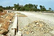
Culverts were added to ensure that what became Whitehouse Lagoon remained tidal, however these have not worked and the beach has become mud and sludge since the motorway opened. In 2008 the Northern Ireland Executive approved a plan to dual the road from the University of Ulster campus at Jordanstown as far as Carrickfergus, involving the compulsory purchase of twelve houses, a commercial unit and parts of 68 gardens. The dualling will be completed in 2013, and will leave only a two-mile section from Whitehouse through Whiteabbey as single lane road.[5]
Junctions
| M5 motorway | ||
| Northbound exits | Junction | Southbound exits |
| End of motorway M2 motorway continues Belfast City Centre M2 |
M2, J2 | Start of motorway |
| Start of motorway | J1 | End of motorway Whiteabbey, Carrickfergus Belfast (Shore Road) A2 |
See also
References
External links
- CBRD Motorway Database – M5 (Northern Ireland)
- Northern Ireland Roads Site – M5
- The Motorway Archive – M5 (Northern Ireland)
| Motorways |  | |
|---|---|---|
| Main 'A' roads | ||
| Main 'B' roads | ||
| Others | ||
| Great Britain | .svg.png) | |||||||
|---|---|---|---|---|---|---|---|---|
| Northern Ireland | ||||||||
| Former | ||||||||
| Unbuilt | ||||||||
| Proposed | ||||||||
| Related articles | ||||||||
| ||||||||