M56 motorway
| |
|---|---|
_map.svg.png) | |
|
Near Chester Services | |
| Route information | |
|
Part of | |
| Length: | 33.3 mi (53.6 km) |
| Existed: | 1971 – present |
| History: | Constructed 1971–1981 |
| Major junctions | |
| East end: | Cheadle |
|
J1 → M60 motorway Junction 4 J9 → M6 motorway Junction 20 J15 → M53 motorway Junction 11 | |
| West end: | Mollington |
| Location | |
| Primary destinations: | Manchester, Wythenshawe, Manchester Airport, Warrington, Runcorn, Ellesmere Port, Chester |
| Road network | |

The M56 motorway, also known as the North Cheshire motorway, is in Cheshire and Greater Manchester, England. It runs from junction 4 of the M60 to Dunkirk, Cheshire and is 33.3 miles (53.6 km) in length. It is often busy with long-distance commuter traffic towards North Wales. It serves commuters heading to Manchester particularly those from the wider Cheshire area and gives access to Manchester Airport from the national motorway network.[1]
The road forms part of the unsigned Euroroute E22.
Route
Although the main line of the motorway starts as a continuation of the A5103 Princess Parkway, the M56 begins on Sharston Spur (also known as the Sharston Bypass) where it detaches from the M60 motorway. After passing through junctions 1 and 2, the spur joins the main line at junction 3, increasing from two lanes to four to accommodate Manchester Airport traffic.
The road then heads south to the west of Wythenshawe and Manchester Airport until it reaches junction 6, where it turns west. It runs to the south of Hale, reducing to three lanes. It passes junctions 7 and 8 which are part of the same complex. Junction 8 was planned to be used by the proposed A556(M)[2]). The current proposals are to upgrade the A556 to a dual carriageway.[3] Traffic for the southbound M6 leaves here and this junction can suffer from congestion. The motorway then enters a more rural setting between Broomedge and High Legh.
After meeting the M6 motorway it passes south of Appleton Thorn. After reaching junction 11, it runs through the outskirts of Runcorn and Frodsham. Between junctions 12 and 14, and the missing junction 13, it runs parallel to the River Mersey and the Manchester Ship Canal. After meeting the M53 motorway, the road finally returns to two lanes, it proceeds between Chester to the south and Ellesmere Port to its termination at Dunkirk, Cheshire where it becomes the A494.
Traffic for North Wales can take either the M53 or A494 to reach the A55.
Motorway Services on the M56 are Chester (Run by Roadchef) and Lymm (Run by Moto, also accessible from M6)
History
The first proposal for a road along this route was agreed in 1958 and it entered the Trunk Road Programme for 1967/1968.[4] Construction began in 1968[5] and the motorway opened in stages between 1971 and 1981:[6]
- Junctions 1 to 3 opened in 1975.
- Junctions 3 to 7 opened in 1972.
- Junctions 7 to 9 opened in 1974.
- Junctions 9 to 11 opened in 1975.
- Junctions 11 to 14 opened in 1971.
- Junctions 14 to 16 opened in 1981.
Proposals existed for an extension into North Wales across the proposed Dee Barrage,[7] but these have not happened.[8]
Until 2008 the M56 terminated at a roundabout at the west end. Work started in 2006[9] to grade-separate this junction (and others) to allow free-flowing traffic to North Wales. The project was completed in 2008.
Junctions
Data[10] from driver location signs are used to provide distance information.
| M56 motorway junctions | ||||
| mile | km | Eastbound exits (B Carriageway) | Junction | Westbound exits (A Carriageway) |
| Stockport M60 Leeds (M62) |
M60, J4 | Start of motorway (Sharston Spur) | ||
| Didsbury A34 | J1 | No access (on-slip only) | ||
| No access (on-slip only) | J2 | Wythenshawe, Altrincham A560 (M60) | ||
| Altrincham, Wythenshawe, Wythenshawe Hospital, Cheadle A560 | J3a | Start of motorway (Princess Parkway spur) | ||
| Altrincham, Congleton, Wythenshawe A5103 Manchester Ring Road (M60) |
J3 | No access (on-slip only) | ||
| 7.2 | 11.6 | No access (on-slip only) | J4 | Wythenshawe |
| 7.8 | 12.6 | Manchester |
J5 | Manchester |
| 8.9 | 14.3 | Hale, Wilmslow, Macclesfield A538 | J6 | Wilmslow, Hale, Macclesfield A538 |
| 12.4 | 19.9 | Altrincham A56 | J7/8 | Northwich A556 Lymm A56 Birmingham (M6) |
| 17.6 | 28.3 | Preston, Birmingham, Leeds (M62) M6 | J9 | Preston, Liverpool (M62) M6 |
| 20.8 | 33.4 | Warrington, Northwich A49 | J10 | Northwich, Warrington A49 |
| 23.8 | 38.3 | Runcorn (E), Warrington A56 | J11 | Preston Brook, Daresbury A56 |
| 26.8 | 43.1 | Runcorn, Widnes, Northwich A557 | J12 | Frodsham, Runcorn, Widnes A557 |
| 31.9 | 51.4 | Stanlow Refinery, Helsby A5117 Chester services |
J14 Services |
Stanlow Refinery, Helsby A5117 Chester services |
| 34.5 | 55.6 | No access (on-slip only) | J15 | Ellesmere Port, Birkenhead, Chester, Wrexham M53 |
| Start of motorway | J16 | Hoylake, Chester A540 | ||
| North Wales, Queensferry A5117 Non-motorway traffic |
Road continues as A494 towards North Wales | |||
Junction 7 slip closures
At junction 7 in July 2009, the slip road letting traffic come in southbound along the M56 and turn onto the A556 southbound was closed while the bridge where it crosses the M56 (the Bowdon View Bridge), which for many years had had a weight restriction, was worked on; traffic intending to use it had to carry on to junction 10 and there turn round, or go through the centre of Altrincham; traffic for the nearby Tatton Park Flower Show, and the resulting closure to through traffic of the minor road along the southwest edge of Tatton Park from Ashley, Cheshire to Mere, Cheshire (which would otherwise have acted as a bypass for people living in the area), added to the resulting congestion.
In October and November 2010, the bridge was demolished and replaced.[11] [12] [13] [14]
Thorley Lane bridge replacement
On Saturday 28 February and Sunday 1 March 2015, the new concrete girders of the Thorley Lane bridge a little north of Manchester Airport were put in. (The old bridge was demolished because it was found to be cracking.) The M56 was closed over that weekend for this. This caused much traffic congestion from M56 traffic diverted through Altrincham and Wythenshawe and along Styal Road and Kingsway, starting on Thursday 26 March because of work putting cones on the carriageway.
Upgrades
The Government announced in August 2015 that the motorway would be upgraded to a smart motorway as part of the Northern Powerhouse strategy.
There will also be a new junction between the existing Junctions 11 and 12 to relieve heavy congestion on this stretch and serve the new Mersey Gateway bridge.[15][16]
M56 corridor
"The M56 corridor" is a term used by estate agents and social geographers to describe what is considered to be a relatively affluent area of North West England, within easy reach of the M56. The area includes the cities of Manchester and Chester, and commuter towns and villages in rural Cheshire. It also includes Warrington and St Helens where the chemical and pharmaceutical industries are prominent.[17]
See also
References
- ↑ "Motorway Database » M56". CBRD. Retrieved 1 January 2012.
- ↑ Steven Jukes. "Pathetic Motorways - A556(M)". Pathetic.org.uk. Retrieved 1 January 2012.
- ↑ "Highways Agency Press Release". Highways.gov.uk. Retrieved 1 January 2012.
- ↑ "The Motorway Archive - M56 Scheme Introduction". Iht.org. Retrieved 1 January 2012.
- ↑ "The Motorway Archive - M56 Dates Page". Iht.org. Retrieved 1 January 2012.
- ↑ CBRD Motorway Database - M56 Timeline
- ↑ "The Motorway Archive - M56 J16 to J14". Iht.org. Retrieved 1 January 2012.
- ↑ Department of the Official Report (Hansard), House of Commons, Westminster. "House of Commons Hansard Debates for 23 July 1993 - Column 403". Publications.parliament.uk. Retrieved 1 January 2012.
- ↑ "Highways Agency - A5117 / A550 Deeside Park Junctions Improvement". Highways.gov.uk. Retrieved 1 January 2012.
- ↑ Driver Location Signs, Highway Agency Area 10 (map) - Highway Authority, 2009
- ↑ "Bridge repair work on M56 extended to three weekends". BBC News. 18 October 2010. Retrieved 18 October 2010.
- ↑ "M56 Bowdon View Bridge successfully demolished". Fidgetwith.com. 18 October 2010. Retrieved 1 January 2012.
- ↑ "M56 Junction 7 Bowdon View Bridge Replacement and Junction Improvement". Highways.gov.uk. 4 July 2011. Retrieved 1 January 2012.
- ↑ "M56 bridge repair works continue near Bowdon". BBC News. 23 October 2010.
- ↑ http://www.chesterchronicle.co.uk/news/chester-cheshire-news/m56-smart-motorway-hapsford-runcorn-9833410
- ↑ https://www.gov.uk/government/uploads/system/uploads/attachment_data/file/427339/the-northern-powerhouse-tagged.pdf
- ↑ "M56 corridor dated 2008-09-17". Property Week article. 19 April 2002. Retrieved 1 January 2012.
External links
| Great Britain | .svg.png) | |||||||
|---|---|---|---|---|---|---|---|---|
| Northern Ireland | ||||||||
| Former | ||||||||
| Unbuilt | ||||||||
| Proposed | ||||||||
| Related articles | ||||||||
| ||||||||
Transport in Greater Manchester | |||||||||||
|---|---|---|---|---|---|---|---|---|---|---|---|
| Air | 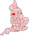 | ||||||||||
| Bus |
| ||||||||||
| Road | |||||||||||
| Tram | |||||||||||
| Cycle | |||||||||||
| Rail |
| ||||||||||
| TIF bid | |||||||||||
See also: Transport in Manchester | |||||||||||