M2 (Istanbul Metro)
| M2 Yenikapı – Hacıosman | ||||||||||||||||||||||||||||||||||||||||||||||||||||||||||||||||||||||||||||||||||||||||||||||||||||||||||||||||||||||||||||||||||||||||
|---|---|---|---|---|---|---|---|---|---|---|---|---|---|---|---|---|---|---|---|---|---|---|---|---|---|---|---|---|---|---|---|---|---|---|---|---|---|---|---|---|---|---|---|---|---|---|---|---|---|---|---|---|---|---|---|---|---|---|---|---|---|---|---|---|---|---|---|---|---|---|---|---|---|---|---|---|---|---|---|---|---|---|---|---|---|---|---|---|---|---|---|---|---|---|---|---|---|---|---|---|---|---|---|---|---|---|---|---|---|---|---|---|---|---|---|---|---|---|---|---|---|---|---|---|---|---|---|---|---|---|---|---|---|---|---|---|
|
| ||||||||||||||||||||||||||||||||||||||||||||||||||||||||||||||||||||||||||||||||||||||||||||||||||||||||||||||||||||||||||||||||||||||||
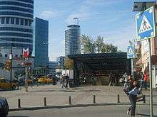
 A northbound train at the Levent station | ||||||||||||||||||||||||||||||||||||||||||||||||||||||||||||||||||||||||||||||||||||||||||||||||||||||||||||||||||||||||||||||||||||||||
| Overview | ||||||||||||||||||||||||||||||||||||||||||||||||||||||||||||||||||||||||||||||||||||||||||||||||||||||||||||||||||||||||||||||||||||||||
| Type | Rapid transit | |||||||||||||||||||||||||||||||||||||||||||||||||||||||||||||||||||||||||||||||||||||||||||||||||||||||||||||||||||||||||||||||||||||||
| System | Istanbul Metro | |||||||||||||||||||||||||||||||||||||||||||||||||||||||||||||||||||||||||||||||||||||||||||||||||||||||||||||||||||||||||||||||||||||||
| Status | Operational | |||||||||||||||||||||||||||||||||||||||||||||||||||||||||||||||||||||||||||||||||||||||||||||||||||||||||||||||||||||||||||||||||||||||
| Locale | Istanbul, Turkey | |||||||||||||||||||||||||||||||||||||||||||||||||||||||||||||||||||||||||||||||||||||||||||||||||||||||||||||||||||||||||||||||||||||||
| Termini |
Yenikapı Hacıosman | |||||||||||||||||||||||||||||||||||||||||||||||||||||||||||||||||||||||||||||||||||||||||||||||||||||||||||||||||||||||||||||||||||||||
| Stations | 16 | |||||||||||||||||||||||||||||||||||||||||||||||||||||||||||||||||||||||||||||||||||||||||||||||||||||||||||||||||||||||||||||||||||||||
| Services | 1 (Branch to Seyrantepe) | |||||||||||||||||||||||||||||||||||||||||||||||||||||||||||||||||||||||||||||||||||||||||||||||||||||||||||||||||||||||||||||||||||||||
| Daily ridership | 320,000[1] | |||||||||||||||||||||||||||||||||||||||||||||||||||||||||||||||||||||||||||||||||||||||||||||||||||||||||||||||||||||||||||||||||||||||
| Operation | ||||||||||||||||||||||||||||||||||||||||||||||||||||||||||||||||||||||||||||||||||||||||||||||||||||||||||||||||||||||||||||||||||||||||
| Opened | September 16, 2000 | |||||||||||||||||||||||||||||||||||||||||||||||||||||||||||||||||||||||||||||||||||||||||||||||||||||||||||||||||||||||||||||||||||||||
| Owner | Istanbul Metropolitan Municipality | |||||||||||||||||||||||||||||||||||||||||||||||||||||||||||||||||||||||||||||||||||||||||||||||||||||||||||||||||||||||||||||||||||||||
| Operator(s) | İstanbul Ulaşım A.Ş. | |||||||||||||||||||||||||||||||||||||||||||||||||||||||||||||||||||||||||||||||||||||||||||||||||||||||||||||||||||||||||||||||||||||||
| Depot(s) | Seyrantepe[2] | |||||||||||||||||||||||||||||||||||||||||||||||||||||||||||||||||||||||||||||||||||||||||||||||||||||||||||||||||||||||||||||||||||||||
| Rolling stock | 124 Hyundai Rotem[1] | |||||||||||||||||||||||||||||||||||||||||||||||||||||||||||||||||||||||||||||||||||||||||||||||||||||||||||||||||||||||||||||||||||||||
| Technical | ||||||||||||||||||||||||||||||||||||||||||||||||||||||||||||||||||||||||||||||||||||||||||||||||||||||||||||||||||||||||||||||||||||||||
| Line length | 23.5 km (14.6 mi) | |||||||||||||||||||||||||||||||||||||||||||||||||||||||||||||||||||||||||||||||||||||||||||||||||||||||||||||||||||||||||||||||||||||||
| Number of tracks | 2 | |||||||||||||||||||||||||||||||||||||||||||||||||||||||||||||||||||||||||||||||||||||||||||||||||||||||||||||||||||||||||||||||||||||||
| Track gauge | 1,435 mm (4 ft 8 1⁄2 in) standard gauge | |||||||||||||||||||||||||||||||||||||||||||||||||||||||||||||||||||||||||||||||||||||||||||||||||||||||||||||||||||||||||||||||||||||||
| Electrification | 750 V DC Third rail | |||||||||||||||||||||||||||||||||||||||||||||||||||||||||||||||||||||||||||||||||||||||||||||||||||||||||||||||||||||||||||||||||||||||
| Route number | M2, Shuttle | |||||||||||||||||||||||||||||||||||||||||||||||||||||||||||||||||||||||||||||||||||||||||||||||||||||||||||||||||||||||||||||||||||||||
| ||||||||||||||||||||||||||||||||||||||||||||||||||||||||||||||||||||||||||||||||||||||||||||||||||||||||||||||||||||||||||||||||||||||||
M2, officially referred to as the M2 Yenikapı – Hacıosman line (Turkish: M2 Yenikapı - Hacıosman metro hattı), is a 23.5-kilometre (14.6 mi), 16-station[1] rapid transit line of the Istanbul Metro. It is colored light green on the maps and route signs. The M2 operates between Hacıosman in southern Sarıyer to Yenikapı in south-central Fatih on the historic peninsula of Istanbul. Shuttle trains run from Sanayi to Seyrantepe to Türk Telekom Arena. The M2 line has a total length of 23.5 km (14.6 mi) and has a daily ridership of 320,000 making it the busiest and second longest line of the Istanbul Metro system. Only the M1 line has a longer route length.
History
Construction for a north-south metro line started on 19 August 1992 when the groundbreaking of the M2 took place. The original route was a wholly underground 7 km (4.3 mi) line between Taksim and 4. Levent. Construction of the tunnels took place in three separate areas; Taksim, Şişli and 4. Levent. These tunnels were connected to each other on 8 July 1994 and were completed on 30 April 1995. The line was completed in early 11 January 1999 and the first rolling stock were lowered into the tunnels. On 25 March 1999 the first test runs began and the line entered service on 16 September 2000 between Taksim and Levent. 4. Levent was opened one month later on 24 October 2000.
Timeline
The following are events in the timeline of the M2 service:[1]
- August 19, 1992: Construction of the M2 begins.
- June 12, 1994: Taksim - Şişli part is completed.
- July 8, 1994: Şişli - 4.Levent part is completed.
- April 30, 1995: The two tunnels are connected.
- January 11, 1999: The first trainsets are used for test runs.
- September 16, 2000: Taksim - 4.Levent portion is opened.
- January 31, 2009: Taksim - Şişhane and 4.Levent - Atatürk Oto Sanayi extensions are opened.
- September 2, 2010: A northern extension to Darüşşafaka is opened.
- November 11, 2010: The branch to Seyrantepe is opened.
- April 29, 2011: The northern extension to Hacıosman is opened.
- February 15, 2014: With the completion of the Golden Horn Metro Bridge, M2 line is fully in service from Yenikapı to Hacıosman.[3]
Route

The M2 starts at Hacıosman in southwestern Sarıyer. From there it travels under Büyükdere Avenue, a major north-south road in the city, through İstanbul's two major financial districts; Maslak and Levent. The line then heads slightly west just south of Levent through Şişli to historical Taksim Square. From there M2 heads through western Beyoğlu to Şişhane. It crosses the Golden Horn towards the Old City and terminates in Yenikapı, a transport hub connecting with M1 line and Marmaray.[3] (The Şehzadebaşı station on the map above was actually named Vezneciler when the extension south of Şişhane opened on Febr 15, 2014).
Stations
- Hacıosman
- Darüşşafaka
- Atatürk Oto Sanayi
- İTÜ-Ayazağa
- Sanayi Mahallesi
- 4. Levent
- Levent (transfer to: M6)
- Gayrettepe (transfer to: Metrobüs)
- Şişli-Mecidiyeköy (transfer to: Metrobüs, M7)
- Osmanbey
- Taksim (transfer to: T2, F1)
- Şişhane (transfer to: T2, F2)
- Golden Horn
- Vezneciler (transfer to: T1)
- Yenikapı (transfer to: M1A & M1B, Marmaray, İDO)
The route splits to form a short one-station spur line at the Sanayi Mahallesi station to the following station:
Rolling Stock
The M2 line in İstanbul uses both Hyundai Rotem and Alstom trains which operate with headways of 5 minutes on the line.
Future extension
A future extension southwest of Yenikapı is planned, with five new stations at Kocamustafapaşa, Silivrikapı, Veliefendi, Zeytinburnu and Bakırköy.
Gallery
|


See also
- Golden Horn Metro Bridge
- Istanbul modern tramways
- Istanbul nostalgic tramways
- Marmaray
- Public transport in Istanbul
References
| Wikimedia Commons has media related to Istanbul Metro line M2. |
- 1 2 3 4 "M2 Yenikapı - Hacıosman metro hattı" [M2 Yenikapı - Hacıosman metro line]. www.istanbululasim.com.tr (in Turkish). İstanbul Ulaşım. Retrieved 2015-10-04.
- ↑ "İstanbul Metrosu (Taksim-4. Levent-Ayazağa (Hacı Osman) Hattı)" (in Turkish). İstanbul Büyükşehir Belediyesi.
- 1 2 "Haliç, Yenikapıyı, Hacıosman'a bağladı". Hürriyet (in Turkish). 15 February 2014. Retrieved 2014-02-15.
External links
![]() Media related to Istanbul Metro line M2 at Wikimedia Commons
Media related to Istanbul Metro line M2 at Wikimedia Commons
 | ||
| | ||
Lines in italic are under construction with planned opening year in parentheses. | ||