Møllehøj
| Møllehøj | |
|---|---|
 Møllehøj seen from the tower on Ejer Bavnehøj, the highest point is obscured by the farm buildings | |
| Highest point | |
| Elevation | 170.86 m (560.6 ft) |
| Prominence | 161 m (528 ft) [1] |
| Listing | Country high point |
| Coordinates | 55°58′37.88″N 9°49′34.42″E / 55.9771889°N 9.8262278°ECoordinates: 55°58′37.88″N 9°49′34.42″E / 55.9771889°N 9.8262278°E |
| Geography | |
 Møllehøj Location of Møllehøj in Denmark | |
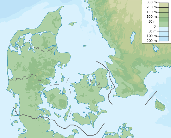
| Location | Skanderborg municipality, Denmark |
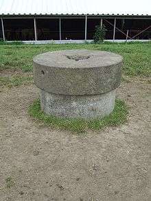
Møllehøj is the highest natural point[Note 1] in Denmark at 170.86 m (561 ft). It is in the Ejerbjerge hills in Skanderborg municipality, very close to Ejer Bavnehøj. The summit is marked with a millstone, a remnant of Ejer mill which was situated on the hill from 1838 to 1917. The mill had eight sides and had an onion-shaped roof.
New measurements made in February 2005 showed that Møllehøj was higher than both Yding Skovhøj (172.66 m including a Bronze Age burial mound on its summit, 170.77 m without) in Horsens municipality or Ejer Bavnehøj which had both been thought higher. These two high points' natural heights are however respectively 9 and 51 cm lower than Møllehøj. It was officially recognised as Denmark's highest point in 2005.
See also
- Himmelbjerget, which was thought to be the highest point of Denmark until 1847
Notes
- ↑ For comparison, the tallest man-made structure in Denmark is the Tommerup Transmitter, which stands 321m or 1045ft high.
References
- ↑ "Møllehøj, Denmark". Peakbagger.com. Retrieved 2014-08-02.