Lyambirsky District
| Lyambirsky District Лямбирский район (Russian) Лямбирьбуе (Erzya) Лямбирень аймак (Moksha) Ләмберә районы (Tatar) | |
|---|---|
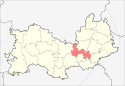 Location of Lyambirsky District in the Republic of Mordovia | |
| Coordinates: 54°17′N 45°08′E / 54.283°N 45.133°ECoordinates: 54°17′N 45°08′E / 54.283°N 45.133°E | |
| Location | |
| Country | Russia |
| Federal subject | Republic of Mordovia[1] |
| Administrative structure (as of June 2015) | |
| Administrative center | selo of Lyambir[2] |
| Administrative divisions:[2] | |
| Selsoviets | 16 |
| Inhabited localities:[2] | |
| Rural localities | 70 |
| Municipal structure (as of March 2010) | |
| Municipally incorporated as | Lyambirsky Municipal District[3] |
| Municipal divisions:[3] | |
| Urban settlements | 0 |
| Rural settlements | 16 |
| Statistics | |
| Area | 852 km2 (329 sq mi) |
| Population (2010 Census) | 34,142 inhabitants[4] |
| • Urban | 0% |
| • Rural | 100% |
| Density | 40.07/km2 (103.8/sq mi)[5] |
| Time zone | MSK (UTC+03:00)[6] |
| Official website | |
| Lyambirsky District on WikiCommons | |
| 2010 Census | 34,142[4] |
|---|---|
| 2002 Census | 33,872[7] |
| 1989 Census | 34,661[8] |
| 1979 Census | 30,139[9] |
Lyambirsky District (Russian: Ля́мбирский райо́н; Erzya: Лямбирьбуе; Moksha: Лямбирень аймак) is an administrative[1] and municipal[3] district (raion), one of the twenty-two in the Republic of Mordovia, Russia. It is located in the northern and central parts of the republic. The area of the district is 852 square kilometers (329 sq mi). Its administrative center is the rural locality (a selo) of Lyambir.[2] As of the 2010 Census, the total population of the district was 34,142, with the population of Lyambir accounting for 24.8 % of that number.[4]
Administrative and municipal status
Within the framework of administrative divisions, Lyambirsky District is one of the twenty-two in the republic.[1] The district is divided into sixteen selsoviets which comprise seventy rural localities.[2] As a municipal division, the district is incorporated as Lyambirsky Municipal District.[3] Its sixteen selsoviets are incorporated into sixteen rural settlements within the municipal district.[3] The selo of Lyambir serves as the administrative center of both the administrative[2] and municipal[3] district.
References
Notes
- 1 2 3 Constitution of the Republic of Mordovia, Article 63
- 1 2 3 4 5 6 Law #7-Z
- 1 2 3 4 5 6 Law #122-Z
- 1 2 3 Russian Federal State Statistics Service (2011). "Всероссийская перепись населения 2010 года. Том 1" [2010 All-Russian Population Census, vol. 1]. Всероссийская перепись населения 2010 года (2010 All-Russia Population Census) (in Russian). Federal State Statistics Service. Retrieved June 29, 2012.
- ↑ The value of density was calculated automatically by dividing the 2010 Census population by the area specified in the infobox. Please note that this value is only approximate as the area specified in the infobox does not necessarily correspond to the area of the entity proper or is reported for the same year as the population.
- ↑ Правительство Российской Федерации. Федеральный закон №107-ФЗ от 3 июня 2011 г. «Об исчислении времени», в ред. Федерального закона №271-ФЗ от 03 июля 2016 г. «О внесении изменений в Федеральный закон "Об исчислении времени"». Вступил в силу по истечении шестидесяти дней после дня официального опубликования (6 августа 2011 г.). Опубликован: "Российская газета", №120, 6 июня 2011 г. (Government of the Russian Federation. Federal Law #107-FZ of June 31, 2011 On Calculating Time, as amended by the Federal Law #271-FZ of July 03, 2016 On Amending Federal Law "On Calculating Time". Effective as of after sixty days following the day of the official publication.).
- ↑ Russian Federal State Statistics Service (May 21, 2004). "Численность населения России, субъектов Российской Федерации в составе федеральных округов, районов, городских поселений, сельских населённых пунктов – районных центров и сельских населённых пунктов с населением 3 тысячи и более человек" [Population of Russia, Its Federal Districts, Federal Subjects, Districts, Urban Localities, Rural Localities—Administrative Centers, and Rural Localities with Population of Over 3,000] (XLS). Всероссийская перепись населения 2002 года [All-Russia Population Census of 2002] (in Russian). Retrieved August 9, 2014.
- ↑ Demoscope Weekly (1989). "Всесоюзная перепись населения 1989 г. Численность наличного населения союзных и автономных республик, автономных областей и округов, краёв, областей, районов, городских поселений и сёл-райцентров" [All Union Population Census of 1989: Present Population of Union and Autonomous Republics, Autonomous Oblasts and Okrugs, Krais, Oblasts, Districts, Urban Settlements, and Villages Serving as District Administrative Centers]. Всесоюзная перепись населения 1989 года [All-Union Population Census of 1989] (in Russian). Институт демографии Национального исследовательского университета: Высшая школа экономики [Institute of Demography at the National Research University: Higher School of Economics]. Retrieved August 9, 2014.
- ↑ "Всесоюзная перепись населения 1979 г. Национальный состав населения по регионам России. (All Union Population Census of 1979. Ethnic composition of the population by regions of Russia.)". Всесоюзная перепись населения 1979 года (All-Union Population Census of 1979) (in Russian). Demoscope Weekly (website of the Institute of Demographics of the State University—Higher School of Economics. 1979. Retrieved 2008-11-25.
Sources
- Конституционное собрание Республики Мордовия. 21 сентября 1995 г. «Конституция Республики Мордовия (текст в ред. от 15 марта 2011 г.)», в ред. Закона №62-З от 3 сентября 2015 г. «О внесении изменений в статьи 71 и 94 Конституции Республики Мордовия». Вступил в силу 22 сентября 1995 г. Опубликован: "Известия Мордовии", №180, 22 сентября 1995 г. (Constitutional Assembly of the Republic of Mordovia. September 21, 1995 Constitution of the Republic of Mordovia (text of rev. of March 15, 2011), as amended by the Law #62-Z of September 3, 2015 On Amending Articles 71 and 94 of the Constitution of the Republic of Mordovia. Effective as of September 22, 1995.).
- Государственное Собрание Республики Мордовия. Закон №7-З от 23 марта 1998 г. «О порядке решения вопросов административно-территориального устройства Республики Мордовия», в ред. Закона №44-З от 15 июня 2015 г. «О внесении изменений в пункт 25 Приложения к Закону Республики Мордовия "О порядке решения вопросов административно-территориального устройства Республики Мордовия"». Вступил в силу со дня официального опубликования. Опубликован: "Известия Мордовии", №54, 25 марта 1998 г. (State Assembly of the Republic of Mordovia. Law #7-Z of March 23, 1998 On the Procedures of the Administrative-Territorial Structure of the Republic of Mordovia, as amended by the Law #44-Z of June 15, 2015 On Amending Item 25 of the Appendix to the Law of the Republic of Mordovia "On the Procedures of the Administrative-Territorial Structure of the Republic of Mordovia". Effective as of the official publication date.).
- Государственное Собрание Республики Мордовия. Закон №122-З от 28 декабря 2004 г. «Об установлении границ муниципальных образований Лямбирского муниципального района, Лямбирского муниципального района и наделении их статусом сельского поселения и муниципального района», в ред. Закона №27-З от 12 марта 2010 г. «О внесении изменений в отдельные законодательные акты Республики Мордовия, устанавливающие границы муниципальных образований». Вступил в силу с 1 января 2005 г. Опубликован: "Известия Мордовии", №198-22, 30 декабря 2004 г. (State Assembly of the Republic of Mordovia. Law #122-Z of December 28, 2004 On Establishing the Borders of the Municipal Formations of Lyambirsky Municipal District, of Lyambirsky Municipal District, and on Granting Them the Status of a Rural Settlement and Municipal District, as amended by the Law #27-Z of March 12, 2010 On Amending Various Legislative Acts of the Republic of Mordovia, Which Establish the Borders of the Municipal Formations. Effective as of January 1, 2005.).
| Administrative districts | |||
|---|---|---|---|
| Cities and towns | |||
| Urban-type settlements | |||