Luster, Norway
| Luster kommune | |||
|---|---|---|---|
| Municipality | |||
 | |||
| |||
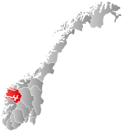
 Luster within Sogn og Fjordane | |||
| Coordinates: 61°29′38″N 07°19′46″E / 61.49389°N 7.32944°ECoordinates: 61°29′38″N 07°19′46″E / 61.49389°N 7.32944°E | |||
| Country | Norway | ||
| County | Sogn og Fjordane | ||
| District | Sogn | ||
| Administrative centre | Gaupne | ||
| Government | |||
| • Mayor (2011) | Ivar Kvalen (Sp) | ||
| Area | |||
| • Total | 2,706.43 km2 (1,044.96 sq mi) | ||
| • Land | 2,600.91 km2 (1,004.22 sq mi) | ||
| • Water | 105.52 km2 (40.74 sq mi) | ||
| Area rank | 15 in Norway | ||
| Population (2014) | |||
| • Total | 5,089 | ||
| • Rank | 197 in Norway | ||
| • Density | 2.0/km2 (5/sq mi) | ||
| • Change (10 years) | 3.3 % | ||
| Demonym(s) | Lustring[1] | ||
| Time zone | CET (UTC+1) | ||
| • Summer (DST) | CEST (UTC+2) | ||
| ISO 3166 code | NO-1426 | ||
| Official language form | Nynorsk | ||
| Website |
www | ||
|
| |||

Luster is a municipality in Sogn og Fjordane county, Norway. It is located at the end of the Sognefjorden in the traditional district of Sogn. The administrative centre is the village of Gaupne. Other villages in Luster include Fortun, Hafslo, Indre Hafslo, Jostedal, Luster, Nes, Ornes, Skjolden, Solvorn, and Veitastrond.
Luster centers on the inner branch of the Sognefjord, which is called the Lustrafjorden. At 2,706-square-kilometre (1,045 sq mi), Luster is one of the largest municipalities by area in all of southern Norway. Its landscape includes fjords, steep mountains, water-abundant waterfalls, blue glaciers, and valleys. Both Jostedalsbreen National Park and Breheimen National Park are partially located in this municipality. The Sognefjellsvegen road goes over a mountain pass in eastern Luster.
General information


Lyster was established as a municipality on 1 January 1838 (see formannskapsdistrikt). The original municipality was identical to the Lyster parish (prestegjeld) with the sub-parishes (sokn) of Fortun, Dale, Nes, and Gaupne. On 1 January 1963, the neighboring municipalities of Hafslo and Jostedal were merged with Luster, forming a much larger municipality. After the merger, Luster had 5,854 residents.[2]
Since the consolidation of the three municipalities of Hafslo, Jostedal and Luster in 1963, the area has been characterized by scattered rural settlements and large distances between these settlements. Luster is the largest municipality in Sogn og Fjordane county.[3]
Name
The name (Old Norse Lústr) originally belonged to the fjord (now Lustrafjorden). The name is derived from the word ljóss which means "light" or "bright" - referring to the bright color of the water from the glaciers. Prior to 1918, the name was written Lyster.[4]
Coat of arms
The coat of arms are relatively new; they were granted on 20 April 1990. They show a silver-colored rounded tilia twig on a blue background. Although they are newly designed, they are inspired by an old woodcarving found in the Urnes Stave Church which is located in Luster.[5]
Churches
The Church of Norway has eight parishes (sokn) within the municipality of Luster. It is part of the Indre Sogn deanery in the Diocese of Bjørgvin.[3][6]
| Parish (Sokn) | Church Name | Location of the Church | Year Built |
|---|---|---|---|
| Dale | Dale Church | Luster | 1250 |
| Fet og Joranger | Fet Church | Fet | 1894 |
| Joranger Church | Joranger | 1660 | |
| Fortun | Fortun Church | Fortun | 1879 |
| Gaupne | Gaupne Church | Gaupne | 1908 |
| Old Gaupne Church | 1647 | ||
| Hafslo | Hafslo Church | Hafslo | 1878 |
| Veitastrond Chapel | Veitastrond | 1928 | |
| Jostedal | Jostedal Church | Jostedal | 1660 |
| Nes | Nes Church | Nes | 1909 |
| Solvorn | Solvorn Church | Solvorn | 1883 |
| Urnes Stave Church | Ornes | 1130 |
Government

All municipalities in Norway, including Luster, are responsible for primary education (through 10th grade), outpatient health services, senior citizen services, unemployment and other social services, zoning, economic development, and municipal roads. The municipality is governed by a municipal council of elected representatives, which in turn elect a mayor.
Municipal council
The municipal council (Kommunestyre) of Luster is made up of 25 representatives that are elected to every four years. For 2011–2015, the party breakdown is as follows:[7]
| Party Name | Name in Norwegian | Number of representatives | |
|---|---|---|---|
| Labour Party | Arbeiderpartiet | 8 | |
| Progress Party | Framstegspartiet | 3 | |
| Conservative Party | Høgre | 3 | |
| Christian Democratic Party | Kristelig Folkeparti | 2 | |
| Centre Party | Senterpartiet | 7 | |
| Liberal Party | Venstre | 2 | |
| Total number of members: | 25 | ||
Mayor
The mayor (ordførar) of a municipality in Norway is usually a representative of the majority party of the municipal council who is elected to lead the council. Ivar Kvalen of the Centre Party was elected mayor for the 2011-2015 term.
Geography


Location
Luster, one of the largest municipalities in southern Norway, is located in the glacial mountains where the Sognefjorden begins its path to the North Sea. The fjord is fed by many large glaciers such as the Harbardsbreen, Holåbreen, Jostedalsbreen, Nigardsbreen, Spørteggbreen, and others.[8]
It is bordered by four municipalities in Sogn og Fjordane county: Stryn to the north, Jølster to the west, Sogndal to the southwest, and Årdal to the southeast. It is also bordered by three municipalities in Oppland county: Skjåk to the northeast and by Lom and Vang to the east.
Mountains
The Hurrungane, Breheimen, and Jotunheimen mountains cover parts of the municipality. Store Skagastølstind (or Storen) is the third highest mountain peak in Norway at 2,405 metres (7,890 ft) high, and it is located on the southern border of Luster and Årdal. It is part of the Hurrungane mountain range which contains some of the most alpine peaks in Norway.
| Mountain | Height | Mountain | Height |
|---|---|---|---|
| Store Skagastølstind | 2,405 m (7,890 ft) | Store Dyrhaugstind | 2,147 m (7,044 ft) |
| Store Styggedalstinden | 2,387 m (7,831 ft) | Mjølkedalstind | 2,137 m (7,011 ft) |
| Jervvasstind | 2,351 m (7,713 ft) | Store Ringstind | 2,124 m (6,969 ft) |
| Sentraltind | 2,351 m (7,713 ft) | Tverrådalskyrkja | 2,088 m (6,850 ft) |
| Vetle Skagastølstind | 2,340 m (7,680 ft) | Lodalskåpa | 2,083 m (6,834 ft) |
| Midtre Skagastølstind | 2,284 m (7,493 ft) | Store Soleiebotntind | 2,083 m (6,834 ft) |
| Store Austanbotntind | 2,203 m (7,228 ft) | Søre Dyrhaugstind | 2,072 m (6,798 ft) |
| Store Raudalseggi | 2,168 m (7,113 ft) | Fannaråken | 2,068 m (6,785 ft) |
| Store Raudalstind | 2,157 m (7,077 ft) | Stetind i Jotunheimen | 2,020 m (6,630 ft) |
| Uranostind | 2,157 m (7,077 ft) | Brenibba | 2,018 m (6,621 ft) |
Lakes and Rivers
There are notable lakes such as Veitastrondsvatnet, Austdalsvatnet, Styggevatnet, Tunsbergdalvatnet, Prestesteinsvatnet, and Hafslovatnet. There are also many big waterfalls such as the Feigumfoss waterfall at 218 metres (715 ft) tall. The river Jostedøla runs through the Jostedal valley and empties into the fjord at Gaupne.

Glaciers
The Jostedalsbreen glacier (including the arm called Nigardsbreen) is the biggest glacier in continental Europe, the highest point on it is Høgste Breakulen. It is located west of Jostedal, north of Gaupne, in Jostedalsbreen National Park, much of which is located in the municipality of Luster.[9] Other glaciers include the Austerdalsbreen, Harbardsbreen and Spørteggbreen.
Economy
The inhabitants of Luster make their living by farming, growing berries and fruit, tourism, and hydroelectricity. Jøstedal and Fortun have large hydroelectric power stations. Summer tourism is quite busy. Tourist activities include mountain climbing, skiing, fishing, hiking, and hunting.[9] The Sognefjellsvegen tourist road passes through Luster.
River fishing
Fishing permits (for salmon fishing) are sold for use on specific rivers, including Årøy-elva.[10]
Attractions
Feigumfoss waterfall
With a vertical drop of 218 metres (715 ft), the Feigumfoss Waterfall is one of the highest in Scandinavia.[9]
Historic churches

- Urnes Stave Church
Urnes Stave Church was built around 1150 and is Norway's oldest Stave church. The Church lies majestically on the top of Urnes. The Stave church is one of four Norwegian Churches on UNESCO`s list of the most precious cultural monuments in the world.
The Stave churches are constructions of high quality, richly decorated with carvings. In virtually all of them the door frames are decorated from top to bottom with carvings. This tradition of rich ornamentation appears to go back to the animal carvings of the Viking age. The dragons are lovingly executed and transformed into long-limbed creatures of fantasy, here and there entwined with tendrils of vine, with winding stems and serrated leaves. The elaborate designs are executed with supreme artistic skill. The stave church doorways are, therefore, among the most distinctive works of art to be found in Norway. However, it is difficult to connect them with the Christian gospel.[9]
- Old Gaupne Church
The Old Gaupne Church is a magnificent church that was built in 1647 on a hill directly opposite Gaupne centre.[9]
- Dale Church
Dale Church is a stone church that was built in gothic style in the year 1250.[9]
Breheim center
The Breheim Center contains a comprehensive exhibition. A journey through 20,000 years - from the Ice age to the present day, an audio/visual show takes visitors inside the glacier. Glacier boat M/S "Jostedalsrypa" crosses the Nigard Glacier Lake. There are internationally approved guides, glacier and climbing courses, and ski-trips.[9]
Notable inhabitants
- Peter J. Dale, a Wisconsin legislator is from Luster
- Christian Ellefson, a Wisconsin legislator (who succeeded Rep. Dale) is from Luster
Twin cities/towns
Photo gallery
 Lodalskåpa, a peak in the northeast part of Jostedalsbreen
 Feigumfossen
 Hafslovatnet lake with the Sognefjord in the background
 Lustrafjorden
 Sognefjell
 Skjolden at Lustrafjorden in Luster, Norway
 Several groups of people are glacier hiking on the glacier Nigardsbreen
References
- ↑ "Navn på steder og personer: Innbyggjarnamn" (in Norwegian). Språkrådet. Retrieved 2015-12-01.
- ↑ Jukvam, Dag (1999). "Historisk oversikt over endringer i kommune- og fylkesinndelingen" (PDF) (in Norwegian). Statistics Norway.
- 1 2 Natvik, Oddvar (9 February 2005). "Some historical data on the 26 Kommunes". Retrieved 23 June 2008.
- ↑ Rygh, Oluf (1919). Norske gaardnavne: Nordre Bergenhus amt (in Norwegian) (12 ed.). Kristiania, Norge: W. C. Fabritius & sønners bogtrikkeri. p. 8.
- ↑ "Civic heraldry of Norway - Norske Kommunevåpen". Heraldry of the World. Retrieved 2014-02-24.
- ↑ "Alle kirker og kirkegårder i Norge" (in Norwegian). 2008.
- ↑ "Members of the local councils, by party/electoral lists and municipality" (in Norwegian). Statistics Norway. 2011. Retrieved 2014-02-24.
- ↑ Wobig, Andreas (2008). "Luster, Sogn og Fjordane".
- 1 2 3 4 5 6 7 8 "Luster Kommune". GoNorway.no. 2008. Retrieved 24 June 2008.
- ↑ "Laksefiske for alle". Aftenposten. 2014-07-19. p. 11.
- ↑ "Local History of Luster". 2008.
External links
| Wikimedia Commons has media related to Luster, Norway. |
- Luster Municipality Website (Norwegian)
- Urnes Stave Church