Luperón, Dominican Republic
| Luperón | |
|---|---|
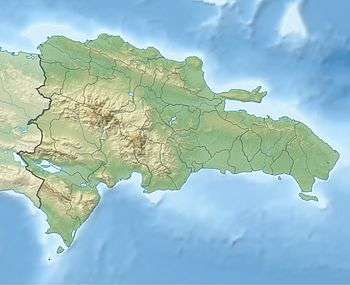 Luperón Luperón in the Dominican Republic | |
| Coordinates: 19°54′0″N 70°57′0″W / 19.90000°N 70.95000°WCoordinates: 19°54′0″N 70°57′0″W / 19.90000°N 70.95000°W | |
| Country |
|
| Province | Puerto Plata |
| Area[1] | |
| • Total | 272.07 km2 (105.05 sq mi) |
| Population (2012)[2] | |
| • Total | 20,259 |
| • Density | 74/km2 (190/sq mi) |
| Municipal Districts |
3 |
| Climate | As |
Luperón is a town in the Puerto Plata province of the Dominican Republic. It lies in the north of the country and is a small tourist center with one all-inclusive hotel and a coastal bay.
The town was formerly known as Blanco (White) or Pueblo Blanco (White Town), possibly after the many Spaniards who came to trade timber. Due to its shape and location, Luperon bay is ideal for sheltering from hurricanes, and many boats anchor there during the hurricane season.
Although there is no record of early inhabitants, it is said that Christopher Columbus had to enter the bay to protect his ships from a storm. Columbus named it "Bahia de Gracias" (Thanksgiving Bay), the current official name.
The current mayor is Danilo Morrobel of the Dominican Liberation Party (PLD in Spanish), who after a few failed attempts finally beat Mario Martinez of the PRD party to become the local mayor.
The slain dictator Rafael Leonidas Trujillo had plans to elevate Luperon to the status of province but was killed a few months before he was due to do it.
Three of the better-known families are the Morrobel, Cueto and Villamán families. They were the pioneers of this town, and their numbers continue to grow. Luperón's beaches have made it well known as a prime vacation location. In recent years, a sizeable population of Luperonians have moved abroad (most notably to Spain), often maintaining their same careers by working within the resort and catering industries.
The bay contains extensive mangroves, unique to Hispaniola, and is an ecological habitat for many species.
Unlike most of the towns in the northern part of the island, also known as Cibao, Luperon does not have a big cockfighting fan base. The sport is legal in the Dominican Republic and followed by thousands in the country. It has an arena where, every Friday afternoon, the cockfights take place. Money is made out of bets and the entrance fee. The sport though is not as big in Luperón as in the other towns in the Puerto Plata province.
Every year the town holds a heavily attended softball tournament. This takes place every Saturday and Sunday at the local field. Games are played only during the daytime as the field lacks electric lights. The Williams family is noted for baseball expertise in Luperón.
Basketball is also popular, with a basketball tournament being held every summer. The tournament consists of local players, Luperón-born players and a few players from other municipalities, although there can only be two non-local players per team. Unlike softball, the basketball games are played at night, also during the weekends and the attendees are charged a small fee to enter.
Climate
Luperón has a tropical savanna climate with a pronounced dry season in summer and a wet season in winter (Köppen climate classification: As).[3]
| Month | Jan | Feb | Mar | Apr | May | Jun | Jul | Aug | Sep | Oct | Nov | Dec | Year |
|---|---|---|---|---|---|---|---|---|---|---|---|---|---|
| Record high °C (°F) | 33.0 (91.4) |
34.5 (94.1) |
35.0 (95) |
36.0 (96.8) |
36.4 (97.5) |
36.5 (97.7) |
37.0 (98.6) |
36.0 (96.8) |
36.4 (97.5) |
36.8 (98.2) |
35.8 (96.4) |
33.5 (92.3) |
37.0 (98.6) |
| Average high °C (°F) | 28.9 (84) |
29.3 (84.7) |
30.0 (86) |
30.7 (87.3) |
32.0 (89.6) |
33.3 (91.9) |
33.2 (91.8) |
33.1 (91.6) |
33.2 (91.8) |
32.6 (90.7) |
30.5 (86.9) |
29.1 (84.4) |
31.3 (88.3) |
| Average low °C (°F) | 18.3 (64.9) |
18.2 (64.8) |
18.7 (65.7) |
19.6 (67.3) |
20.8 (69.4) |
21.5 (70.7) |
21.7 (71.1) |
21.7 (71.1) |
21.3 (70.3) |
21.0 (69.8) |
20.0 (68) |
18.7 (65.7) |
20.1 (68.2) |
| Record low °C (°F) | 12.6 (54.7) |
12.0 (53.6) |
13.4 (56.1) |
14.8 (58.6) |
14.5 (58.1) |
18.1 (64.6) |
18.2 (64.8) |
18.0 (64.4) |
15.2 (59.4) |
17.8 (64) |
15.4 (59.7) |
13.4 (56.1) |
12.0 (53.6) |
| Average rainfall mm (inches) | 140.6 (5.535) |
107.7 (4.24) |
92.5 (3.642) |
98.6 (3.882) |
107.3 (4.224) |
25.6 (1.008) |
40.4 (1.591) |
38.1 (1.5) |
56.3 (2.217) |
102.6 (4.039) |
216.5 (8.524) |
222.5 (8.76) |
1,248.7 (49.161) |
| Average rainy days (≥ 1.0 mm) | 9.8 | 7.1 | 6.0 | 7.2 | 6.9 | 3.2 | 4.3 | 4.1 | 4.3 | 6.8 | 11.7 | 11.5 | 82.9 |
| Source #1: NOAA[4] | |||||||||||||
| Source #2: [5] | |||||||||||||
References
- ↑ Superficies a nivel de municipios, Oficina Nacional de Estadistica
- ↑ Censo 2012 de Población y Vivienda, Oficina Nacional de Estadistica
- ↑ "Luperon Climate & Temperature". Climatemps.com. Retrieved 27 December 2014.
- ↑ "Luperon Climate Normals 1961-1990". National Oceanic and Atmospheric Administration. Retrieved September 18, 2016.
- ↑ Antonio Cocco Quezada. "TURISMO Y CLIMATOLOGIA" [Tourism & Climatology] (in Spanish). ACQ & Asociados. Retrieved June 4, 2011.
Sources
- World Gazeteer: Dominican Republic at Archive.is (archived 2012-12-04) – World-Gazetteer.com
| |||||||||||||||||||||||||||||||||||||||||||||||||||||||||||||||