Lumber City, Georgia
| Lumber City, Georgia | |
|---|---|
| City | |
 Location in Telfair County and the state of Georgia | |
| Coordinates: 31°55′48″N 82°41′1″W / 31.93000°N 82.68361°WCoordinates: 31°55′48″N 82°41′1″W / 31.93000°N 82.68361°W | |
| Country | United States |
| State | Georgia |
| County | Telfair |
| Area | |
| • Total | 1.9 sq mi (5 km2) |
| • Land | 1.9 sq mi (5 km2) |
| • Water | 0 sq mi (0 km2) |
| Elevation | 138 ft (42 m) |
| Population (2000) | |
| • Total | 1,247 |
| • Density | 656.3/sq mi (249.4/km2) |
| Time zone | Eastern (EST) (UTC-5) |
| • Summer (DST) | EDT (UTC-4) |
| ZIP code | 31549 |
| Area code(s) | 912 |
| FIPS code | 13-47952[1] |
| GNIS feature ID | 0356372[2] |
Lumber City is a city located in Telfair County, Georgia. As of the 2000 census, the city had a total population of 1,247. Before 1837 it was named Flournoy's Mills.
Geography
Lumber City is located at 31°55'48" North, 82°41'1" West (31.930033, -82.683723).[3]
According to the United States Census Bureau, the city has a total area of 1.9 square miles (5.0 km²), all land.
It is located at the confluence of the Ocmulgee River and the Oconee River, which combine to form the Altamaha River.
Demographics
| Historical population | |||
|---|---|---|---|
| Census | Pop. | %± | |
| 1890 | 471 | — | |
| 1900 | 760 | 61.4% | |
| 1910 | 1,195 | 57.2% | |
| 1920 | 978 | −18.2% | |
| 1930 | 1,043 | 6.6% | |
| 1940 | 1,044 | 0.1% | |
| 1950 | 1,232 | 18.0% | |
| 1960 | 1,360 | 10.4% | |
| 1970 | 1,377 | 1.3% | |
| 1980 | 1,426 | 3.6% | |
| 1990 | 1,429 | 0.2% | |
| 2000 | 1,247 | −12.7% | |
| 2010 | 1,328 | 6.5% | |
| Est. 2015 | 1,254 | [4] | −5.6% |
As of the census[1] of 2000, there were 1,247 people, 488 households, and 309 families residing in the city. The population density was 642.7 people per square mile (248.2/km²). There were 578 housing units at an average density of 297.9 per square mile (115.0/km²). The racial makeup of the city was 46.75% White, 51.40% African American, 0.08% Native American, 0.00% Asian, 0.00% Pacific Islander, 1.28% from other races, and 0.48% from two or more races. 2.65% of the population were Hispanic or Latino of any race.
There were 488 households out of which 29.3% had children under the age of 18 living with them, 37.3% were married couples living together, 23.0% had a female householder with no husband present, and 36.5% were non-families. 33.2% of all households were made up of individuals and 12.7% had someone living alone who was 65 years of age or older. The average household size was 2.40 and the average family size was 3.06.
In the city the population was spread out with 25.7% under the age of 18, 8.1% from 18 to 24, 23.8% from 25 to 44, 23.1% from 45 to 64, and 19.3% who were 65 years of age or older. The median age was 39 years. For every 100 females there were 79.4 males. For every 100 females age 18 and over, there were 70.4 males.
The median income for a household in the city was $18,555, and the median income for a family was $25,568. Males had a median income of $22,802 versus $17,031 for females. The per capita income for the city was $12,271. 25.3% of the population and 18.9% of families were below the poverty line. Out of the total population, 32.8% of those under the age of 18 and 29.1% of those 65 and older were living below the poverty line.
In 2010, Lumber City had the 19th-lowest median household income of all places in the United States with a population over 1,000.[6]
Churches
There are several houses of worship located in Lumber City, including:
- Lumber City United Methodist Church
- Lumber City Baptist Church
- Lumber City Church of God
- Full Gospel Church of God
- New Life Christian Fellowship
References
- 1 2 "American FactFinder". United States Census Bureau. Retrieved 2008-01-31.
- ↑ "US Board on Geographic Names". United States Geological Survey. 2007-10-25. Retrieved 2008-01-31.
- ↑ "US Gazetteer files: 2010, 2000, and 1990". United States Census Bureau. 2011-02-12. Retrieved 2011-04-23.
- ↑ "Annual Estimates of the Resident Population for Incorporated Places: April 1, 2010 to July 1, 2015". Retrieved July 2, 2016.
- ↑ "Census of Population and Housing". Census.gov. Retrieved June 4, 2015.
- ↑ "US Census". Retrieved 18 January 2014.
Municipalities and communities of Telfair County, Georgia, United States | ||
|---|---|---|
| Cities | 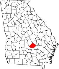 | |
| Town | ||
| Footnotes | ‡This populated place also has portions in an adjacent county or counties | |