Luapula Province
| Luapula | |
|---|---|
| Province | |
 Luapula Province showing its districts | |
| Country |
|
| Capital | Mansa |
| Area | |
| • Total | 50,567 km2 (19,524 sq mi) |
| Population (2010) | |
| • Total | 991,927 |
| • Density | 20/km2 (51/sq mi) |
Luapula Province is one of Zambia's ten provinces, and is located in the northern part of the country. The provincial capital is Mansa. Luapula Province was named after the Luapula River. As per the 2010 Zambian census, Luapula Province had a population of 991,927 accounting to 7.57 per cent of the total Zambian population.
The province borders along Congo and extends along the northern and eastern banks of the river from Lake Bangweulu to Lake Mweru, including waters and islands of those lakes. The province is inhabited by Bemba, who are also the major tribe in the country and Bemba is the most spoken language. The major economic activity is agriculture and fishing, with sweet potato being the major crop in the province. Mutukumbo festival is the major festival celebrated in the province. Lumangwe Falls, Mumbuluma Falls, Mumbotuta Waterfalls, Kundabwika Waterfalls and Chilongo Waterfalls are the major water falls in the province.
The chief artery of the province is the Samfya-Mansa-Mwansabombwe-Nchelenge highway known informally as the Zambia Way. The province is bordered along the Luapula river, through Lake Mweru and to its north by DR Congo. Luapula is one of the poorest provinces in Zambia with 80.5 per cent of the population accounted as poor in 2010 census. It has eight major attractions of the country among its waterfalls, wildlife and cultural heritage. Major mineral deposits found in the province are Manganese, lime, Copper and precious metals.
History
In the 19th century, the valley was dominated by the Lunda kingdom of Mwata Kazembe.[1] The boundaries of the province between Zambia and Democratic Republic of Congo were disputed for many years, running from an 1894 treaty into the late 1960s. The province has a long history of opposing colonial rule through militancy. From the 1950s, there were revolutionary groups that supported Anti Federationist African National Congress. Post independence, the province was the base for the United National Independence Party (UNIP) militants. Laupula has constant migration of labour from Congo DR and also from nearby Copperbelt province. During the 1980s, the then President appointed traditional Chiefs of the region as District Governors or members of the powerful UNIP central committee. The practice was seen similar to colonial rule when local leaders were drafted to political domain. Mwata Kazambe was appointed the District Governor for the province by president Kaunda during the 1980s.[2]
Chiluba, the leader of Movement for Multi-Party Democracy (MMD), who went on to become the President of Zambia in 1991, is considered the son of the soil and the citizens of the province gave him majority mandate during the 1991 elections. The province was the least affected among all areas in the country during the 1991 famine. Agriculture suffered in the region on account of removal of agricultural subsidies and rural credit schemes during the 90s.[3]
The province is bordered along the Luapula River, through Lake Mweru and to its north by DR Congo. The Congo Pedicle is located between the province and the industrial and commercial heartland of the Copperbelt which has caused problems partly resolved by construction of the Luapula Bridge and the Samfya-Serenje road, and being further alleviated by the construction of the Chembe Bridge. The capital of the province is Mansa, which is also the headquarters of Mansa district.[1]
Geography
The province borders along Congo and it extends along the northern and eastern banks of the river from Lake Bangweulu to Lake Mweru, including waters and islands of those lakes.[4] Congo Pedicle, the southeast salient of the Katanga Province of the Democratic Republic of Congo which sticks into neighbouring Zambia, divides it into two lobes. It is bordered by Northern on the eastern side and Central on the southeastern side. The major towns in the province include Samfya, Mansa, Nchelege and Mwamsombwe.[5] Around 40 per cent of the Province is covered with water and there are a number of rivers and lakes. It has eight attractions in waterfalls, wildlife and cultural heritage. Major mineral deposits found in the province are Manganese, lime, Copper and precious metals.[6]
| Climate data for Luapula (Zambia) | |||||||||||||
|---|---|---|---|---|---|---|---|---|---|---|---|---|---|
| Month | Jan | Feb | Mar | Apr | May | Jun | Jul | Aug | Sep | Oct | Nov | Dec | Year |
| Record high °C (°F) | 27.1 (80.8) |
27.3 (81.1) |
27.4 (81.3) |
27.3 (81.1) |
26.7 (80.1) |
25.2 (77.4) |
25.2 (77.4) |
27.3 (81.1) |
30.4 (86.7) |
31.2 (88.2) |
29.2 (84.6) |
27.1 (80.8) |
31.2 (88.2) |
| Average high °C (°F) | 20.8 (69.4) |
20.9 (69.6) |
20.9 (69.6) |
20.6 (69.1) |
18.8 (65.8) |
16.5 (61.7) |
16.6 (61.9) |
18.6 (65.5) |
21.8 (71.2) |
23.2 (73.8) |
22.2 (72) |
20.8 (69.4) |
23.2 (73.8) |
| Average low °C (°F) | 16.8 (62.2) |
16.8 (62.2) |
16.6 (61.9) |
15.4 (59.7) |
12.3 (54.1) |
9.1 (48.4) |
8.6 (47.5) |
10.4 (50.7) |
13.5 (56.3) |
16.1 (61) |
16.9 (62.4) |
16.8 (62.2) |
8.6 (47.5) |
| Average precipitation mm (inches) | 22 (0.87) |
18 (0.71) |
17 (0.67) |
7 (0.28) |
1 (0.04) |
0 (0) |
0 (0) |
0 (0) |
0 (0) |
4 (0.16) |
15 (0.59) |
22 (0.87) |
106 (4.17) |
| Source: [7] | |||||||||||||
Demographics
| Historical population | ||
|---|---|---|
| Year | Pop. | ±% |
| 1964 | 357,000 | — |
| 1969 | 336,000 | −5.9% |
| 1980 | 728,775 | +116.9% |
| 1990 | 750,542 | +3.0% |
| 2000 | 775,353 | +3.3% |
| 2010 | 991,927 | +27.9% |
| Sources: | ||
As per the 2010 Zambian census, Luapula Province had a population of 991,927 accounting to 7.57 per cent of the total Zambian population of 1,3,092,666. There were 488,589 males and 503,338 females, making the sex ratio to 1,030 for every 1,000 males, compared to the national average of 1,028.[10] The literacy rate stood at 62.60 per cent against a national average of 70.2 per cent.[11] The rural population constituted 80.39 per cent, while the urban population was 19.61 per cent. The total area of the province was 50,567 sq. km and the population density was 19.60 per sq. km. The population density during 2000 Zambian census stood at 19.60.[12] The decadal population growth of the province was 2.50 per cent. The median age in the province at the time of marriage was 20.3.[13] The average household size was 4.9, with the families headed by females being 4.0 and 5.4 for families headed by men.[14] The total eligible voters in the province was 65.40 per cent.[15] The unemployment rate of the province was 7.70 per cent. The total fertility rate was 7.3, complete birth rate was 6.5, crude birth rate was 39.0, child women population at birth was 835, general fertility rate was 172, gross reproduction rate was 2.7 and net reproduction rate was 1.8.[16] The total labour force constituted 58.60 per cent of the total population. Out of the labour force,66.2 per cent were men and 51.7 per cent women. The annual growth rate of labour force was 1.9 per cent.[17] Bemba was the most spoken language with 71.30 per cent speaking it.[18] Albinism is a condition where the victims do not have any pigment in their skin, hair or eyes. The total population in the province with the condition stood at 2,278.[19] The life expectancy at birth stood at 45 compared to the national average of 51.[20] Luapula is one of the poorest provinces in Zambia with 80.5 per cent of the population accounted as poor and 64.9 as extremely poor as of 2010 compared to 73.9 and 53.5 per cent in 2006.[11] Among all provinces, Luapula recorded the highest Total Fertility Rate (TFR) of 7.3, [21] and also the highest Infant Mortality Rate (IMR) of 100 deaths per 1,000 births as of 2010.[22]
Economy and utility services
| HIV infected & AIDS deaths[23] | ||
|---|---|---|
| Year | HIV infected | AIDS deaths |
| 1985 | 427 | 107 |
| 1990 | 6,971 | 198 |
| 1995 | 32,447 | 1,478 |
| 2000 | 46,293 | 3,682 |
| 2005 | 49,798 | 5,131 |
| 2010 | 51,211 | 5,209 |
The major economic activity in the province is fishing. The chief artery of the province is the Samfya-Mansa-Mwansabombwe-Nchelenge highway known as the Zambia Way. Though rich in natural resources, the province is one of the backward districts in the country. According to LCMS report of 2004, 79 per cent of the population is poor against a national average of 68. The total area of crops planted during the year 2014 in the province was 57,966.31 hectares which constituted 3.06 per cent of the total area cultivated in Zambia. The net production stood at 150,029 metric tonnes, which formed 3.68 per cent of the total agricultural production in the country. Sweet potata was the major crop in the province with 11,356 metric tonnes, constituting 7.56 per cent of the national output.[24]
As of 2004, the province had 527 basic schools, 20 high schools and the number of school children out of school in ages between 7 and 15 stood at 527.[25] As per IMF report, there were 360 basic government schools, 18 high schools, one teacher training college and one trade training college as of 2000.[26] The employment levels in the province has remained low decreasing from 14.3 per cent in 1990 to 8.1 2000. The unemployment rate was 6 per cent and the general unemployment rate for youth stood at 14 per cent as of 2008.[25]
The province had 30 doctors as of 2005. There were 407 Malaria incidence for every 1,000 people in the province as of 2005 and there were 5,209 AIDS death as of 2010.[25]
The province has around 700 km (430 mi) of paved roads as of 2007 that connects the different districts to the capital, along with 2,000 km (1,200 mi) of unpaved roads.[26]
Administration
| Profession[27] | % of working population |
| Agriculture, Forestry & Fishing (by Industry) | 10.50 |
| Community, Social and Personal | 3.10 |
| Construction | 3.10 |
| Electricity, Gas, and water | 0.00 |
| Financial & Insurance activities | 2.40 |
| Hotels and Restaurants | 1.40 |
| Manufacturing | 4.30 |
| Mining & Quarrying | 0.90 |
| Transportation and Storage | 3.20 |
| Wholesale & Retail Trade | 4.80 |
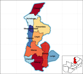
Provincial administration is setup purely for administrative purposes. The province is headed by a minister appointed by the President and there are ministries of central government for each province. The administrative head of the province is the Permanent Secretary, appointed by the President. There is a Deputy Premanent Secretary, heads of government departments and civil servants at the provincial level. Luapula Province is divided into eleven districts Chembe District, Chiengi District, Chipili District, Kawambwa District, Lunga District, Mansa District, Milengi District, Mwansabombwe District, Mwense District, Nchelenge District and Samfya District. All the district headquarters are the same as the district names. There are eleven councils in the province, each of which is headed by a an elected representative, called councilor. Each councilor holds office for three years.[28] The administrative staff of the council is selected based on Local Government Service Commission from within or outside the district. The office of the provincial government is located in each of the district headquarters and has provincial local government officers and auditors. Each council is responsible for raising and collecting local taxes and the budgets of the council are audited and submitted every year after the annual budget. The elected members of the council do not draw salaries, but are paid allowances from the council. Luapula is a predominantly rural province and there are no city or municipal councils. The government stipulates 63 different functions for the councils with the majority of them being infrastructure management and local administration. Councils are mandated to maintain each of their community centres, zoos, local parks, drainage system, playgrounds, cemeteries, caravan sites, libraries, museums and art galleries. They also work along with specific government departments for helping in agriculture, conservation of natural resources, postal service, establishing and maintaining hospitals, schools and colleges. The councils prepare schemes that encourage community participation.[29]
Culture and tourism
.jpg)
Lumangwe Falls located 84 km (52 mi) from Mporokoso district, Ntumbacushi Falls located in Kawambwa district, Kabwelume Waterfalls on the Kalungwishi river, Mumbuluma Falls in Mansa, Mumbotuta Waterfalls in the confluence of Mumbotuta streams and Luapula River, Kundabwika Waterfalls, Chilongo Waterfalls located 85 km (53 mi) from Kawambwa boma are the major water falls in the province.[30] Samfya Beach in Lake Bangweulu, shores Of Lake Mweru in Chienge District and Nchelemge Beach in Lake Mweru are other major picnic areas in the Province.[31] Lusenga Plain National Park and Bangweulu Wetlands are the major wildlife areas in the province. Lake Mweru, Luapula River, Lake Bangweulu and its wetlands have exotic bird life, aquatic animals and fish.[32]
Mutukumbo festival is the major festival celebrated in the province in Luapala Valley. It is held annually during July and attracts around 20,000 people and the President of Zambia. The event involves enacting migration of Lubalunda and conquest the valley.[33] Kwanga festival is held in the October every year by the Njumba tribe in Samfya. It is seen as a cultural reunion of the tribe to preserve their rituals and traditions.[34] Malaila Ceremony, the festival of death of evil lion, Musubilwa Mpemba Ceremony and Ubwilile traditional ceremony are the other festivals celebrated in the province.[35]
See also
Notes
- 1 2 Mwakikagile 2010, p. 68
- ↑ Gould 2002, p. 321
- ↑ Gould 2002, p. 314
- ↑ Griffiths, Ieuan (July 1986). "The Scramble for Africa: Inherited Political Boundaries". The Geographical Journal. 152 (2): 204–216.
- ↑ Mwakikagile 2010, p. 70
- ↑ International Monetary Fund 2007, p. 335
- ↑ "Weather statistics for Luapula (Zambia)". Norway: Norwegian Meteorological Institute and Norwegian Broadcasting Corporation. 2007. Retrieved 20 October 2016.
- ↑ Census of population and housing, 1969 (PDF) (Report). Lusaka: Central Statistical Office, Republic of Zambia. 1970. pp. A6–7.
- ↑ Summary report for the 2000 Census of population (Report). Lusaka: Central Statistical Office, Republic of Zambia. 2003. p. 6.
- 1 2 Census 2012, p. 7
- 1 2 Census 2012, p. 24
- ↑ Census 2012, p. 17
- ↑ Census 2012, pp. 12-13
- ↑ Census 2012, p. 19
- ↑ Census 2012, p. 21
- ↑ Census 2012, p. 44
- ↑ Census 2012, p. 93
- ↑ Census 2012, p. 99
- ↑ Census 2012, p. 78
- ↑ Census 2012, p. 74
- ↑ Census 2012, p. 41
- ↑ Census 2012, p. 49
- ↑ "AIDS and HIV statistics". Central Stastistical Office of Zambia. 2011. Retrieved 17 October 2016.
- ↑ "Agriculture statistics of Zambia 2014". Central Stastistical Office of Zambia. 2016. Retrieved 17 October 2016.
- 1 2 3 "Atlas Home". Zambia data portal, Central statistical Office of Zambia. 2011. Retrieved 16 October 2016.
- 1 2 International Monetary Fund 2007, p. 336
- ↑ "Labour force survey". Central Stastistical Office of Zambia. 2008. Retrieved 17 October 2016.
- ↑ Zambi Public administration Country profile (PDF) (Report). Division for Public Administration and Development Management (DPADM), Department of Economic and Social Affairs (DESA), United Nations. 2004. p. 7. Retrieved 16 October 2016.
- ↑ The local government system in Zambia (PDF) (Report). Common Wealth Local Government Forum. pp. 218–220. Retrieved 16 October 2016.
- ↑ "Waterfalls in Luapala province". Zambia Tourism Board. 2011. Retrieved 19 October 2016.
- ↑ "Beaches in Luapala province". Zambia Tourism Board. 2011. Retrieved 19 October 2016.
- ↑ "National parks in Luapala province". Zambia Tourism Board. 2011. Retrieved 19 October 2016.
- ↑ Mwakikagile 2010, p. 68-69
- ↑ Mwakikagile 2010, p. 83
- ↑ "Ceremonies in Luapala province". Zambia Tourism Board. 2011. Retrieved 19 October 2016.
References
- Summary report for the 2010 Census of population (PDF) (Report). Lusaka: Central Statistical Office, Republic of Zambia. 2012.
- Mwakikagile, Godfrey (2010). Zambia: Life in an African Country. New Africa Press. ISBN 9789987160112.
- Gould, Jeremy (2002). "Zambia:contesting Democracy". In Laakso, Liisa. Multi-party elections in Africa. James Currey Publishers. p. 314. ISBN 9780852558430.
- Zambia: Poverty Reduction Strategy Paper (Report). International Monetary Fund. 2007.
External links
Coordinates: 11°00′S 29°00′E / 11.000°S 29.000°E